Old Maps of Penjur, Arkansas for Genealogy
Trace your family roots with 18 historic maps of Penjur. These high-res maps reveal old neighborhoods, homesites, landmarks, and streets — helping you uncover where your ancestors lived and how the area evolved over time.
- Explore historic neighborhoods: Identify where your relatives may have lived in the 1800s or 1900s.
- Compare maps over time: Trace the changes in streets, buildings, and landmarks for multi-generational research.
- Perfect for genealogy & ancestry research: Used by family historians and researchers to map out lineage and migration.
These maps are an incredible resource for exploring your personal connection to Penjur's past.
Penjur, AR maps
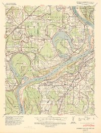
(18)- 1931 Map of Horseshoe Lake
 1931 Horseshoe Lake1931 Print · USGSThe Mississippi Delta's shifting landscape is captured here in the early thirties, centered on the great oxbow of Horseshoe Lake. Genealogists and historians can trace family-named tracts like the Tucker Plantation and Seyppel Plantation, alongside rural landmarks like the Y M C A Camp and Robinsonville.
 - 1939 Map of Horseshoe Lake, 1941 Print
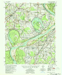
 1939 Horseshoe Lake1941 Print · USGSThe oxbows and plantations of the Mississippi delta are captured here in the late thirties as the river redefines state boundaries. Genealogists can locate named homesteads and community centers like the Abbey Leatherman Plantation, Robinsonville, and the Hopewell Sch & Ch.2 unique versions available
 - 1948 Map of Helena
 1948 Helena1948 Print · USGSEastern Arkansas and the Mississippi Delta are captured here just after the war, showing a landscape defined by its great rivers and rail lines. Genealogists can trace family locations near Bemis Plantation, Helena, and smaller rail stops like Wheatley and Moro.
 - 1950 Map of Helena
 1950 Helena1950 Print · USGSMid-century Phillips County and the surrounding Delta region are shown at a peak of rail and river commerce. Genealogists and historians can trace family locations through numerous rural communities like Old Austin, Cotton Plant, and West Helena, or follow the routes of the Missouri Pacific RR across Grand Prairie.2 unique versions available
 - 1954 Map of Horseshoe Lake
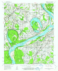
 1954 Horseshoe Lake1954 Print · USGSThe Mississippi Delta riverfront in the 1950s was a landscape of expansive plantations and river landings. Genealogists can trace family names and community hubs through features like Snowden Plantation, Rosenwald Sch, and Penton Ch & Cem.2 unique versions available
 - 1955 Map of Helena, 1967 Print
 1955 Helena1967 Print · USGSThe Arkansas Delta and Mississippi floodplains are captured here in the mid-fifties, during a period of expanding flood control and rail commerce. Researchers can trace the extensive Chicago Rock Island and Pacific RR lines and locate sites like the Arkansas State College Experimental Rice Farm or Friars Point.2 unique versions available
 - 1959 Map of Helena
 1959 Helena1959 Print · USGSThe Arkansas and Mississippi Delta regions are captured here in the late fifties, showing a landscape defined by the Mississippi River and the Grand Prairie. Genealogists and researchers can trace the rail networks of the Illinois Central RR and locate community landmarks like Helena and the White River National Wildlife Refuge.
 - 1960 Map of Helena
 1960 Helena1960 Print · USGSThe Arkansas and Mississippi Delta regions meet along the great river bends during a period of significant agricultural and rail expansion. Genealogists and historians can trace the paths of the Missouri Pacific railroad through Clarendon or locate landings along the Mississippi River and White River.
 - 1960 Map of Horseshoe Lake, 1963 Print
 1960 Horseshoe Lake1963 Print · USGSCrittenden and Tunica counties are shown in the early sixties as a patchwork of Delta plantations and river landings. Genealogists can trace family footprints at Joe Beck Plantation, Happy Ch & Cem, and local schoolhouses like Snowden Sch.2 unique versions available
 - 1975 Map of Horseshoe Lake NW, 1976 Print
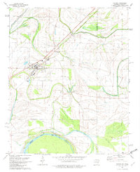
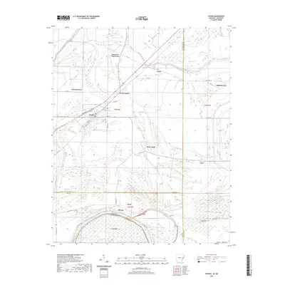
 1975 Horseshoe Lake NW1976 Print · USGSThe Arkansas Delta near the Mississippi border comes into sharp focus in the mid-1970s, revealing a landscape of oxbow lakes and precision farming. Genealogists and local historians can trace the street layouts of Hughes and locate the rural settlement of Penjur near Council Lake.
 - 1981 Map of Hughes, 1982 Print
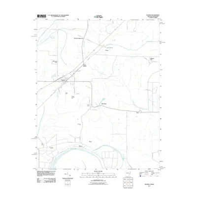
 1981 Hughes1982 Print · USGSThe Delta landscape around Hughes in the early eighties is captured here just as the agricultural and drainage patterns were firmly established. Genealogists can locate family landmarks like St Johns Ch, Sweet Home Ch, and the small settlement at Penjur.2 unique versions available
 - 1984 Map of Helena, 1985 Print
 1984 Helena1985 Print · USGSThe Delta landscape of Arkansas and Mississippi comes to life in this mid-eighties survey of river bends and ridge settlements. Researchers can trace the rail-and-river economy through Missouri Pacific lines and local landmarks like Whiskey Island or Marianna.
 - 1990 Map of Helena, 1991 Print
 1990 Helena1991 Print · USGSThe Arkansas and Mississippi delta regions meet here in the 1990s, where the great river's oxbows and islands define the state line. Genealogists and historians can trace the rail networks of the Illinois Central Gulf RR and local settlements like Palestine, Marvell, and La Grange.
 - 2011 Map of Hughes, 2011 Print
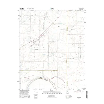
 2011 Hughes2011 Print · USGSCovers Penjur, including Hughes, North Hughes, and other nearby areas
 - 2014 Map of Hughes, 2014 Print
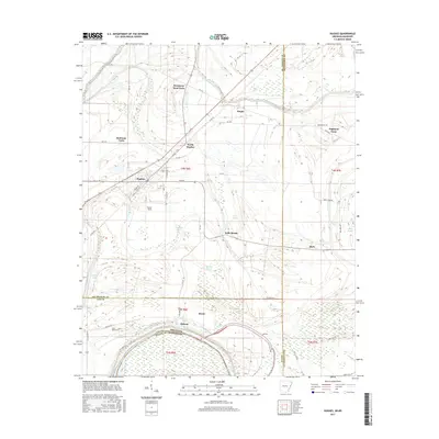
 2014 Hughes2014 Print · USGSCovers Penjur, including Hughes, North Hughes, and other nearby areas
 - 2017 Map of Hughes, 2017 Print
 2017 Hughes2017 Print · USGSCovers Penjur, including Hughes, North Hughes, and other nearby areas
 - 2020 Map of Hughes, 2020 Print
 2020 Hughes2020 Print · USGSCovers Penjur, including Hughes, North Hughes, and other nearby areas
 - 2024 Map of Hughes, 2024 Print
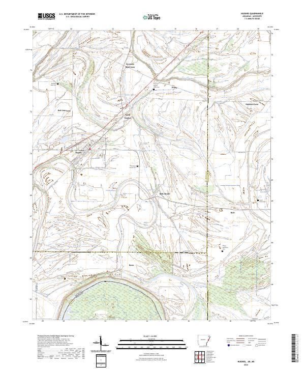 2024 Hughes2024 Print · USGSThe Delta country around St. Francis County comes into focus in this recent survey of the Arkansas-Mississippi borderlands. Family researchers can pinpoint numerous local burial grounds including Saint Marys Cem and Stoddard Farm Cem or trace the drainage of Fifteenmile Bayou.
End of results
Showing maps 1-18 of 18
Top cities near Penjur
- Memphis historical maps
- West Memphis historical maps
- Marion historical maps
- Hughes historical maps
- Horseshoe Lake historical maps
- Edmondson historical maps
See more
Frequently asked questions
- What are the different types of historical maps available for Penjur?
- What is the oldest map of Penjur?
- Where can I purchase historical maps of Penjur for my home or office?
- Where can I download high-res historical maps of Penjur?
- Are there historical topographic maps available for Penjur?
- Is there historical aerial imagery available for Penjur?
- Where are historical maps of Penjur sourced from?