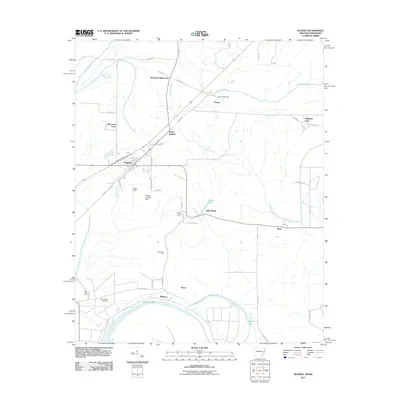
2011 Map of Hughes
USGS Topo · Published 2011About this map
The agricultural landscape of St. Francis County surrounds the hub of Hughes, showing a region defined by its fertile lowlands and managed water systems. The map depicts a late twentieth-century rural economy where large family-named operations like Sycamore Bend Farm, Red Gum Farm, and Highland Farm dominate the terrain. This area is heavily interlaced with drainage and irrigation features, including the winding course of Fifteenmile Bayou and several oxbow remnants such as Midway Lake and Goose Lake. Small pockets of settlement and industry are scattered throughout, from the community at Beck to the aviation infrastructure at the Hughes Landing Strip and Tucker Field. For those researching local history, the location of Saint Marys Cemetery near the southern edge provides a vital genealogical landmark within this network of cotton and grain fields.
Find a feature on this map
58 named features on this map. Tap any name to fly to it.
Don’t see what you’re looking for? This feature index may not catch every label — zoom into the map to look around manually.
Map Details
Editions of this 2011 Hughes Map
This is the sole edition of this map. No revisions or reprints were ever made.
Other maps of this area

1931 · Horseshoe Lake
USGS Topo · 1:62,500

1939 · Horseshoe Lake
USGS Topo · 1:62,500

1939 · Park Place
USGS Topo · 1:62,500

1939 · Edmondson
USGS Topo · 1:62,500

1940 · Whitmore
USGS Topo · 1:62,500

1948 · Helena
USGS Topo · 1:250,000

1950 · Helena
USGS Topo · 1:250,000

1953 · Memphis
USGS Topo · 1:250,000

1954 · Horseshoe Lake
USGS Topo · 1:62,500

1954 · Edmondson
USGS Topo · 1:62,500