
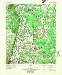
1940 Map of Whitmore
USGS Topo · Published 1942About this map
Wittsburg Island and the meandering channels of the St Francis River dominate this early 1940s landscape, where riverine geography dictated the placement of small agricultural settlements. The map documents a rural network of churches and schools that served as the social backbone of St. Francis County, including Masadonia Ch & Sch and New Haven Ch & Sch. Historical transport routes are clearly visible, from the ancient path of the Military Road to the Pacific Power rail line passing through Whitmore.
Find a feature on this map
112 named features on this map. Tap any name to fly to it.
Don’t see what you’re looking for? This feature index may not catch every label — zoom into the map to look around manually.
Map Details
Editions of this 1940 Whitmore Map
2 editions found
Other maps of this area

1931 · Horseshoe Lake
USGS Topo · 1:62,500

1939 · Vanndale
USGS Topo · 1:62,500

1939 · Horseshoe Lake
USGS Topo · 1:62,500

1939 · Park Place
USGS Topo · 1:62,500

1939 · Wynne
USGS Topo · 1:62,500

1939 · Edmondson
USGS Topo · 1:62,500

1940 · Deckerville
USGS Topo · 1:62,500

1940 · Princedale
USGS Topo · 1:62,500

1940 · Marianna
USGS Topo · 1:62,500

1948 · Helena
USGS Topo · 1:250,000