Old Maps of Mountain View, Arkansas
Explore 32 old maps of Mountain View, spanning from 1892 to today. These high-resolution historic maps reveal how streets, neighborhoods, landmarks, and natural features evolved over time — perfect for genealogy, metal detecting, research, and local history exploration.
What you can do with these maps:
- See how Mountain View changed over time: Compare historical maps to modern-day views to trace roads, homesites, rail lines & more.
- View detailed metadata: Each map includes creators, publishers, year, scale, and archive source.
- Overlay maps with satellite & LiDAR: Visualize the past alongside modern tools to explore terrain & human change.
- Trusted historical sources: Maps sourced from the USGS, Library of Congress, and other archives.
- Access maps your way: View online, download high-res files, or order prints for personal or research use.
Start exploring old maps of Mountain View to uncover forgotten places, hidden landmarks, and the deep history beneath your feet.
Mountain View, AR maps
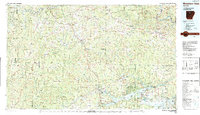
(32)- 1892 Map of Mountain View
 1892 Mountain View1892 Print · USGSThe Arkansas Ozarks are mapped here in the late nineteenth century, a time when river ferries and fords were the primary connections between isolated mountain towns. Trace the early streets of Mountain View and Clinton, or locate old crossings at Upper Fy. and Wilsons Fd.
 - 1894 Map of Mountain View
 1894 Mountain View1894 Print · USGSThe Arkansas Ozark foothills and river valleys are shown in the 1890s as a network of isolated homesteads and river landings. Genealogists can trace early families near Mountain View, Clinton, and river crossings like Upper Fy. or Goffs Cove.5 unique versions available
 - 1956 Map of Russellville
 1956 Russellville1956 Print · USGSThe Arkansas River valley and the surrounding Boston Mountains are captured here in the mid-fifties, showing a landscape of small timber towns and new reservoirs. Genealogists can trace family roots through upland settlements like Pelsor and Witts Springs or locate the campus of Arkansas Polytechnic College.2 unique versions available
 - 1964 Map of Russellville
 1964 Russellville1964 Print · USGSMid-century Central Arkansas is defined here by the river-valley towns and the surrounding mountain ranges before the full expansion of the interstate system. Genealogists and historians can trace rail-town development along the Missouri Pacific Railroad and locate landmarks like Arkansas Polytechnic College or Petit Jean State Park.
 - 1964 Map of Sylamore, 1965 Print
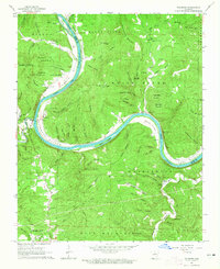 1964 Sylamore1965 Print · USGSThe White River corridor of mid-century Stone County reveals a landscape of isolated mountain settlements and riverside rail industry. Trace family history through the Jeffery Cem and Sylamore Cem, or locate the old Ferry crossing near the Missouri Pacific line.3 unique versions available
 - 1969 Map of Mountain View SW, 1971 Print
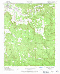
 1969 Mountain View SW1971 Print · USGSStone County’s rural Ozark landscape is documented here in the late sixties, showing a terrain defined by ridges and deep hollows. Researchers can locate family landmarks and early congregations like the Mennonite Ch, Fredonia Cem, and the settlement of Sunny Land.
 - 1969 Map of Mountain View, 1971 Print
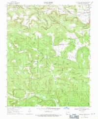
 1969 Mountain View1971 Print · USGSStone County life in the late sixties is centered around the growth of Mountain View and the surrounding timbered hollows. Genealogists can trace family roots through numerous sites like Flatwoods Cem, Nirkee Chapel, and the community at Luber.
 - 1972 Map of Fiftysix, 1973 Print
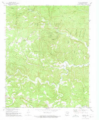 1972 Fiftysix1973 Print · USGSStone County, Arkansas, comes to life in the early seventies, showing the remote ridge-top settlements and cavern systems of the Ozarks. Genealogists and hikers can trace the paths to Fiftysix, Blanchard Caverns, and the Red Doors Cemetery.3 unique versions available
 - 1977 Map of Russellville
 1977 Russellville1977 Print · USGSThe Arkansas River Valley and surrounding Ozark Mountains are documented here during a period of significant postwar growth and infrastructure development. Genealogists and researchers can locate family landmarks such as Mount Carmel Cem, St Josephs Church, and several remote Coal Mine sites along the Missouri Pacific RR line.
 - 1983 Map of Mountain View
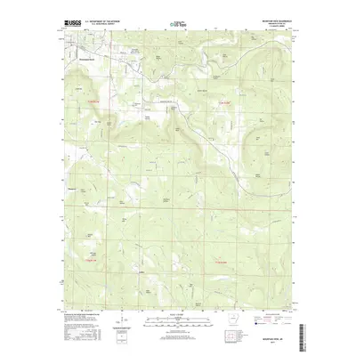
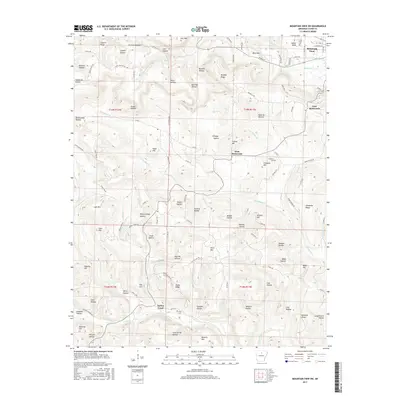
 1983 Mountain View1983 Print · USGSNorth-central Arkansas comes into sharp focus during the early eighties, showing the transition from traditional Ozark mountain settlements to a landscape shaped by major reservoirs. Genealogists and historians can trace family roots through mountain hamlets like Snowball, Witts Springs, and Timbo, or locate landmarks such as Zion Hill Church and the Missouri Pacific Railroad.
 - 1984 Map of Russellville
 1984 Russellville1984 Print · USGSThe Arkansas River valley was undergoing significant change in the 1950s as transportation and water management reshaped the region from Russellville to Conway. Researchers can trace the era's rail networks like the Missouri Pacific RR and explore landmarks like Magazine Mountain and Petit Jean State Park.
 - 1992 Map of Russellville, 1993 Print
 1992 Russellville1993 Print · USGSCentral Arkansas in the early nineties shows a landscape defined by the Arkansas River valley and the surrounding national forests. Trace the development of river towns like Russellville and Dardanelle alongside landmarks such as Lake Dardanelle and Magazine Mtn.
 - 2011 Map of Mountain View SW, 2011 Print
 2011 Mountain View SW2011 Print · USGSCovers Mountain View, including East Richwoods, West Richwoods, and other nearby areas
 - 2011 Map of Sylamore, 2011 Print
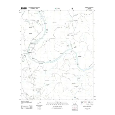 2011 Sylamore2011 Print · USGSCovers Mountain View, including Twin Creek, Allison, and other nearby areas
 - 2011 Map of Fiftysix, 2011 Print
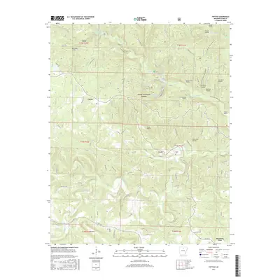
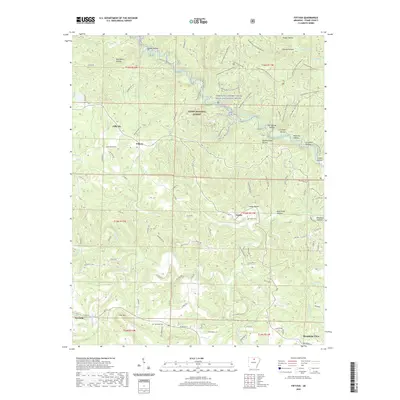
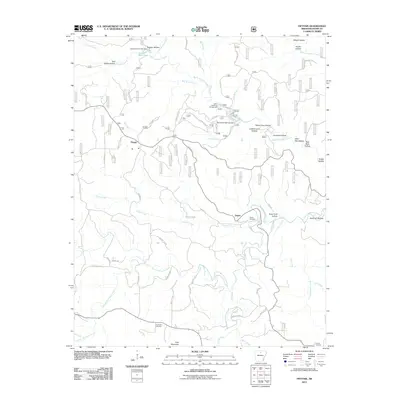 2011 Fiftysix2011 Print · USGSCovers Mountain View, including Fifty-Six, Gayler, and other nearby areas
 - 2011 Map of Mountain View, 2011 Print
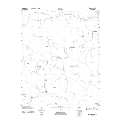
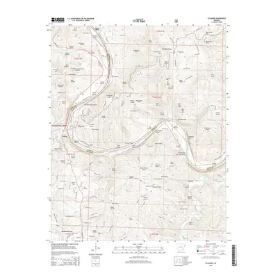
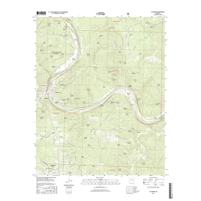
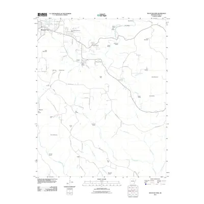 2011 Mountain View2011 Print · USGSCovers Mountain View, including Luber, Hanover, and other nearby areas
 - 2014 Map of Mountain View SW, 2014 Print
 2014 Mountain View SW2014 Print · USGSCovers Mountain View, including East Richwoods, West Richwoods, and other nearby areas
 - 2014 Map of Fiftysix, 2014 Print
 2014 Fiftysix2014 Print · USGSCovers Mountain View, including Fifty-Six, Gayler, and other nearby areas
 - 2014 Map of Mountain View, 2014 Print
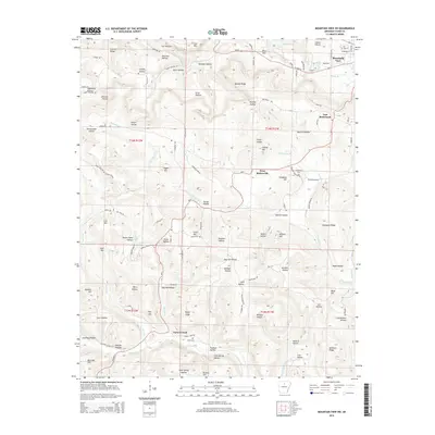
 2014 Mountain View2014 Print · USGSCovers Mountain View, including Luber, Hanover, and other nearby areas
 - 2014 Map of Sylamore, 2014 Print
 2014 Sylamore2014 Print · USGSCovers Mountain View, including Twin Creek, Allison, and other nearby areas
 - 2017 Map of Fiftysix, 2017 Print
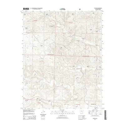
 2017 Fiftysix2017 Print · USGSCovers Mountain View, including Fifty-Six, Gayler, and other nearby areas
 - 2017 Map of Mountain View, 2017 Print
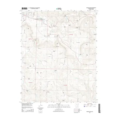
 2017 Mountain View2017 Print · USGSCovers Mountain View, including Luber, Hanover, and other nearby areas
 - 2017 Map of Mountain View SW, 2017 Print
 2017 Mountain View SW2017 Print · USGSCovers Mountain View, including East Richwoods, West Richwoods, and other nearby areas
 - 2017 Map of Sylamore, 2017 Print
 2017 Sylamore2017 Print · USGSCovers Mountain View, including Twin Creek, Allison, and other nearby areas
 - 2020 Map of Fiftysix, 2020 Print
 2020 Fiftysix2020 Print · USGSCovers Mountain View, including Fifty-Six, Gayler, and other nearby areas
Showing maps 1-25 of 32
Top cities near Mountain View
- Fairfield Bay historical maps
- Melbourne historical maps
- Shirley historical maps
- Fifty-Six historical maps
- Guion historical maps
Frequently asked questions
- What are the different types of historical maps available for Mountain View?
- What is the oldest map of Mountain View?
- Where can I purchase historical maps of Mountain View for my home or office?
- Where can I download high-res historical maps of Mountain View?
- Are there historical topographic maps available for Mountain View?
- Is there historical aerial imagery available for Mountain View?
- Where are historical maps of Mountain View sourced from?