Old Maps of Joy, Arkansas for Hiking & Exploration
Hike through history with 10 historic maps of Joy. Explore old trails, ghost towns, and forgotten backroads — perfect for outdoor adventurers and local explorers.
- Rediscover forgotten places: Map out old mining camps, roads, and footpaths that no longer exist on modern maps.
- Layer with modern tools: Combine with LiDAR or satellite views to plan hikes through historical terrain.
- Made for exploration: Popular among hikers, overlanders, and local history lovers.
Use these maps to find adventure and explore the hidden past of Joy.
Joy, AR maps
(10)- 1953 Map of Memphis, 1966 Print
 1953 Memphis1966 Print · USGSEastern Arkansas and the Memphis riverfront are shown here during the mid-century period of regional growth and river management. Local historians can trace the paths of the Chicago Rock Island & Pacific RR through Forrest City or locate river landmarks like President's Island.3 unique versions available
 - 1956 Map of Memphis
 1956 Memphis1956 Print · USGSThe Mississippi Delta and the bluffs of West Tennessee meet in the mid-fifties, showing a landscape defined by massive river systems and rail hubs. Researchers can trace the path of Crowleys Ridge or locate vanished river landings near Centennial Island and Island No 35.
 - 1963 Map of Sidon, 1964 Print
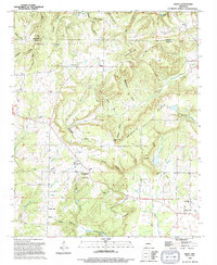
 1963 Sidon1964 Print · USGSThe rural uplands of White County are captured in the early sixties as a network of ridge-top farms and creek-bottom communities. Genealogists and local historians can trace the foundations of Sidon and Center Hill, locating Sidon Cem and Mt Hebron Ch.2 unique versions available
 - 1986 Map of Searcy
 1986 Searcy1986 Print · USGSWhite County and its neighbors reached a period of established agricultural and rail prosperity by the mid-1980s. Local researchers can trace the routes of the Missouri Pacific RR and locate rural communities like Velvet Ridge, Sunnydale, and Cotton Plant.2 unique versions available
 - 1994 Map of Sidon
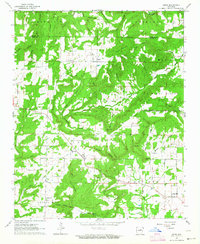
 1994 Sidon1994 Print · USGSThe rural communities of White County appear here during the mid-nineties, showing a landscape of high ridges and winding creek bottoms. Genealogists and historians can trace the sites of Sidon, Joy, and Center Hill, along with local landmarks like Pleasant Ridge Cem and Georgia Ridge.
 - 2011 Map of Sidon, 2011 Print
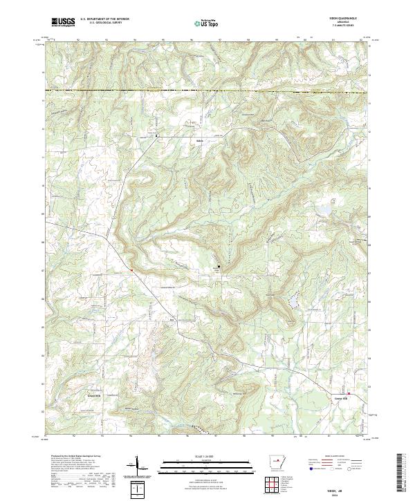
 2011 Sidon2011 Print · USGSCovers Joy, including Center Hill, Sidon, and other nearby areas
 - 2014 Map of Sidon, 2014 Print
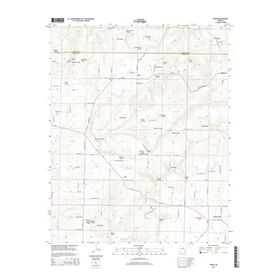 2014 Sidon2014 Print · USGSCovers Joy, including Center Hill, Sidon, and other nearby areas
 - 2017 Map of Sidon, 2017 Print
 2017 Sidon2017 Print · USGSCovers Joy, including Center Hill, Sidon, and other nearby areas
 - 2020 Map of Sidon, 2020 Print
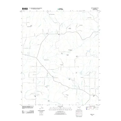
 2020 Sidon2020 Print · USGSCovers Joy, including Center Hill, Sidon, and other nearby areas
 - 2024 Map of Sidon, 2024 Print
 2024 Sidon2024 Print · USGSModern-day White County settlement patterns are showcased here, reflecting a landscape of ridge-top roads and creek-hollow drainages. Researchers can trace family roots at Sidon Cem or locate rural landmarks like Sweet Springs Airport and Gravel Hill.
End of results
Showing maps 1-10 of 10
Top cities near Joy
- Searcy historical maps
- Beebe historical maps
- Heber Springs historical maps
- Vilonia historical maps
- McRae historical maps
- Pangburn historical maps
See more
Frequently asked questions
- What are the different types of historical maps available for Joy?
- What is the oldest map of Joy?
- Where can I purchase historical maps of Joy for my home or office?
- Where can I download high-res historical maps of Joy?
- Are there historical topographic maps available for Joy?
- Is there historical aerial imagery available for Joy?
- Where are historical maps of Joy sourced from?