Old Maps of Barson, Arkansas
Explore 12 old maps of Barson, spanning from 1939 to today. These high-resolution historic maps reveal how streets, neighborhoods, landmarks, and natural features evolved over time — perfect for genealogy, metal detecting, research, and local history exploration.
What you can do with these maps:
- See how Barson changed over time: Compare historical maps to modern-day views to trace roads, homesites, rail lines & more.
- View detailed metadata: Each map includes creators, publishers, year, scale, and archive source.
- Overlay maps with satellite & LiDAR: Visualize the past alongside modern tools to explore terrain & human change.
- Trusted historical sources: Maps sourced from the USGS, Library of Congress, and other archives.
- Access maps your way: View online, download high-res files, or order prints for personal or research use.
Start exploring old maps of Barson to uncover forgotten places, hidden landmarks, and the deep history beneath your feet.
Barson, AR maps
(12)- 1939 Map of Hunter, 1942 Print
 1939 Hunter1942 Print · USGSWoodruff and Cross counties were at the peak of their rail-driven economy just before the war, when timber and agriculture dominated the Delta. Genealogists can trace family names at Odd Fellows Cem or locate rural landmarks like Hillmann Jr High Sch and the Whitehall Ch & Cem.2 unique versions available
 - 1953 Map of Memphis, 1966 Print
 1953 Memphis1966 Print · USGSEastern Arkansas and the Memphis riverfront are shown here during the mid-century period of regional growth and river management. Local historians can trace the paths of the Chicago Rock Island & Pacific RR through Forrest City or locate river landmarks like President's Island.3 unique versions available
 - 1956 Map of Memphis
 1956 Memphis1956 Print · USGSThe Mississippi Delta and the bluffs of West Tennessee meet in the mid-fifties, showing a landscape defined by massive river systems and rail hubs. Researchers can trace the path of Crowleys Ridge or locate vanished river landings near Centennial Island and Island No 35.
 - 1956 Map of Hunter, 1968 Print
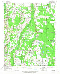 1956 Hunter1968 Print · USGSEastern Arkansas at the mid-century mark reveals a landscape defined by the ST LOUIS SOUTHWESTERN rail line and the CACHE RIVER bottomlands. Researchers can locate numerous family-named landmarks and rural hubs, including Woodmans Cem, Beard Sch, and Whitehall Ch & Cem.
 - 1958 Map of Hunter
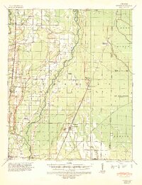
 1958 Hunter1958 Print · USGSEastern Arkansas at the dawn of the space age reveals a landscape defined by the Cache River and an extensive rail network. Genealogists and historians can trace family roots through numerous rural sites like Odd Fellows Cemetery, Beard School, and Whitehall Church and Cemetery.
 - 1971 Map of Fair Oaks, 1973 Print
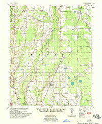
 1971 Fair Oaks1973 Print · USGSFair Oaks and the surrounding Arkansas Delta are captured here in the early seventies, where rail lines and irrigation dominate the landscape. Researchers can trace the junction of two major railroads and locate sites like Penrose, Morton, and the Minnow Ponds.
 - 1986 Map of Searcy
 1986 Searcy1986 Print · USGSWhite County and its neighbors reached a period of established agricultural and rail prosperity by the mid-1980s. Local researchers can trace the routes of the Missouri Pacific RR and locate rural communities like Velvet Ridge, Sunnydale, and Cotton Plant.2 unique versions available
 - 2011 Map of Fair Oaks, 2011 Print
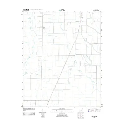 2011 Fair Oaks2011 Print · USGSCovers Barson, including Fair Oaks, Penrose, and other nearby areas
 - 2014 Map of Fair Oaks, 2014 Print
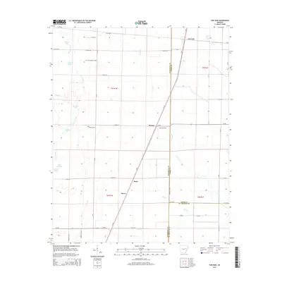 2014 Fair Oaks2014 Print · USGSCovers Barson, including Fair Oaks, Penrose, and other nearby areas
 - 2017 Map of Fair Oaks, 2017 Print
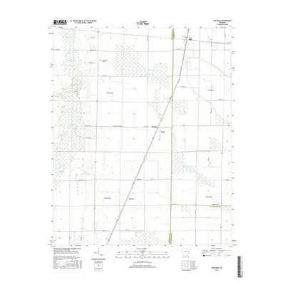 2017 Fair Oaks2017 Print · USGSCovers Barson, including Fair Oaks, Penrose, and other nearby areas
 - 2020 Map of Fair Oaks, 2020 Print
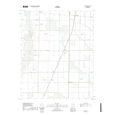 2020 Fair Oaks2020 Print · USGSCovers Barson, including Fair Oaks, Penrose, and other nearby areas
 - 2024 Map of Fair Oaks, 2024 Print
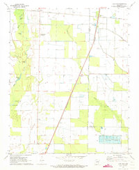
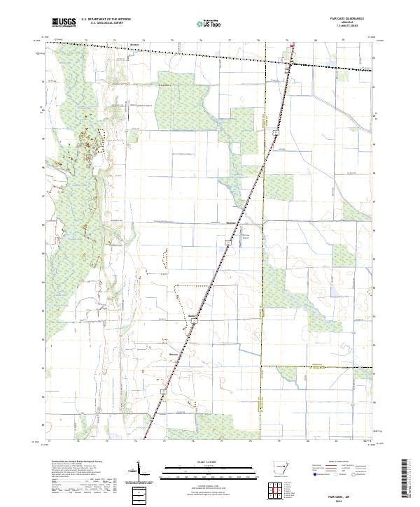 2024 Fair Oaks2024 Print · USGSEastern Arkansas at the edge of the Mississippi Delta is captured here, showing the intersection of heavy river bottomlands and high-yield farmland. Researchers can trace rural settlement patterns near Fair Oaks and Penrose or locate remote landmarks like Big Jack Lake.
End of results
Showing maps 1-12 of 12
Top cities near Barson
- McCrory historical maps
- Cotton Plant historical maps
- Palestine historical maps
- Patterson historical maps
- Wheatley historical maps
- Hunter historical maps
See more
Frequently asked questions
- What are the different types of historical maps available for Barson?
- What is the oldest map of Barson?
- Where can I purchase historical maps of Barson for my home or office?
- Where can I download high-res historical maps of Barson?
- Are there historical topographic maps available for Barson?
- Is there historical aerial imagery available for Barson?
- Where are historical maps of Barson sourced from?