Old Maps of Telegraph City, California
Explore 15 old maps of Telegraph City, spanning from 1916 to today. These high-resolution historic maps reveal how streets, neighborhoods, landmarks, and natural features evolved over time — perfect for genealogy, metal detecting, research, and local history exploration.
What you can do with these maps:
- See how Telegraph City changed over time: Compare historical maps to modern-day views to trace roads, homesites, rail lines & more.
- View detailed metadata: Each map includes creators, publishers, year, scale, and archive source.
- Overlay maps with satellite & LiDAR: Visualize the past alongside modern tools to explore terrain & human change.
- Trusted historical sources: Maps sourced from the USGS, Library of Congress, and other archives.
- Access maps your way: View online, download high-res files, or order prints for personal or research use.
Start exploring old maps of Telegraph City to uncover forgotten places, hidden landmarks, and the deep history beneath your feet.
Telegraph City, CA maps
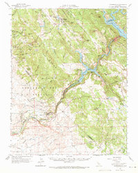
(15)- 1916 Map of Copperopolis
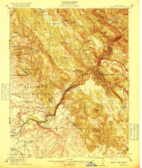 1916 Copperopolis1916 Print · USGSCalaveras and Stanislaus counties at the height of the early copper and ranching era reveal a landscape of deep canyons and mining outposts. Trace the Sierra Ry of California or locate historic crossings like Reynolds Ferry and the Wilbur-Womble Mine.3 unique versions available
 - 1942 Map of Copperopolis
 1942 Copperopolis1942 Print · USGSThe Mother Lode's mining and water heritage is preserved here in the early 1940s, centered on the copper-rich hills and the Stanislaus River. Genealogists and historians can trace family-named sites like Curtin Ranch, old schools such as O'Byrnes School, and active mines including the Wilbur Womble Mine.
 - 1947 Map of San Jose, 1948 Print
 1947 San Jose1948 Print · USGSNorthern California's heartland is captured here just after the war, showing the rapid growth of the Santa Clara and Central Valleys. Researchers can trace the legacy of rail and water at Castle Air Force Base, Stockton, and the Hetch Hetchy Aqueduct.
 - 1954 Map of Copperopolis, 1956 Print
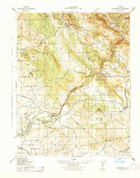
 1954 Copperopolis1956 Print · USGSThe California foothills in the mid-fifties reveal a transition from gold and copper mining to water management along the Stanislaus River. Locate historic sites like Central Ferry and the Napoleon Mine while tracing the Sierra Railroad.
 - 1956 Map of San Jose
 1956 San Jose1956 Print · USGSCentral California in the mid-fifties reveals the transition from sprawling orchards to growing urban hubs like San Jose and Stockton. Genealogists and historians can trace the rail-era landscape of the Mother Lode through Chinese Camp and Tuttletown, or follow the water through the Joaquin River and Calaveras Reservoir.
 - 1962 Map of San Jose
 1962 San Jose1962 Print · USGSCentral California in the early sixties showcases the expansion of the San Joaquin and Santa Clara valleys. Researchers can trace the rail-to-road transition along the Southern Pacific RR or locate landmarks like Castle USAF Base and Loma Prieta.4 unique versions available
 - 1962 Map of Copperopolis, 1963 Print
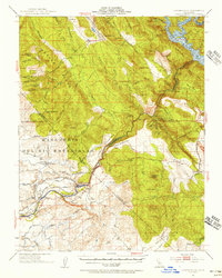
 1962 Copperopolis1963 Print · USGSCalaveras County's copper-mining heartland is captured here in the early 1960s, showing the town of Copperopolis and its surrounding ridge. Researchers can trace dozens of legacy mining sites, including the Keystone Mine, Quail Hill Mine, and the Empire Mine works.5 unique versions available
 - 1962 Map of Copperopolis, 1964 Print
 1962 Copperopolis1964 Print · USGSThe foothills of the Mother Lode come alive in the early sixties as mining towns and water projects reshape the landscape. Genealogists and historians can trace family-named sites like Wagner Ranch and Kistler Ranch alongside the historic Sierra Railroad and Knights Ferry crossing.2 unique versions available
 - 1966 Map of San Jose
 1966 San Jose1966 Print · USGSCentral California in the mid-1960s reveals a landscape of massive irrigation projects and expanding Cold War military footprints. Researchers can trace the rail-and-river network of the San Joaquin Valley or locate specialized sites like Castle Air Force Base and the Sharp General Depot (Military).
 - 1994 Map of Oakdale, 1995 Print
 1994 Oakdale1995 Print · USGSThe San Joaquin Valley meets the Sierra foothills in the mid-1990s, where massive reservoirs and canal networks fueled California's agricultural heartland. Researchers can trace the Hetch Hetchy Aqueduct, find the Sierra RR, and locate the Riverbank Army Ammunition Plant.2 unique versions available
 - 2012 Map of Copperopolis, 2012 Print
 2012 Copperopolis2012 Print · USGSCovers Telegraph City, including Copper Cove Subdivision, Copper Cove Village, and other nearby areas
 - 2015 Map of Copperopolis, 2015 Print
 2015 Copperopolis2015 Print · USGSCovers Telegraph City, including Copper Cove Subdivision, Copper Cove Village, and other nearby areas
 - 2018 Map of Copperopolis, 2018 Print
 2018 Copperopolis2018 Print · USGSCovers Telegraph City, including Copper Cove Subdivision, Copper Cove Village, and other nearby areas
 - 2021 Map of Copperopolis, 2021 Print
 2021 Copperopolis2021 Print · USGSCovers Telegraph City, including Copper Cove Subdivision, Copper Cove Village, and other nearby areas
 - 2023 Map of Copperopolis, 2023 Print
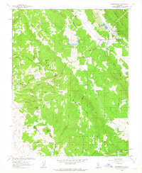
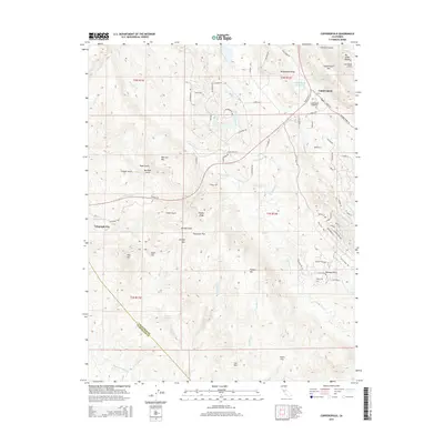
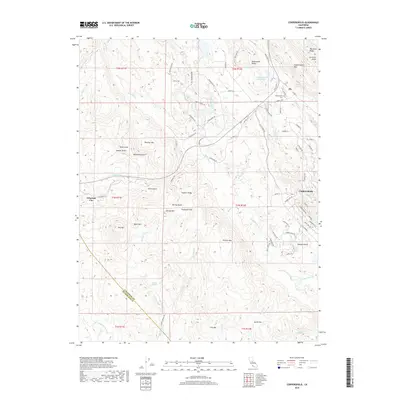
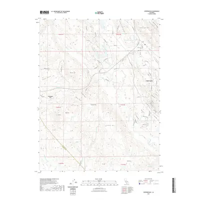
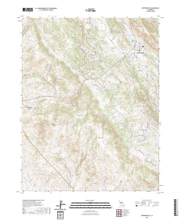 2023 Copperopolis2023 Print · USGSCalaveras County's famous copper-mining region is documented here in the early twenty-first century as it balances historic settlements with modern residential growth. Researchers can locate the Copperopolis Cem, trace the remains of Telegraph City, and explore the drainage of McCarty Creek.
End of results
Showing maps 1-15 of 15
Top cities near Telegraph City
Frequently asked questions
- What are the different types of historical maps available for Telegraph City?
- What is the oldest map of Telegraph City?
- Where can I purchase historical maps of Telegraph City for my home or office?
- Where can I download high-res historical maps of Telegraph City?
- Are there historical topographic maps available for Telegraph City?
- Is there historical aerial imagery available for Telegraph City?
- Where are historical maps of Telegraph City sourced from?