Old Maps of Oakdale, California
Explore 36 old maps of Oakdale, spanning from 1915 to today. These high-resolution historic maps reveal how streets, neighborhoods, landmarks, and natural features evolved over time — perfect for genealogy, metal detecting, research, and local history exploration.
What you can do with these maps:
- See how Oakdale changed over time: Compare historical maps to modern-day views to trace roads, homesites, rail lines & more.
- View detailed metadata: Each map includes creators, publishers, year, scale, and archive source.
- Overlay maps with satellite & LiDAR: Visualize the past alongside modern tools to explore terrain & human change.
- Trusted historical sources: Maps sourced from the USGS, Library of Congress, and other archives.
- Access maps your way: View online, download high-res files, or order prints for personal or research use.
Start exploring old maps of Oakdale to uncover forgotten places, hidden landmarks, and the deep history beneath your feet.
Oakdale, CA maps
(36)- 1915 Map of Oakdale
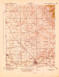
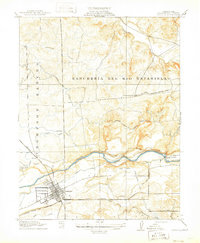 1915 Oakdale1915 Print · USGSStanislaus County at the height of its early twentieth-century rail boom serves as a hub for three distinct railroads. Genealogists and local historians can trace the early town grid of Oakdale, locate the Booth School, and explore the massive Rancheria Del Rio Estanislao land grant.2 unique versions available
 - 1915 Map of Thalheim
 1915 Thalheim1915 Print · USGSThe Central Valley's burgeoning irrigation and rail networks are captured here during a period of rapid agricultural expansion. Researchers can trace the development of early settlements like Thalheim and Escalon alongside rural landmarks such as Burwood School and the Thompson Rancho.2 unique versions available
 - 1916 Map of Riverbank
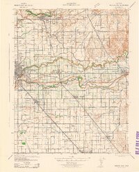
 1916 Riverbank1916 Print · USGSThe Stanislaus and Tuolumne Rivers frame this early twentieth-century survey of the California Central Valley. Researchers can trace the development of agricultural irrigation and rail transport through features like Burneyville Ferry, Riverbank, and McHenry School.2 unique versions available
 - 1916 Map of Waterford
 1916 Waterford1916 Print · USGSStanislaus County agriculture was entering a transformative era of irrigation and rail expansion just before the Great War. Genealogists and local historians can trace the early footprints of Waterford, the Thompson Rancho, and rural schools like Robinson and New Hope.2 unique versions available
 - 1939 Map of Modesto East, 1965 Print
 1939 Modesto East1965 Print · USGSStanislaus County thrived as a rail and irrigation hub just before the Second World War. Genealogists can locate family-named landmarks like Thompson Rancho, rural schoolhouses such as Bellpassi School, and the Stanislaus Cem burial grounds.
 - 1942 Map of Farmington
 1942 Farmington1942 Print · USGSThe San Joaquin and Stanislaus border country is revealed in the early 1940s as a complex network of rail lines and irrigation canals. Genealogists and historians can trace old school districts like Burwood Sch, the tracks of the Southern Pacific, and the early layout of Escalon.
 - 1942 Map of Modesto East
 1942 Modesto East1942 Print · USGSStanislaus County during the early war years shows an intricate landscape of irrigation canals and rural schoolhouses. Genealogists can locate family landmarks like St Stanislaus Cem, Robinson School, and the historic Thompson Rancho.
 - 1947 Map of San Jose, 1948 Print
 1947 San Jose1948 Print · USGSNorthern California's heartland is captured here just after the war, showing the rapid growth of the Santa Clara and Central Valleys. Researchers can trace the legacy of rail and water at Castle Air Force Base, Stockton, and the Hetch Hetchy Aqueduct.
 - 1953 Map of Escalon, 1954 Print
 1953 Escalon1954 Print · USGSSan Joaquin County agriculture and rail industry thrived mid-century as these two major railroads converged. Researchers can trace the layout of early schools like Union High Sch and Burwood Sch or locate family plots at Burwood Cem.
 - 1953 Map of Riverbank, 1954 Print
 1953 Riverbank1954 Print · USGSMid-century Modesto and Riverbank are shown here as the postwar agricultural economy is being joined by major industrial and aviation expansion. Researchers can find many family landmarks, including Belpassi School, the Riverbank Ordnance Plant, and the small settlement of D'Accardo.
 - 1953 Map of Oakdale, 1955 Print
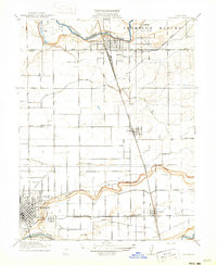
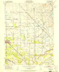
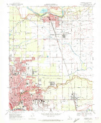
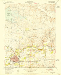 1953 Oakdale1955 Print · USGSOakdale and the surrounding Stanislaus County plains were defined by a robust rail-and-canal economy in the early fifties. Researchers can trace the dual tracks of the Southern Pacific and Atchison Topeka and Santa Fe Railroad near the Orange Blossom Bridge.
 - 1953 Map of Waterford, 1955 Print
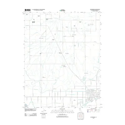
 1953 Waterford1955 Print · USGSWaterford and the surrounding agricultural lands are captured here in the mid-1950s as irrigation systems reshaped the landscape. Researchers can trace the Southern Pacific rail line through Claribel and locate regional landmarks like the local Winery and Gravel Pits.
 - 1956 Map of San Jose
 1956 San Jose1956 Print · USGSCentral California in the mid-fifties reveals the transition from sprawling orchards to growing urban hubs like San Jose and Stockton. Genealogists and historians can trace the rail-era landscape of the Mother Lode through Chinese Camp and Tuttletown, or follow the water through the Joaquin River and Calaveras Reservoir.
 - 1962 Map of San Jose
 1962 San Jose1962 Print · USGSCentral California in the early sixties showcases the expansion of the San Joaquin and Santa Clara valleys. Researchers can trace the rail-to-road transition along the Southern Pacific RR or locate landmarks like Castle USAF Base and Loma Prieta.4 unique versions available
 - 1966 Map of San Jose
 1966 San Jose1966 Print · USGSCentral California in the mid-1960s reveals a landscape of massive irrigation projects and expanding Cold War military footprints. Researchers can trace the rail-and-river network of the San Joaquin Valley or locate specialized sites like Castle Air Force Base and the Sharp General Depot (Military).
 - 1968 Map of Escalon, 1971 Print
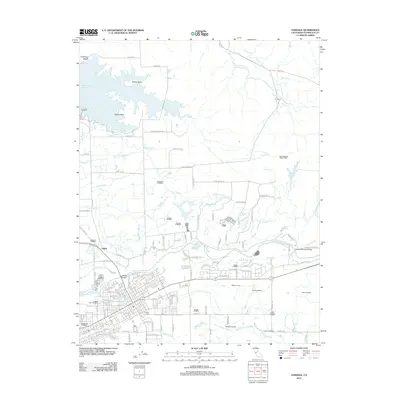
 1968 Escalon1971 Print · USGSThe Escalon area in the late sixties shows a thriving agricultural hub at the convergence of three major railroads. Genealogists can trace family names at Valley Home Cem, Burwood Sch, and along the banks of the Stanislaus River.4 unique versions available
 - 1968 Map of Oakdale, 1972 Print
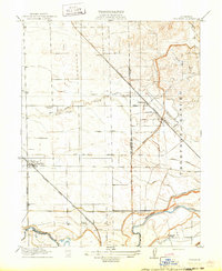
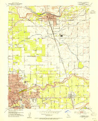
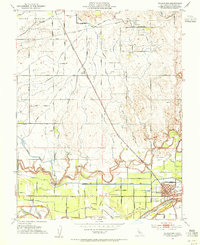
 1968 Oakdale1972 Print · USGSOakdale and the surrounding Stanislaus County landscape are documented here during a period of significant regional growth and infrastructure development. Genealogists and local historians can trace the foundations of the community through the IOOF Cemetery, Grange Hall, and the junction of major rail lines like the Southern Pacific.2 unique versions available
 - 1969 Map of Waterford, 1971 Print
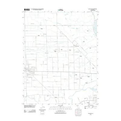
 1969 Waterford1971 Print · USGSStanislaus County agriculture and water infrastructure are in sharp focus during the late sixties, centered on the growing town of Waterford. Researchers can trace the path of the Southern Pacific through Claribel or locate the historic Grave near Dry Creek.2 unique versions available
 - 1969 Map of Riverbank, 1972 Print
 1969 Riverbank1972 Print · USGSMid-century Stanislaus County comes to life as a bustling hub of rail transport, military industry, and irrigation. Genealogists and historians can trace family locations near Empire, Claus, and neighborhood landmarks like Cardoza Sch and the City County Airport.3 unique versions available
 - 1994 Map of Oakdale, 1995 Print
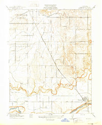
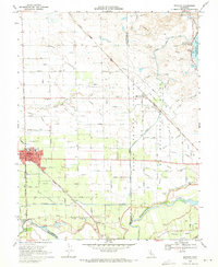
 1994 Oakdale1995 Print · USGSThe San Joaquin Valley meets the Sierra foothills in the mid-1990s, where massive reservoirs and canal networks fueled California's agricultural heartland. Researchers can trace the Hetch Hetchy Aqueduct, find the Sierra RR, and locate the Riverbank Army Ammunition Plant.2 unique versions available
 - 2012 Map of Waterford, 2012 Print
 2012 Waterford2012 Print · USGSCovers Oakdale, including Waterford, Claribel, and other nearby areas
 - 2012 Map of Escalon, 2012 Print
 2012 Escalon2012 Print · USGSCovers Oakdale, including Escalon, Valley Home, and other nearby areas
 - 2012 Map of Oakdale, 2012 Print
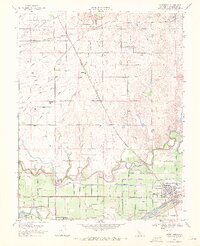
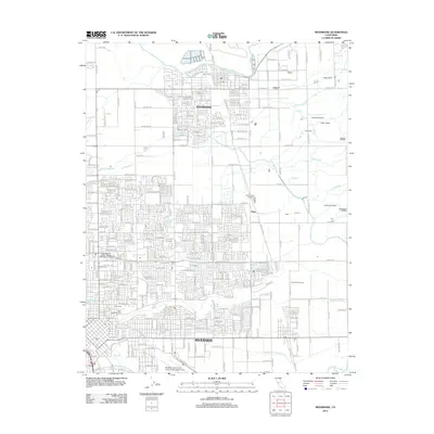
 2012 Oakdale2012 Print · USGSCovers Oakdale, including Adela, East Oakdale, and other nearby areas
 - 2012 Map of Riverbank, 2012 Print
 2012 Riverbank2012 Print · USGSCovers Oakdale, including Modesto, Riverbank, and other nearby areas
 - 2015 Map of Waterford, 2015 Print
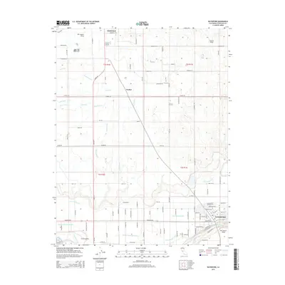 2015 Waterford2015 Print · USGSCovers Oakdale, including Waterford, Claribel, and other nearby areas
Showing maps 1-25 of 36
Top cities near Oakdale
- Modesto historical maps
- Ceres historical maps
- Riverbank historical maps
- Waterford historical maps
- Escalon historical maps
- Hughson historical maps
See more
Frequently asked questions
- What are the different types of historical maps available for Oakdale?
- What is the oldest map of Oakdale?
- Where can I purchase historical maps of Oakdale for my home or office?
- Where can I download high-res historical maps of Oakdale?
- Are there historical topographic maps available for Oakdale?
- Is there historical aerial imagery available for Oakdale?
- Where are historical maps of Oakdale sourced from?