2020s Maps of Oakdale, California
Explore 4 historic maps of Oakdale from the 2020s. These maps offer a rare glimpse into what life looked like during the 2020s — showing old roads, neighborhoods, homes, and landmarks that have changed or disappeared over time.
Whether you're researching your family's past, planning a metal detecting trip, or studying how Oakdale's landscape evolved across the 2020s, these high-resolution maps are a powerful tool for exploring the history of this region.
- Focus on a specific era: All maps on this page are from the 2020s, giving you a focused view of this time period.
- See what’s changed: Compare century-old streets, trails, and buildings to today's modern landscape using overlays and satellite layers.
- Research with precision: Use these maps for genealogy, historical research, land use analysis, or educational projects.
- View, download, or print: Maps are fully viewable online in high resolution, and can be downloaded or printed for your own records.
Start exploring Oakdale's history through authentic maps from the 2020s. This is your window into the past.
Oakdale, CA maps
(4)- 2021 Map of Oakdale, 2021 Print
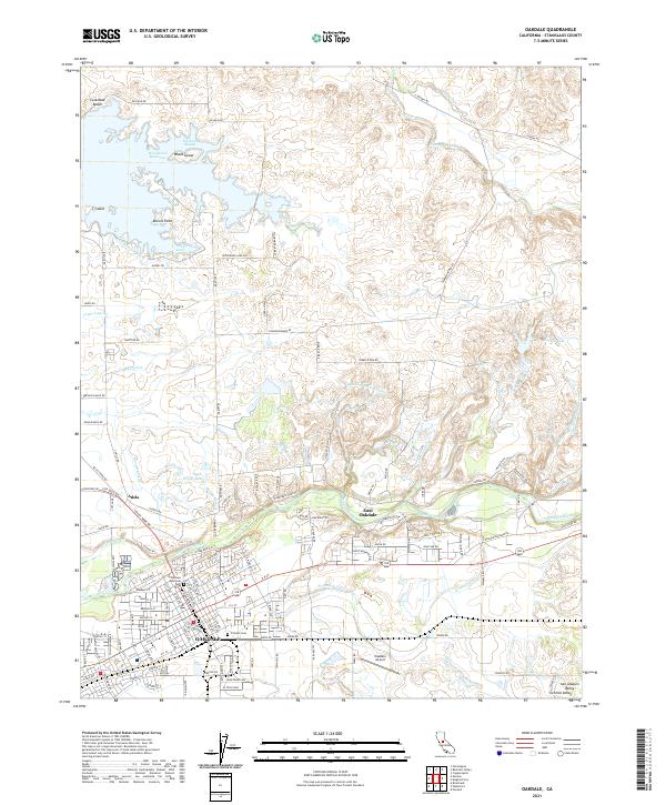 2021 Oakdale2021 Print · USGSOakdale and the surrounding agricultural lands of the San Joaquin Valley are captured here in the early twenty-first century. Genealogists and researchers can trace local landmarks like Citizens Cem, the Oakdale Airport, and the varied irrigation channels including the Oakdale N Main Canal.
 - 2021 Map of Waterford, 2021 Print
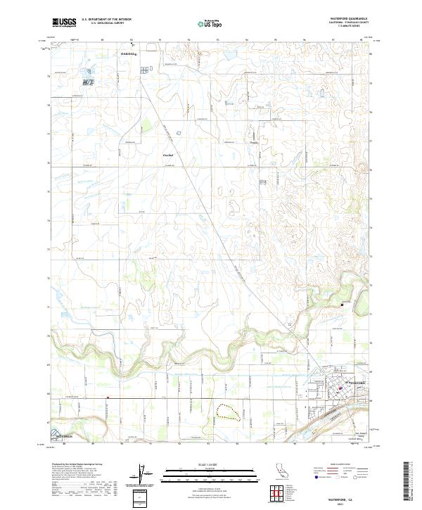 2021 Waterford2021 Print · USGSThe San Joaquin Valley at the start of the 2020s is defined by its massive irrigation networks and riverfront towns. Trace the paths of the Modesto Main Canal and the Tuolumne River near Waterford, Claribel, and the Martin Cem.
 - 2021 Map of Escalon, 2021 Print
 2021 Escalon2021 Print · USGSSan Joaquin and Stanislaus counties come together in this contemporary look at the valley's deep-rooted agricultural corridor. Genealogists and local historians can trace family land via Burwood Cem, the settlement at Valley Home, and the northern edge of Oakdale.
 - 2021 Map of Riverbank, 2021 Print
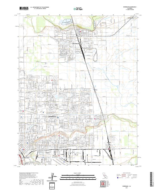 2021 Riverbank2021 Print · USGSThe Stanislaus River corridor and the growing suburbs of the San Joaquin Valley are captured here during a period of significant expansion. Genealogists and local historians can trace family locations near Saint Stanislaus Cem, the BNSF Railway lines, and early schools like Sylvan School.
End of results
Showing maps 1-4 of 4
Top cities near Oakdale
- Modesto historical maps
- Ceres historical maps
- Riverbank historical maps
- Waterford historical maps
- Escalon historical maps
- Hughson historical maps
See more
Frequently asked questions
- What are the different types of historical maps available for Oakdale?
- What is the oldest map of Oakdale?
- Where can I purchase historical maps of Oakdale for my home or office?
- Where can I download high-res historical maps of Oakdale?
- Are there historical topographic maps available for Oakdale?
- Is there historical aerial imagery available for Oakdale?
- Where are historical maps of Oakdale sourced from?