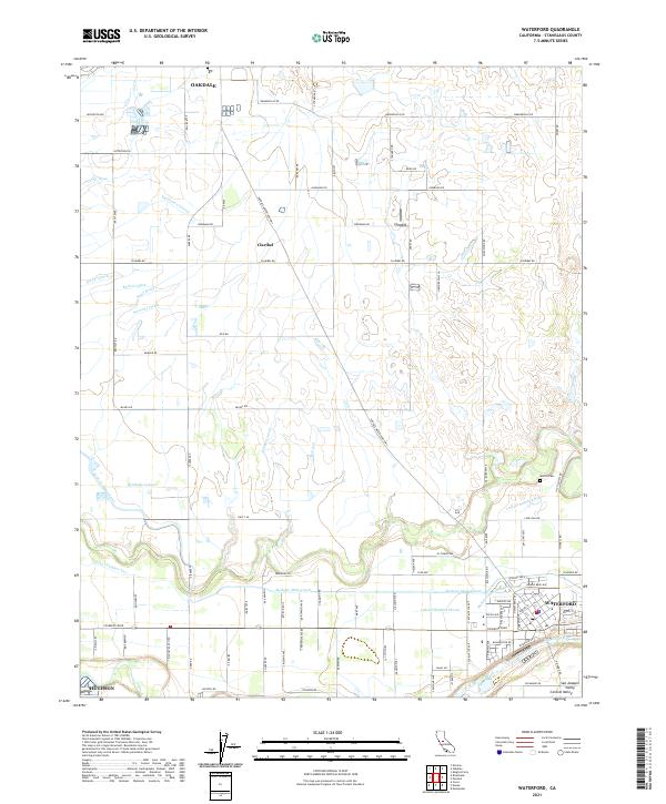
2021 Map of Waterford
USGS Topo · Published 2021About this map
The Tuolumne River winds through the southern reaches of this landscape, anchoring the city of Waterford and the northern edge of Hughson within the San Joaquin Valley. This 2021 study reveals an intricate network of irrigation infrastructure essential to the region's agricultural character, including the Modesto Main Canal and Waterford Lower Main Canal. Numerous distribution channels like the Brichetto Lateral, Stowell Lateral, and Lateral Number Nine carve through the terrain between the primary settlements.
Find a feature on this map
142 named features on this map. Tap any name to fly to it.
Don’t see what you’re looking for? This feature index may not catch every label — zoom into the map to look around manually.
Map Details
Editions of this 2021 Waterford Map
This is the sole edition of this map. No revisions or reprints were ever made.
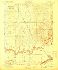
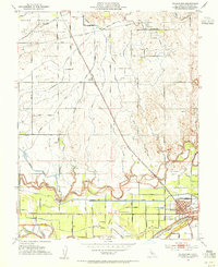
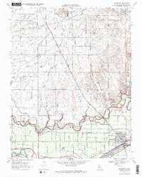
Historical Maps of Oakdale Through Time
4 maps found