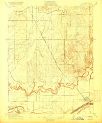
1916 Map of Waterford
USGS Topo · Published 1916About this map
Thompson Rancho dominates the northern reaches of this Central Valley landscape, illustrating the persistent influence of large land grants on early California settlement patterns. The map centers on the transition from the winding course of Dry Creek to the broader Tuolumne River in the south, where the town of Waterford is positioned at a strategic junction of water and road. This 1914 survey reveals an emerging irrigation network, highlighted by the Modesto Canal and No 2 Lateral, which began transforming the arid pastures into productive agricultural land during this era.
Find a feature on this map
12 named features on this map. Tap any name to fly to it.
Don’t see what you’re looking for? This feature index may not catch every label — zoom into the map to look around manually.
Map Details
Editions of this 1916 Waterford Map
2 editions found
Other maps of this area

1915 · Oakdale
USGS Topo · 1:31,680

1915 · Paulsell
USGS Topo · 1:31,680

1915 · Thalheim
USGS Topo · 1:31,680

1916 · Montpellier
USGS Topo · 1:31,680

1916 · Riverbank
USGS Topo · 1:31,680

1916 · Denair
USGS Topo · 1:31,680

1916 · Waterford
USGS Topo · 1:31,680

1916 · Ceres
USGS Topo · 1:31,680

1916 · Copperopolis
USGS Topo · 1:62,500

1939 · Modesto East
USGS Topo · 1:62,500