
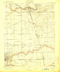
1916 Map of Riverbank
USGS Topo · Published 1916About this map
The Stanislaus River and Tuolumne River anchor this 1916 landscape, defining a fertile corridor of the Central Valley before modern urban expansion. The settlement of Riverbank is shown in its early grid pattern, serving as a vital rail hub where the Atchison Topeka and Santa Fe and the Oakdale Branch converge. This era reveals an agricultural society organized around irrigation, with Lateral No 6 and Lateral No 3 of the Modesto Canal cutting across the ranch lands.
Find a feature on this map
28 named features on this map. Tap any name to fly to it.
Don’t see what you’re looking for? This feature index may not catch every label — zoom into the map to look around manually.
Map Details
Editions of this 1916 Riverbank Map
2 editions found
Other maps of this area

1914 · Avena
USGS Topo · 1:31,680

1915 · Oakdale
USGS Topo · 1:31,680

1915 · Westport
USGS Topo · 1:31,680

1915 · Salida
USGS Topo · 1:31,680

1915 · Thalheim
USGS Topo · 1:31,680

1916 · Denair
USGS Topo · 1:31,680

1916 · Waterford
USGS Topo · 1:31,680

1916 · Ceres
USGS Topo · 1:31,680

1939 · Modesto East
USGS Topo · 1:62,500
1941 · Modesto West
USGS Topo · 1:62,500