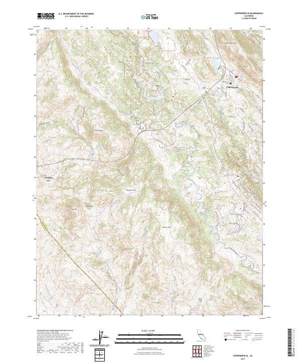
2023 Map of Copperopolis
USGS Topo · Published 2023About this map
Copperopolis sits near the foot of Copperopolis Mtn, anchoring a landscape defined by the intersection of the Sierra Foothills and the Central Valley. This survey documents the modern layout of the town and its surrounding highlands, including the Copperopolis Cem and the Copperopolis Reservoir. The terrain is deeply incised by a network of seasonal watercourses and ridges, from Big Seven Ridge in the north to the southern slopes of Iron Mtn.
Find a feature on this map
90 named features on this map. Tap any name to fly to it.
Don’t see what you’re looking for? This feature index may not catch every label — zoom into the map to look around manually.
Map Details
Editions of this 2023 Copperopolis Map
This is the sole edition of this map. No revisions or reprints were ever made.
Other maps of this area

1889 · Jackson
USGS Topo · 1:125,000

1892 · Jackson
USGS Topo · 1:125,000

1897 · Jackson
USGS Topo · 1:125,000

1902 · Jackson
USGS Topo · 1:125,000

1915 · Oakdale
USGS Topo · 1:31,680

1916 · Bachelor Valley
USGS Topo · 1:31,680

1916 · Copperopolis
USGS Topo · 1:62,500

1942 · Farmington
USGS Topo · 1:62,500

1942 · Copperopolis
USGS Topo · 1:62,500

1944 · Valley Springs
USGS Topo · 1:62,500
Featured Places
- Telegraph City, CA
- Copper Cove Subdivision, CA
- Copper Cove Village, CA
- Copperopolis, CA
- Stanislaus County, CA