2000s (21st Century) Maps of Auberry, California
Explore 5 historic maps of Auberry from the 2000s (21st Century). These maps offer a rare glimpse into what life looked like during the 2000s — showing old roads, neighborhoods, homes, and landmarks that have changed or disappeared over time.
Whether you're researching your family's past, planning a metal detecting trip, or studying how Auberry's landscape evolved across the 2000s, these high-resolution maps are a powerful tool for exploring the history of this region.
- Focus on a specific era: All maps on this page are from the 2000s, giving you a focused view of this time period.
- See what’s changed: Compare century-old streets, trails, and buildings to today's modern landscape using overlays and satellite layers.
- Research with precision: Use these maps for genealogy, historical research, land use analysis, or educational projects.
- View, download, or print: Maps are fully viewable online in high resolution, and can be downloaded or printed for your own records.
Start exploring Auberry's history through authentic maps from the 2000s. This is your window into the past.
Auberry, CA maps
(5)- 2004 Map of Auberry, 2007 Print
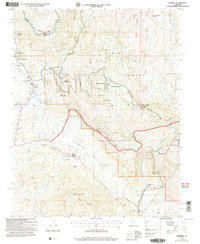 2004 Auberry2007 Print · USGSFresno County's foothill communities are captured here in the early 2000s, showing the junction of forest lands and local settlements. Genealogists can locate family landmarks such as the Cem near the Indian Mission and the Auberry Union Sch.
 - 2012 Map of Auberry, 2012 Print
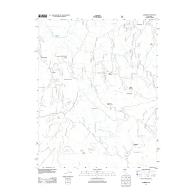 2012 Auberry2012 Print · USGSCovers Auberry, including Meadow Lakes, New Auberry, and other nearby areas
 - 2015 Map of Auberry, 2015 Print
 2015 Auberry2015 Print · USGSCovers Auberry, including Meadow Lakes, New Auberry, and other nearby areas
 - 2018 Map of Auberry, 2018 Print
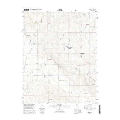
 2018 Auberry2018 Print · USGSCovers Auberry, including Meadow Lakes, New Auberry, and other nearby areas
 - 2021 Map of Auberry, 2021 Print
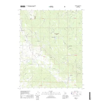
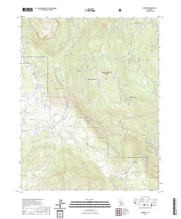 2021 Auberry2021 Print · USGSIn the Sierra Nevada foothills during the early twenty-first century, this area shows the development of mountain communities and forest management. Researchers can trace local history at Tollhouse Cem, the Prescott Mill, and through the residential clusters at Meadow Lakes and Alder Springs.
End of results
Showing maps 1-5 of 5
Top cities near Auberry
Frequently asked questions
- What are the different types of historical maps available for Auberry?
- What is the oldest map of Auberry?
- Where can I purchase historical maps of Auberry for my home or office?
- Where can I download high-res historical maps of Auberry?
- Are there historical topographic maps available for Auberry?
- Is there historical aerial imagery available for Auberry?
- Where are historical maps of Auberry sourced from?