Old Maps of Kneeland, California for Hiking & Exploration
Hike through history with 10 historic maps of Kneeland. Explore old trails, ghost towns, and forgotten backroads — perfect for outdoor adventurers and local explorers.
- Rediscover forgotten places: Map out old mining camps, roads, and footpaths that no longer exist on modern maps.
- Layer with modern tools: Combine with LiDAR or satellite views to plan hikes through historical terrain.
- Made for exploration: Popular among hikers, overlanders, and local history lovers.
Use these maps to find adventure and explore the hidden past of Kneeland.
Kneeland, CA maps
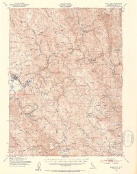
(10)- 1922 Map of Korbel
 1922 Korbel1922 Print · USGSHumboldt County’s timber and rail economy is on full display in the early 1920s as rail lines converge along the Mad River. Genealogists and historians can trace family-named outposts like Berry's, Bairs, and Murphy or follow the early tracks of the Arcata and Mad River Railroad.
 - 1945 Map of Blue Lake, 1948 Print
 1945 Blue Lake1948 Print · USGSCoastal Humboldt County meets the timber-heavy interior in the 1940s, showing a landscape of scattered family ranches and river-based industry. Genealogy researchers can trace family lands like Angel Ranch or find vanished school sites such as Maple Creek School.
 - 1951 Map of Blue Lake, 1953 Print
 1951 Blue Lake1953 Print · USGSCoastal Humboldt County in the early 1950s shows the deep connection between the timber industry and the high-prairie ranching life. Genealogists can trace family landmarks and rural infrastructure like Blue Lake, the Ford Ranch, and the Redwood School.5 unique versions available
 - 1958 Map of Redding
 1958 Redding1958 Print · USGSNorthern California's valley and mountain landscapes are captured in the late fifties, showing the region as new reservoirs reshaped the river systems. Genealogists and historians can trace rail-side towns like Cottonwood, the military presence at Red Bluff Air Force Station, and mountain outposts like Weaverville.5 unique versions available
 - 1979 Map of Korbel
 1979 Korbel1979 Print · USGSCoastal Humboldt County during the late 1970s reveals a landscape of working ranches and remote river valleys. Genealogists and local historians can trace family-named sites like Angel Ranch, the settlement of Korbel, and the distinct high prairies of Fickle Hill.
 - 1982 Map of Hayfork, 1983 Print
 1982 Hayfork1983 Print · USGSTrinity and Humboldt counties appear here in the early eighties as a landscape of timber and mining. Researchers can trace remote river settlements like Hyampom and Burnt Ranch or locate old operations such as the Yellowstone Mine and Index Mine.
 - 2012 Map of Korbel, 2012 Print
 2012 Korbel2012 Print · USGSCovers Kneeland, including Arcata, Blue Lake, and other nearby areas
 - 2015 Map of Korbel, 2015 Print
 2015 Korbel2015 Print · USGSCovers Kneeland, including Arcata, Blue Lake, and other nearby areas
 - 2018 Map of Korbel, 2018 Print
 2018 Korbel2018 Print · USGSCovers Kneeland, including Arcata, Blue Lake, and other nearby areas
 - 2021 Map of Korbel, 2021 Print
 2021 Korbel2021 Print · USGSHumboldt County’s river-carved timber lands are captured in this modern survey, showing the relationship between steep topography and rural settlements. Researchers can trace the path of the Mad River near Korbel or explore remote locales like Camp Four Flat and Lost Meadow.
End of results
Showing maps 1-10 of 10
Top cities near Kneeland
- Eureka historical maps
- Arcata historical maps
- McKinleyville historical maps
- Fortuna historical maps
- Fortuna historical maps
- Blue Lake historical maps
Frequently asked questions
- What are the different types of historical maps available for Kneeland?
- What is the oldest map of Kneeland?
- Where can I purchase historical maps of Kneeland for my home or office?
- Where can I download high-res historical maps of Kneeland?
- Are there historical topographic maps available for Kneeland?
- Is there historical aerial imagery available for Kneeland?
- Where are historical maps of Kneeland sourced from?