Old Maps of Maple Creek, California for Academic Research
Study the evolution of Maple Creek with 11 high-resolution historic maps. Whether you're teaching, researching, or modeling changes in land use, these maps provide essential visual documentation of urban, environmental, and geographic change.
- Analyze long-term change: Track patterns in development, transportation, and natural features.
- Ideal for environmental or urban studies: Support academic projects with primary historical map data.
- Use in the classroom or lab: Educators and researchers rely on these maps to bring historical context to life.
These maps are a powerful tool for teaching, research, and visualizing how Maple Creek has changed over the decades.
Maple Creek, CA maps
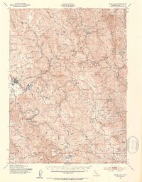
(11)- 1922 Map of Korbel
 1922 Korbel1922 Print · USGSHumboldt County’s timber and rail economy is on full display in the early 1920s as rail lines converge along the Mad River. Genealogists and historians can trace family-named outposts like Berry's, Bairs, and Murphy or follow the early tracks of the Arcata and Mad River Railroad.
 - 1945 Map of Blue Lake, 1948 Print
 1945 Blue Lake1948 Print · USGSCoastal Humboldt County meets the timber-heavy interior in the 1940s, showing a landscape of scattered family ranches and river-based industry. Genealogy researchers can trace family lands like Angel Ranch or find vanished school sites such as Maple Creek School.
 - 1951 Map of Blue Lake, 1953 Print
 1951 Blue Lake1953 Print · USGSCoastal Humboldt County in the early 1950s shows the deep connection between the timber industry and the high-prairie ranching life. Genealogists can trace family landmarks and rural infrastructure like Blue Lake, the Ford Ranch, and the Redwood School.5 unique versions available
 - 1958 Map of Redding
 1958 Redding1958 Print · USGSNorthern California's valley and mountain landscapes are captured in the late fifties, showing the region as new reservoirs reshaped the river systems. Genealogists and historians can trace rail-side towns like Cottonwood, the military presence at Red Bluff Air Force Station, and mountain outposts like Weaverville.5 unique versions available
 - 1977 Map of Maple Creek, 1978 Print
 1977 Maple Creek1978 Print · USGSHumboldt County ranching and timber lands are documented here in the late seventies, showing the remote outposts of the northern coast ranges. Researchers can trace family-named landmarks like Russ Ranch, Ayres Cabin, and the small settlement at Maple Creek.
 - 1982 Map of Hayfork, 1983 Print
 1982 Hayfork1983 Print · USGSTrinity and Humboldt counties appear here in the early eighties as a landscape of timber and mining. Researchers can trace remote river settlements like Hyampom and Burnt Ranch or locate old operations such as the Yellowstone Mine and Index Mine.
 - 1997 Map of Maple Creek, 2001 Print
 1997 Maple Creek2001 Print · USGSHumboldt County ranching and timber lands are preserved here as they stood in the late twentieth century. Researchers can locate remote family landmarks like Ayers Cabin and Russ Ranch or trace the geography of high-country clearings such as Lake Prairie.
 - 2012 Map of Maple Creek, 2012 Print
 2012 Maple Creek2012 Print · USGSCovers Maple Creek, including Fernwood, Humboldt County, and other nearby areas
 - 2015 Map of Maple Creek, 2015 Print
 2015 Maple Creek2015 Print · USGSCovers Maple Creek, including Fernwood, Humboldt County, and other nearby areas
 - 2018 Map of Maple Creek, 2018 Print
 2018 Maple Creek2018 Print · USGSCovers Maple Creek, including Fernwood, Humboldt County, and other nearby areas
 - 2021 Map of Maple Creek, 2021 Print
 2021 Maple Creek2021 Print · USGSHumboldt County’s forest landscape is documented here in the early 2020s, showing the intersection of public lands and rural settlements. Researchers can trace historic access routes like Guy Kerr Ranch Rd and locate landmarks such as Murphy Meadow and Lake Prairie.
End of results
Showing maps 1-11 of 11
Top cities near Maple Creek
Frequently asked questions
- What are the different types of historical maps available for Maple Creek?
- What is the oldest map of Maple Creek?
- Where can I purchase historical maps of Maple Creek for my home or office?
- Where can I download high-res historical maps of Maple Creek?
- Are there historical topographic maps available for Maple Creek?
- Is there historical aerial imagery available for Maple Creek?
- Where are historical maps of Maple Creek sourced from?