Old Maps of Port Kenyon, California for Hiking & Exploration
Hike through history with 14 historic maps of Port Kenyon. Explore old trails, ghost towns, and forgotten backroads — perfect for outdoor adventurers and local explorers.
- Rediscover forgotten places: Map out old mining camps, roads, and footpaths that no longer exist on modern maps.
- Layer with modern tools: Combine with LiDAR or satellite views to plan hikes through historical terrain.
- Made for exploration: Popular among hikers, overlanders, and local history lovers.
Use these maps to find adventure and explore the hidden past of Port Kenyon.
Port Kenyon, CA maps
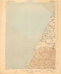
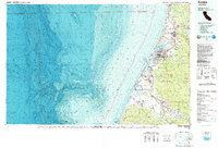
(14)- 1916 Map of Cape Fortunas
 1916 Cape Fortunas1916 Print · USGSCoastal Humboldt County was a landscape of tide-water sloughs and productive dairies during this 1910s survey. Researchers can trace the early property boundaries of the Mayflower Ranch or locate vanished sites like the Belmonte Creamery and the river landing at Port Kenyon.
 - 1943 Map of Ferndale
 1943 Ferndale1943 Print · USGSThe lower Eel River delta and the Humboldt coastline are shown here during the early 1940s. Genealogists and local researchers can trace the locations of numerous rural schoolhouses and family landmarks like Port Kenyon, Table Bluff Rancheria, and Fern Cottage.2 unique versions available
 - 1949 Map of Eureka
 1949 Eureka1949 Print · USGSCoastal Northern California in the late 1940s shows a landscape of timber towns and maritime outposts. You can trace the Northwestern Pacific rail line through Eureka or locate family landmarks like the Tyson Chrome Mine and Crescent City Lighthouse.2 unique versions available
 - 1951 Map of Ferndale, 1953 Print
 1951 Ferndale1953 Print · USGSCoastal Humboldt County and the Eel River delta are captured here in the early fifties during a period of active ranching and maritime surveillance. Genealogists can trace family landmarks like Fern Cottage and Arlynda Corners or locate several local schoolhouses including Eel River Sch and Table Bluff Sch.2 unique versions available
 - 1958 Map of Eureka, 1967 Print
 1958 Eureka1967 Print · USGSNorthern California's rugged redwood coast and timber corridors are captured in the late fifties, from the Oregon border down to Shelter Cove. Researchers can trace the path of the Northwestern Pacific railroad and locate rural landmarks like Grizzly Bluff School or the St Josephs Sch.
 - 1958 Map of Eureka, 1978 Print
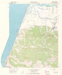
 1958 Eureka1978 Print · USGSCoastal Humboldt County is captured here in the late fifties, showing the region's logging and maritime identity before later development changed the Eel River delta. Genealogists and historians can trace the Northwestern Pacific rail line and locate old community hubs like Rio Dell, Scotia, and Ferndale.
 - 1959 Map of Ferndale, 1961 Print
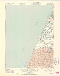
 1959 Ferndale1961 Print · USGSHumboldt County's coastal ranching country is captured here during the late fifties, showing the productive lands between the mountains and the sea. Researchers can trace historic family properties like Fern Cottage or locate the Island School and Port Kenyon.3 unique versions available
 - 1959 Map of Ferndale, 1961 Print
 1959 Ferndale1961 Print · USGSThe Eel River delta and Humboldt coast are captured here in the late fifties, showing a landscape of tidal sloughs and established dairy ranches. Genealogists can locate family landmarks like Mayflower Ranch, Port Kenyon, and the Table Bluff Rancheria.2 unique versions available
 - 1961 Map of Eureka
 1961 Eureka1961 Print · USGSThe Northern California coast and its deep redwood forests are mapped here at a time when the timber and rail industries defined the region. Researchers can trace historic family ranches and remote sites like Fort Dick, Table Bluff Lighthouse, and the Copper Creek Mine.2 unique versions available
 - 1987 Map of Eureka
 1987 Eureka1987 Print · USGSThe Humboldt County coastline in the late eighties reveals a landscape shaped by timber, transport, and the sea. Trace the Northwestern Pacific RR through Eureka or locate family roots near Ocean View Cem and Arlynda Corners.
 - 2012 Map of Ferndale, 2012 Print
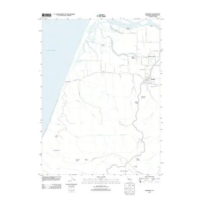 2012 Ferndale2012 Print · USGSCovers Port Kenyon, including Ferndale, Arlynda Corners, and other nearby areas
 - 2015 Map of Ferndale, 2015 Print
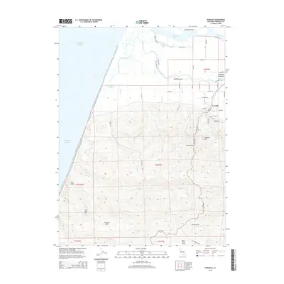 2015 Ferndale2015 Print · USGSCovers Port Kenyon, including Ferndale, Arlynda Corners, and other nearby areas
 - 2018 Map of Ferndale, 2018 Print
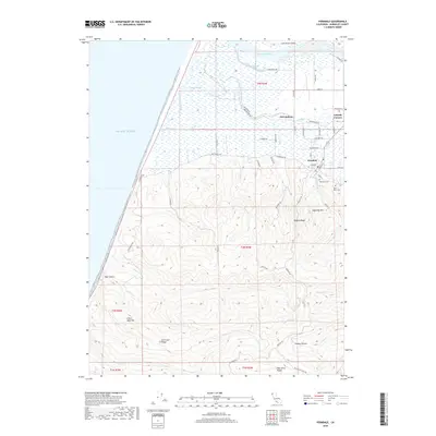 2018 Ferndale2018 Print · USGSCovers Port Kenyon, including Ferndale, Arlynda Corners, and other nearby areas
 - 2022 Map of Ferndale, 2022 Print
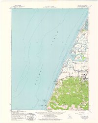
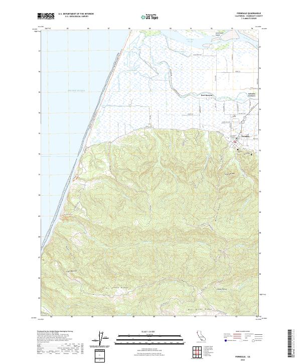 2022 Ferndale2022 Print · USGSCoastal Humboldt County meets the steep ascent of the ridges in this 2022 survey of the Eel River delta. Trace local genealogy and geography through landmarks like Ferndale Cem, the historic river landing at Port Kenyon, and the heights of Sugarloaf Mtn.
End of results
Showing maps 1-14 of 14
Top cities near Port Kenyon
- Eureka historical maps
- Arcata historical maps
- Fortuna historical maps
- Fortuna historical maps
- Rio Dell historical maps
- Ferndale historical maps
See more
Frequently asked questions
- What are the different types of historical maps available for Port Kenyon?
- What is the oldest map of Port Kenyon?
- Where can I purchase historical maps of Port Kenyon for my home or office?
- Where can I download high-res historical maps of Port Kenyon?
- Are there historical topographic maps available for Port Kenyon?
- Is there historical aerial imagery available for Port Kenyon?
- Where are historical maps of Port Kenyon sourced from?