1940s Maps of Table Bluff Wiyot Reservation / giloulh, California
Explore 4 historic maps of Table Bluff Wiyot Reservation / giloulh from the 1940s. These maps offer a rare glimpse into what life looked like during the 1940s — showing old roads, neighborhoods, homes, and landmarks that have changed or disappeared over time.
Whether you're researching your family's past, planning a metal detecting trip, or studying how Table Bluff Wiyot Reservation / giloulh's landscape evolved across the 1940s, these high-resolution maps are a powerful tool for exploring the history of this region.
- Focus on a specific era: All maps on this page are from the 1940s, giving you a focused view of this time period.
- See what’s changed: Compare century-old streets, trails, and buildings to today's modern landscape using overlays and satellite layers.
- Research with precision: Use these maps for genealogy, historical research, land use analysis, or educational projects.
- View, download, or print: Maps are fully viewable online in high resolution, and can be downloaded or printed for your own records.
Start exploring Table Bluff Wiyot Reservation / giloulh's history through authentic maps from the 1940s. This is your window into the past.
Table Bluff Wiyot Reservation / giloulh, CA maps
(4)- 1942 Map of Eureka
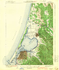 1942 Eureka1942 Print · USGSCoastal Humboldt County appears here in the early 1940s, showing the vital rail and maritime links between the bay and the redwood interior. Genealogists can locate family landmarks like Fieldbrook Sch and vanished junctions such as Freshwater Junction or Essex.3 unique versions available
 - 1943 Map of Ferndale
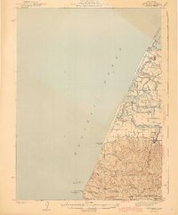 1943 Ferndale1943 Print · USGSThe lower Eel River delta and the Humboldt coastline are shown here during the early 1940s. Genealogists and local researchers can trace the locations of numerous rural schoolhouses and family landmarks like Port Kenyon, Table Bluff Rancheria, and Fern Cottage.2 unique versions available
 - 1944 Map of Fortuna
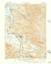 1944 Fortuna1944 Print · USGSHumboldt County’s timber and ranching heartland is captured here in the early 1940s as the Eel River valley flourished. Genealogists can trace family roots through numerous rural school sites like Bucksport Sch and Grant Union Sch or the mill town of Falk.3 unique versions available
 - 1949 Map of Eureka
 1949 Eureka1949 Print · USGSCoastal Northern California in the late 1940s shows a landscape of timber towns and maritime outposts. You can trace the Northwestern Pacific rail line through Eureka or locate family landmarks like the Tyson Chrome Mine and Crescent City Lighthouse.2 unique versions available
End of results
Showing maps 1-4 of 4
Top cities near Table Bluff Wiyot Reservation / giloulh
- Eureka historical maps
- Arcata historical maps
- McKinleyville historical maps
- Fortuna historical maps
- Fortuna historical maps
- Ferndale historical maps
See more
Frequently asked questions
- What are the different types of historical maps available for Table Bluff Wiyot Reservation / giloulh?
- What is the oldest map of Table Bluff Wiyot Reservation / giloulh?
- Where can I purchase historical maps of Table Bluff Wiyot Reservation / giloulh for my home or office?
- Where can I download high-res historical maps of Table Bluff Wiyot Reservation / giloulh?
- Are there historical topographic maps available for Table Bluff Wiyot Reservation / giloulh?
- Is there historical aerial imagery available for Table Bluff Wiyot Reservation / giloulh?
- Where are historical maps of Table Bluff Wiyot Reservation / giloulh sourced from?