Old Maps of Bombay Beach, California for Metal Detecting
Plan your next treasure hunt with 17 historic maps of Bombay Beach. Find old homesites, ghost towns, trails, and gathering spots that may be lost to time — perfect for identifying promising metal detecting locations.
- Locate forgotten sites: Uncover places like long-lost settlements, abandoned rail lines, or gathering spots.
- Plan better hunts: Use map overlays combined with LiDAR or satellite views to narrow in on historically rich areas.
- Made for detectorists: Thousands of hobbyists use these maps to discover relics, coins, and hidden history.
Use these historic maps to boost your research and find new opportunities beneath the surface of Bombay Beach.
Bombay Beach, CA maps
(17)- 1940 Map of Frink, 1956 Print
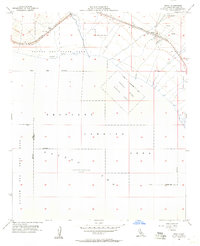
 1940 Frink1956 Print · USGSThe Imperial County desert meets the shoreline of the Salton Sea in the early 1940s as infrastructure begins to reshape the basin. You can trace the Southern Pacific rail line through remote stops at Frink, Pope, and Wister, or locate the historic Frink Spring.
 - 1944 Map of Frink, 1945 Print
 1944 Frink1945 Print · USGSWartime Imperial County comes to life along the Salton Sea shoreline as the irrigation network expands across the desert. Genealogists and historians can trace rail stops at Bombay Beach and Mundo, or find the Imperial Salt Co and Greer Ranch.
 - 1954 Map of Salton Sea
 1954 Salton Sea1954 Print · USGSThe Colorado River and Imperial Valley desert frontiers are captured here in the 1950s. Trace the irrigation networks of Calipatria and mining sites like Eagle Mountain Mine.
 - 1955 Map of Salton Sea
 1955 Salton Sea1955 Print · USGSThe Colorado River and Imperial Valley desert basins appear here during the mid-fifties, revealing a landscape of remote mines and agricultural irrigation. Genealogists and researchers can trace locations like the Parker Alien Reception Center Unit No 1, Blythe, and the Kane Springs School.2 unique versions available
 - 1956 Map of Frink, 1957 Print
 1956 Frink1957 Print · USGSThe northeastern shore of the Salton Sea in the 1950s was a landscape defined by military aviation and desert rail commerce. Genealogists and historians can trace the rail sidings at Frink and Pope, or examine the extensive Naval Reservation and its Landing Strip.3 unique versions available
 - 1956 Map of Frink, 1958 Print
 1956 Frink1958 Print · USGSThe eastern shores of the Salton Sea come into focus during the mid-fifties, revealing a desert landscape shaped by military ranges and irrigation canals. Genealogists and desert historians can trace the Southern Pacific rail stops at Frink and Mundo or locate the unique Tropical Fish Farm near Hot Mineral Spa.3 unique versions available
 - 1959 Map of Salton Sea, 1968 Print
 1959 Salton Sea1968 Print · USGSThe Colorado River and Salton Sea basin are shown here during a decade of intense military and agricultural activity. Trace family roots in Blythe or Niland, and locate historical mining operations like the Eagle Mountain Mine and Red Cloud Mine.4 unique versions available
 - 1963 Map of Salton Sea
 1963 Salton Sea1963 Print · USGSThe Colorado Desert during the early sixties shows a landscape defined by massive water projects and Cold War military ranges. Trace the growth of Salton City and Brawley, or locate remote desert outposts like the Paymaster Mine and Desert Center.
 - 1965 Map of Salton Sea
 1965 Salton Sea1965 Print · USGSThe Colorado Desert and Imperial Valley are caught in a period of intense irrigation and military expansion during the mid-sixties. Researchers can trace the desert's industrial footprint through the Eagle Mountain Mine, the remote Desert Center, and the Salton Sea Test Base.
 - 1985 Map of Salton Sea
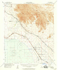
 1985 Salton Sea1985 Print · USGSIn the mid-1980s, the California desert around the Salton Sea shows a unique mix of military gunnery ranges, irrigated agriculture, and shoreline settlements. Trace the Southern Pacific rail route through Niland and Bombay Beach, or locate remote desert sites like the Black Eagle Mine.2 unique versions available
 - 1992 Map of Frink, 1995 Print
 1992 Frink1995 Print · USGSThe Salton Sea shoreline in the early nineties reveals a landscape of desert recreation and resource extraction. Researchers can trace the layout of Bombay Beach or locate the historic waters of Frink Spring and the settlement at Pope.
 - 1998 Map of Frink, 2002 Print
 1998 Frink2002 Print · USGSThe eastern shore of the Salton Sea in the late 1990s reveals a mix of desert recreation and industrial utility. Researchers can trace the layout of Bombay Beach, locate the Landing Strip at Frink, and find water sources like Frink Spring.
 - 2002 Map of Frink, 2004 Print
 2002 Frink2004 Print · USGSThe eastern shore of the Salton Sea and the Chocolate Mountains are documented here in the early 2000s. Researchers can trace the Southern Pacific rail corridor and explore sites like Bombay Beach, Wister, and the Aerial Gunnery Range.
 - 2012 Map of Frink, 2012 Print
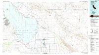
 2012 Frink2012 Print · USGSCovers Bombay Beach, including Imperial County, United States, and other nearby areas
 - 2015 Map of Frink, 2015 Print
 2015 Frink2015 Print · USGSCovers Bombay Beach, including Imperial County, United States, and other nearby areas
 - 2018 Map of Frink, 2018 Print
 2018 Frink2018 Print · USGSCovers Bombay Beach, including Imperial County, United States, and other nearby areas
 - 2021 Map of Frink, 2021 Print
 2021 Frink2021 Print · USGSThe northeastern shoreline of the Salton Sea comes into focus in this recent survey of the California desert. Genealogists and local historians can trace the street grid of Bombay Beach or locate the sites of Pope, Frink, and Frink Spring.
End of results
Showing maps 1-17 of 17
Top cities near Bombay Beach
Frequently asked questions
- What are the different types of historical maps available for Bombay Beach?
- What is the oldest map of Bombay Beach?
- Where can I purchase historical maps of Bombay Beach for my home or office?
- Where can I download high-res historical maps of Bombay Beach?
- Are there historical topographic maps available for Bombay Beach?
- Is there historical aerial imagery available for Bombay Beach?
- Where are historical maps of Bombay Beach sourced from?