1900s (20th Century) Maps of Fish Springs, California
Explore 10 historic maps of Fish Springs from the 1900s (20th Century). These maps offer a rare glimpse into what life looked like during the 1900s — showing old roads, neighborhoods, homes, and landmarks that have changed or disappeared over time.
Whether you're researching your family's past, planning a metal detecting trip, or studying how Fish Springs's landscape evolved across the 1900s, these high-resolution maps are a powerful tool for exploring the history of this region.
- Focus on a specific era: All maps on this page are from the 1900s, giving you a focused view of this time period.
- See what’s changed: Compare century-old streets, trails, and buildings to today's modern landscape using overlays and satellite layers.
- Research with precision: Use these maps for genealogy, historical research, land use analysis, or educational projects.
- View, download, or print: Maps are fully viewable online in high resolution, and can be downloaded or printed for your own records.
Start exploring Fish Springs's history through authentic maps from the 1900s. This is your window into the past.
Fish Springs, CA maps
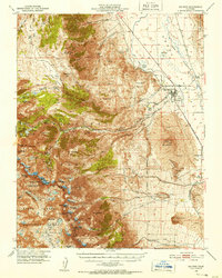
(10)- 1913 Map of Bishop
 1913 Bishop1913 Print · USGSThe Owens Valley was a landscape of high-altitude industry and burgeoning towns in the years before massive water diversions. Trace the path of the Southern Pacific Railroad through Laws and Big Pine, or locate family sites like Roberts Ranch and the Riverside School.8 unique versions available
 - 1947 Map of Mariposa, 1948 Print
 1947 Mariposa1948 Print · USGSThe High Sierra and Owens Valley transition is captured here in the late 1940s, just as the region’s hydroelectric and tourism infrastructure was maturing. Genealogists and historians can trace old ranger stations, the Casa Diablo Mine, and rail stops along the Southern Pacific like Benton Station and Zurich.2 unique versions available
 - 1948 Map of Mariposa, 1951 Print
 1948 Mariposa1951 Print · USGSThe High Sierra and Mariposa foothills are shown here in the late 1940s as the post-war tourism and water infrastructure expanded. Genealogists and historians can locate vanished waypoints like Mormon Bar, the Glacier Point Hotel, and the granite quarries of Knowles.
 - 1950 Map of Big Pine, 1952 Print
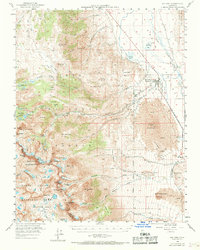
 1950 Big Pine1952 Print · USGSBig Pine and the Owens Valley are captured here in the early fifties, showing the vital intersection of the Southern Pacific railroad and local irrigation. Researchers can trace the legacy of the Big Pine Rancheria, the County Farm, and the high-altitude route of the John Muir Trail.5 unique versions available
 - 1957 Map of Mariposa, 1966 Print
 1957 Mariposa1966 Print · USGSThe High Sierra and Owens Valley appear in the mid-fifties, showing the intersection of conservation, hydroelectric power, and mountain industry. Genealogists and researchers can trace local landmarks like Yosemite Cemetery, the remote Kinsley Station, and the Pine Creek Mine.4 unique versions available
 - 1958 Map of Big Pine, 1969 Print
 1958 Big Pine1969 Print · USGSBig Pine and the Owens Valley are shown here in the late fifties, where the railroad and river define the valley floor below the Sierra Nevada. Genealogists and historians can trace local landmarks like Zurich, the Owens Valley Ranch, and the early mountain retreat at Glacier Lodge.
 - 1963 Map of Mariposa
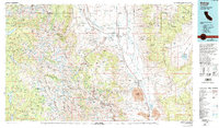
 1963 Mariposa1963 Print · USGSThe High Sierra and Owens Valley meet in the early sixties, showing a landscape defined by gold-rush history and massive post-war water projects. Genealogists and researchers can trace old mining routes near Mariposa, locate the Glacier Point Hotel, and find small settlements like Coarse Gold or Knowles Junction.
 - 1978 Map of Bishop, 1994 Print
 1978 Bishop1994 Print · USGSThe Owens Valley and Eastern Sierra come alive in this late seventies study, documenting a landscape shaped by mining and high-altitude water storage. Local researchers can trace family names and industry at Pine Creek Mine, Scheelite, and Lucky Strike Mine.2 unique versions available
 - 1984 Map of Fish Springs
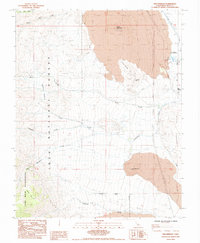 1984 Fish Springs1984 Print · USGSThe eastern Sierra Nevada meets the Owens Valley floor in the early 1980s, revealing a landscape of volcanic cones and vital water sources. Trace historical mining sites like Cleveland Mines or follow the path of Tinemaha Creek past Fish Springs.3 unique versions available
 - 1994 Map of Fish Springs, 1997 Print
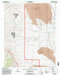 1994 Fish Springs1997 Print · USGSInyo County during the mid-1990s reveals a rugged landscape shaped by volcanic geology and Sierra Nevada runoff. Researchers can trace historical extraction at the Cleveland Mines and water infrastructure like the Fish Springs State Fish Hatchery and Big Pine Canal.
End of results
Showing maps 1-10 of 10
Top cities near Fish Springs
Frequently asked questions
- What are the different types of historical maps available for Fish Springs?
- What is the oldest map of Fish Springs?
- Where can I purchase historical maps of Fish Springs for my home or office?
- Where can I download high-res historical maps of Fish Springs?
- Are there historical topographic maps available for Fish Springs?
- Is there historical aerial imagery available for Fish Springs?
- Where are historical maps of Fish Springs sourced from?