Old Maps of Kern, Bakersfield
Explore 19 old maps of Kern, spanning from 1906 to today. These high-resolution historic maps reveal how streets, neighborhoods, landmarks, and natural features evolved over time — perfect for genealogy, metal detecting, research, and local history exploration.
What you can do with these maps:
- See how Kern changed over time: Compare historical maps to modern-day views to trace roads, homesites, rail lines & more.
- View detailed metadata: Each map includes creators, publishers, year, scale, and archive source.
- Overlay maps with satellite & LiDAR: Visualize the past alongside modern tools to explore terrain & human change.
- Trusted historical sources: Maps sourced from the USGS, Library of Congress, and other archives.
- Access maps your way: View online, download high-res files, or order prints for personal or research use.
Start exploring old maps of Kern to uncover forgotten places, hidden landmarks, and the deep history beneath your feet.
Kern, Bakersfield maps
(19)- 1906 Map of Bakersfield
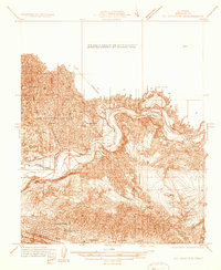
 1906 Bakersfield1906 Print · USGSIn the early 1900s, Bakersfield was the heart of a booming oil and rail network just as the landscape was being transformed. Genealogists and historians can trace early settlements like Oil Center and Jewetta or the industrial workings of the Fullers Earth Mine.5 unique versions available
 - 1914 Map of Caliente
 1914 Caliente1914 Print · USGSBakersfield and the southern Joaquin Valley are captured in the early nineteen-teens as the region's rail and oil industries expanded. Genealogists can trace family landmarks like the Tejon Ranch and Rio Bravo Ranch or locate vanished stops such as Woodford Keene P O and Cottonwood Station.7 unique versions available
 - 1933 Map of Oil Center
 1933 Oil Center1933 Print · USGSKern County's petroleum industry is in full swing during the early 1930s as the Kern River Oil Field transforms the terrain north of Bakersfield. Researchers can trace early company towns and oil-related infrastructure like the Oil Center (P.O.), Petroleum Sch, and the Southern Pacific line.
 - 1940 Map of Oil Center
 1940 Oil Center1940 Print · USGSBakersfield and its surrounding oil fields are caught here at a moment of intense industrial development during the late thirties and early fourties. Genealogists and researchers can trace local landmarks like Oil Center, the County Hospital, and several rural schools including Petroleum Sch.2 unique versions available
 - 1948 Map of Bakersfield
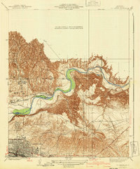
 1948 Bakersfield1948 Print · USGSBakersfield and the southern San Joaquin Valley appear in the late 1940s, showing a landscape of burgeoning oil towns, rail junctions, and early irrigation canals. Genealogists and historians can trace the foundations of local industry through Gardner Field, the Sunset Railway, and the shores of Buena Vista Lake.2 unique versions available
 - 1950 Map of Oil Center
 1950 Oil Center1950 Print · USGSBakersfield and the Kern County oil fields are caught here at a height of industrial activity in the mid-twentieth century. Researchers can trace the layout of early energy settlements like Oil Center and Oil City or locate local landmarks including Aztec Sch and the County Hospital.
 - 1954 Map of Oil Center, 1956 Print
 1954 Oil Center1956 Print · USGSBakersfield and its surrounding petroleum districts are shown in high detail during the mid-1950s, as the oil industry reshaped the Kern County landscape. Genealogists and local historians can locate early industrial sites like Oil Center, the Gordons Ferry site, and numerous local schools such as Aztec Sch.4 unique versions available
 - 1955 Map of Bakersfield
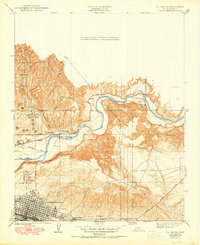
 1955 Bakersfield1955 Print · USGSThe southern San Joaquin Valley in the mid-fifties shows an era of massive oil production and industrial irrigation. Trace family roots in Allensworth, the oil fields of Oildale, or the shorelines of Tulare Lake and Buena Vista Lake.
 - 1956 Map of Bakersfield
 1956 Bakersfield1956 Print · USGSThe southern San Joaquin Valley and High Sierra come alive in the mid-fifties, showing the region's complex agricultural and rail networks. Genealogists and historians can trace family roots in towns like Bakersfield, Taft, and Delano, or locate early infrastructure along the Sunset Railway.
 - 1960 Map of Bakersfield
 1960 Bakersfield1960 Print · USGSThe Southern San Joaquin Valley at mid-century reveals a complex landscape of petroleum development and massive irrigation projects. Researchers can trace the rail lines of the Southern Pacific, explore oil-era landmarks like Oil City, and locate early settlements including Allensworth and Pixley.2 unique versions available
 - 1962 Map of Bakersfield, 1969 Print
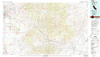
 1962 Bakersfield1969 Print · USGSThe Southern San Joaquin Valley is shown in the 1960s as a bustling intersection of petroleum production, irrigation agriculture, and mountain recreation. Researchers can trace the rail lines of the Southern Pacific through the valley or locate early desert developments like California City and Tehachapi.4 unique versions available
 - 1966 Map of Bakersfield
 1966 Bakersfield1966 Print · USGSThe southern San Joaquin Valley in the mid-sixties reveals a massive industrial and agricultural landscape shaped by water and oil. Genealogists and historians can trace the growth of Bakersfield and Oildale, or locate remote airfields like Minter Field and Mojave-Kern County No. 7 Airport.
 - 1978 Map of Oil Center, 1981 Print
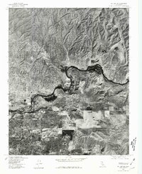 1978 Oil Center1981 Print · USGSThe northern reaches of the Central Valley meet industrial oil fields in the late seventies. Researchers can trace the growing suburban grid of Bakersfield and the winding course of the Kern River past Oil Center.
 - 1978 Map of Tehachapi, 1993 Print
 1978 Tehachapi1993 Print · USGSThe Kern County landscape in the late seventies reveals the transition from valley agriculture to high mountain passes. Trace the rail lines of the Southern Pacific and explore early settlements like Weed Patch, Loraine, and Edmundson Acres.
 - 1992 Map of Oil Center, 1995 Print
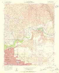
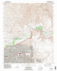 1992 Oil Center1995 Print · USGSBakersfield and the Kern River oil fields are shown in detail during the early nineties, balancing industrial production with residential growth. Researchers can trace historic river crossings at Gordons Ferry or locate landmarks like Bakersfield College and Oil City.
 - 2012 Map of Oil Center, 2012 Print
 2012 Oil Center2012 Print · USGSCovers Kern, including Bakersfield, East Bakersfield, and other nearby areas
 - 2015 Map of Oil Center, 2015 Print
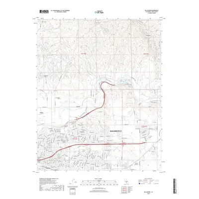
 2015 Oil Center2015 Print · USGSCovers Kern, including Bakersfield, East Bakersfield, and other nearby areas
 - 2018 Map of Oil Center, 2018 Print
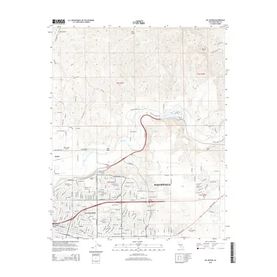
 2018 Oil Center2018 Print · USGSCovers Kern, including Bakersfield, East Bakersfield, and other nearby areas
 - 2022 Map of Oil Center, 2022 Print
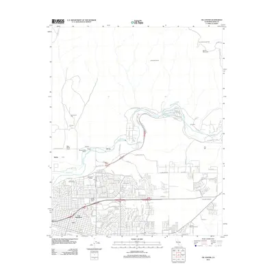
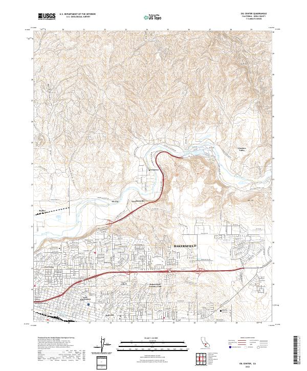 2022 Oil Center2022 Print · USGSBakersfield and its northeastern oil-rich uplands are shown here as the city meets the river valley. Researchers can trace neighborhood growth and industrial sites from Oil City and Goodmanville to the Greenlawn Memorial Park.
End of results
Showing maps 1-19 of 19
Top cities near Kern
- Bakersfield historical maps
- Shafter historical maps
- Arvin historical maps
- Lamont historical maps
- Weedpatch historical maps
Frequently asked questions
- What are the different types of historical maps available for Kern?
- What is the oldest map of Kern?
- Where can I purchase historical maps of Kern for my home or office?
- Where can I download high-res historical maps of Kern?
- Are there historical topographic maps available for Kern?
- Is there historical aerial imagery available for Kern?
- Where are historical maps of Kern sourced from?