1900s (20th Century) Maps of Meridian, California
Explore 12 historic maps of Meridian from the 1900s (20th Century). These maps offer a rare glimpse into what life looked like during the 1900s — showing old roads, neighborhoods, homes, and landmarks that have changed or disappeared over time.
Whether you're researching your family's past, planning a metal detecting trip, or studying how Meridian's landscape evolved across the 1900s, these high-resolution maps are a powerful tool for exploring the history of this region.
- Focus on a specific era: All maps on this page are from the 1900s, giving you a focused view of this time period.
- See what’s changed: Compare century-old streets, trails, and buildings to today's modern landscape using overlays and satellite layers.
- Research with precision: Use these maps for genealogy, historical research, land use analysis, or educational projects.
- View, download, or print: Maps are fully viewable online in high resolution, and can be downloaded or printed for your own records.
Start exploring Meridian's history through authentic maps from the 1900s. This is your window into the past.
Meridian, CA maps
(12)- 1914 Map of Caliente
 1914 Caliente1914 Print · USGSBakersfield and the southern Joaquin Valley are captured in the early nineteen-teens as the region's rail and oil industries expanded. Genealogists can trace family landmarks like the Tejon Ranch and Rio Bravo Ranch or locate vanished stops such as Woodford Keene P O and Cottonwood Station.7 unique versions available
 - 1931 Map of West of Tejon Hills
 1931 West of Tejon Hills1931 Print · USGSThe southern San Joaquin Valley meets the high ridges of Kern County in the early 1930s. Trace early aviation and power infrastructure, from the Airway Beacon to the Southern California Edison Company Transmission Line and Wheeler Ridge.
 - 1934 Map of West of Tejon Hills
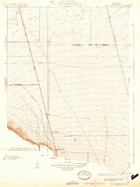 1934 West of Tejon Hills1934 Print · USGSThe southern San Joaquin Valley comes into focus in the mid-1930s, documenting the vital junction of the Golden State Highway and Wheeler Ridge. Trace early aviation and power infrastructure through the Airway Beacon and Tejon Substation.2 unique versions available
 - 1948 Map of Bakersfield
 1948 Bakersfield1948 Print · USGSBakersfield and the southern San Joaquin Valley appear in the late 1940s, showing a landscape of burgeoning oil towns, rail junctions, and early irrigation canals. Genealogists and historians can trace the foundations of local industry through Gardner Field, the Sunset Railway, and the shores of Buena Vista Lake.2 unique versions available
 - 1955 Map of Bakersfield
 1955 Bakersfield1955 Print · USGSThe southern San Joaquin Valley in the mid-fifties shows an era of massive oil production and industrial irrigation. Trace family roots in Allensworth, the oil fields of Oildale, or the shorelines of Tulare Lake and Buena Vista Lake.
 - 1955 Map of Mettler, 1956 Print
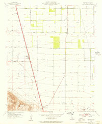 1955 Mettler1956 Print · USGSThe Southern San Joaquin Valley transitions from fertile agricultural grids to oil-rich foothills during the mid-fifties. Researchers can locate the Meridian Sch, trace the path of Tecuya Creek, and identify early infrastructure in the Tejon Oil Field.3 unique versions available
 - 1956 Map of Bakersfield
 1956 Bakersfield1956 Print · USGSThe southern San Joaquin Valley and High Sierra come alive in the mid-fifties, showing the region's complex agricultural and rail networks. Genealogists and historians can trace family roots in towns like Bakersfield, Taft, and Delano, or locate early infrastructure along the Sunset Railway.
 - 1960 Map of Bakersfield
 1960 Bakersfield1960 Print · USGSThe Southern San Joaquin Valley at mid-century reveals a complex landscape of petroleum development and massive irrigation projects. Researchers can trace the rail lines of the Southern Pacific, explore oil-era landmarks like Oil City, and locate early settlements including Allensworth and Pixley.2 unique versions available
 - 1962 Map of Bakersfield, 1969 Print
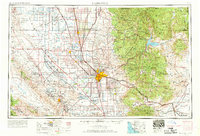 1962 Bakersfield1969 Print · USGSThe Southern San Joaquin Valley is shown in the 1960s as a bustling intersection of petroleum production, irrigation agriculture, and mountain recreation. Researchers can trace the rail lines of the Southern Pacific through the valley or locate early desert developments like California City and Tehachapi.4 unique versions available
 - 1966 Map of Bakersfield
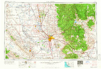 1966 Bakersfield1966 Print · USGSThe southern San Joaquin Valley in the mid-sixties reveals a massive industrial and agricultural landscape shaped by water and oil. Genealogists and historians can trace the growth of Bakersfield and Oildale, or locate remote airfields like Minter Field and Mojave-Kern County No. 7 Airport.
 - 1978 Map of Tehachapi, 1993 Print
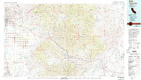 1978 Tehachapi1993 Print · USGSThe Kern County landscape in the late seventies reveals the transition from valley agriculture to high mountain passes. Trace the rail lines of the Southern Pacific and explore early settlements like Weed Patch, Loraine, and Edmundson Acres.
 - 1992 Map of Mettler, 1995 Print
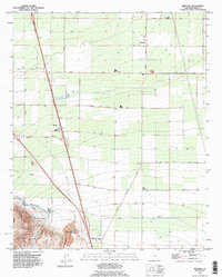 1992 Mettler1995 Print · USGSThe southern San Joaquin Valley comes into focus during the early 1990s, where intensive agriculture meets the petroleum industry. Researchers can trace the path of the Governor Brown California Aqueduct and locate local landmarks like the Oil Field and Mettler.
End of results
Showing maps 1-12 of 12
Top cities near Meridian
Frequently asked questions
- What are the different types of historical maps available for Meridian?
- What is the oldest map of Meridian?
- Where can I purchase historical maps of Meridian for my home or office?
- Where can I download high-res historical maps of Meridian?
- Are there historical topographic maps available for Meridian?
- Is there historical aerial imagery available for Meridian?
- Where are historical maps of Meridian sourced from?