Old Maps of Oildale, California for Genealogy
Trace your family roots with 19 historic maps of Oildale. These high-res maps reveal old neighborhoods, homesites, landmarks, and streets — helping you uncover where your ancestors lived and how the area evolved over time.
- Explore historic neighborhoods: Identify where your relatives may have lived in the 1800s or 1900s.
- Compare maps over time: Trace the changes in streets, buildings, and landmarks for multi-generational research.
- Perfect for genealogy & ancestry research: Used by family historians and researchers to map out lineage and migration.
These maps are an incredible resource for exploring your personal connection to Oildale's past.
Oildale, CA maps
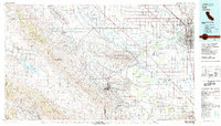
(19)- 1906 Map of Bakersfield
 1906 Bakersfield1906 Print · USGSIn the early 1900s, Bakersfield was the heart of a booming oil and rail network just as the landscape was being transformed. Genealogists and historians can trace early settlements like Oil Center and Jewetta or the industrial workings of the Fullers Earth Mine.5 unique versions available
 - 1910 Map of Buena Vista Lake, 1912 Print
 1910 Buena Vista Lake1912 Print · USGSThe southern San Joaquin Valley comes to life in the years before the great lakes were drained for agriculture. Genealogists and historians can trace early rail stops like Bowerbank and Hazelton or locate rural landmarks such as the Palm School and Moron Taft P O.
 - 1912 Map of Buena Vista Lake, 1921 Print
 1912 Buena Vista Lake1921 Print · USGSThe San Joaquin Valley at the height of its irrigation and oil boom is captured here, from the streets of Bakersfield to the shores of Buena Vista Lake. Genealogists and local historians can trace early schools like Old River School and the rail stops of the Sunset RR.4 unique versions available
 - 1930 Map of Oildale
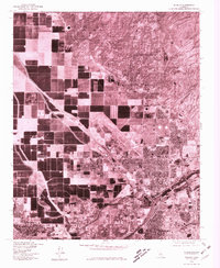
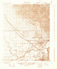 1930 Oildale1930 Print · USGSThe northern reaches of the Central Valley come alive in the early 1930s as petroleum and aviation take root. Researchers can trace the early layout of Oildale alongside the Kern County Airplane Landing Field and rural schools like Beardsley Sch.
 - 1935 Map of Oildale
 1935 Oildale1935 Print · USGSThe San Joaquin Valley landscape north of Bakersfield comes alive in this mid-1930s survey of oil fields and irrigation. Genealogists and historians can trace local life through Standard Sch, the growing streets of Oildale, and the early Kern County Landing Field.3 unique versions available
 - 1942 Map of Bakersfield West, 1944 Print
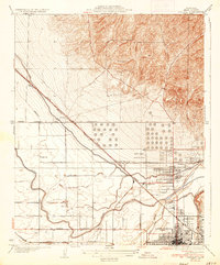
 1942 Bakersfield West1944 Print · USGSBakersfield and the surrounding oil fields are shown here during the early war years, revealing a landscape defined by petroleum and irrigation. Genealogists can locate family holdings near Rosedale, Pumpkin Center, or early schoolhouses like Greeley Sch.
 - 1948 Map of Bakersfield
 1948 Bakersfield1948 Print · USGSBakersfield and the southern San Joaquin Valley appear in the late 1940s, showing a landscape of burgeoning oil towns, rail junctions, and early irrigation canals. Genealogists and historians can trace the foundations of local industry through Gardner Field, the Sunset Railway, and the shores of Buena Vista Lake.2 unique versions available
 - 1954 Map of Oildale, 1956 Print
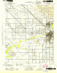
 1954 Oildale1956 Print · USGSIn the mid-1950s, the landscape north of Bakersfield was a hive of industrial activity driven by the petroleum and rail sectors. Genealogists and local historians can trace the growth of Oildale and Fruitvale, finding specific landmarks like Norris School, Oil Junction, and the Kern River Oil Field.4 unique versions available
 - 1955 Map of Bakersfield
 1955 Bakersfield1955 Print · USGSThe southern San Joaquin Valley in the mid-fifties shows an era of massive oil production and industrial irrigation. Trace family roots in Allensworth, the oil fields of Oildale, or the shorelines of Tulare Lake and Buena Vista Lake.
 - 1956 Map of Bakersfield
 1956 Bakersfield1956 Print · USGSThe southern San Joaquin Valley and High Sierra come alive in the mid-fifties, showing the region's complex agricultural and rail networks. Genealogists and historians can trace family roots in towns like Bakersfield, Taft, and Delano, or locate early infrastructure along the Sunset Railway.
 - 1960 Map of Bakersfield
 1960 Bakersfield1960 Print · USGSThe Southern San Joaquin Valley at mid-century reveals a complex landscape of petroleum development and massive irrigation projects. Researchers can trace the rail lines of the Southern Pacific, explore oil-era landmarks like Oil City, and locate early settlements including Allensworth and Pixley.2 unique versions available
 - 1962 Map of Bakersfield, 1969 Print
 1962 Bakersfield1969 Print · USGSThe Southern San Joaquin Valley is shown in the 1960s as a bustling intersection of petroleum production, irrigation agriculture, and mountain recreation. Researchers can trace the rail lines of the Southern Pacific through the valley or locate early desert developments like California City and Tehachapi.4 unique versions available
 - 1966 Map of Bakersfield
 1966 Bakersfield1966 Print · USGSThe southern San Joaquin Valley in the mid-sixties reveals a massive industrial and agricultural landscape shaped by water and oil. Genealogists and historians can trace the growth of Bakersfield and Oildale, or locate remote airfields like Minter Field and Mojave-Kern County No. 7 Airport.
 - 1978 Map of Oildale, 1981 Print
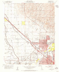
 1978 Oildale1981 Print · USGSKern County's industrial and agricultural heartland is captured here in the late seventies. Researchers can trace the layout of residential areas in Oildale and Bakersfield or study the land use patterns near Saco and Fruitvale.
 - 1981 Map of Taft, 1982 Print
 1981 Taft1982 Print · USGSKern County's oil country and the high desert of the San Luis Obispo border come into focus during the early eighties. Researchers can trace the industrial landscape of Naval Petroleum Reserve No 1 alongside settlements like Taft, McKittrick, and the San Andreas Rift Zone.2 unique versions available
 - 2012 Map of Oildale, 2012 Print
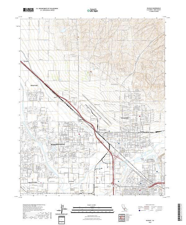
 2012 Oildale2012 Print · USGSCovers Oildale, including Bakersfield, Shafter, and other nearby areas
 - 2015 Map of Oildale, 2015 Print
 2015 Oildale2015 Print · USGSCovers Oildale, including Bakersfield, Shafter, and other nearby areas
 - 2018 Map of Oildale, 2018 Print
 2018 Oildale2018 Print · USGSCovers Oildale, including Bakersfield, Shafter, and other nearby areas
 - 2022 Map of Oildale, 2022 Print
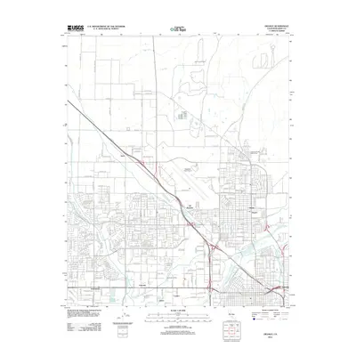
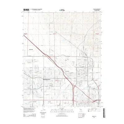
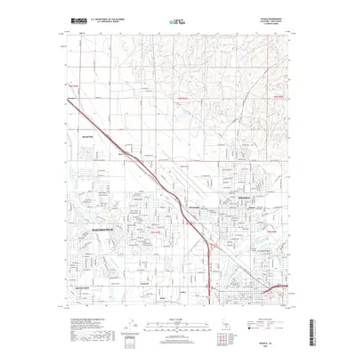
 2022 Oildale2022 Print · USGSThe northern reaches of Bakersfield are shown in contemporary detail, capturing the intersection of major irrigation projects and oil industry transit. Researchers can trace historic locales like Oildale and Fruitvale or locate regional landmarks such as Meadows Field.
End of results
Showing maps 1-19 of 19
Top cities near Oildale
- Bakersfield historical maps
- Shafter historical maps
- Arvin historical maps
- Lamont historical maps
- Weedpatch historical maps
Frequently asked questions
- What are the different types of historical maps available for Oildale?
- What is the oldest map of Oildale?
- Where can I purchase historical maps of Oildale for my home or office?
- Where can I download high-res historical maps of Oildale?
- Are there historical topographic maps available for Oildale?
- Is there historical aerial imagery available for Oildale?
- Where are historical maps of Oildale sourced from?