Old Maps of Harbor City, Los Angeles for Genealogy
Trace your family roots with 21 historic maps of Harbor City. These high-res maps reveal old neighborhoods, homesites, landmarks, and streets — helping you uncover where your ancestors lived and how the area evolved over time.
- Explore historic neighborhoods: Identify where your relatives may have lived in the 1800s or 1900s.
- Compare maps over time: Trace the changes in streets, buildings, and landmarks for multi-generational research.
- Perfect for genealogy & ancestry research: Used by family historians and researchers to map out lineage and migration.
These maps are an incredible resource for exploring your personal connection to Harbor City's past.
Harbor City, Los Angeles maps
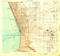
(21)- 1896 Map of Redondo
 1896 Redondo1896 Print · USGSCovers Harbor City, including Los Angeles, Torrance, and other nearby areas10 unique versions available
 - 1901 Map of Southern California Sheet No. 1
 1901 Southern California Sheet No. 11901 Print · USGSCovers Harbor City, including Los Angeles, Long Beach, and other nearby areas11 unique versions available
 - 1904 Map of Southern California Sheet No. 1, 1905 Print
 1904 Southern California Sheet No. 11905 Print · USGSCovers Harbor City, including Los Angeles, Long Beach, and other nearby areas3 unique versions available
 - 1923 Map of Wilmington
 1923 Wilmington1923 Print · USGSCovers Harbor City, including Los Angeles, Long Beach, and other nearby areas
 - 1924 Map of Torrance
 1924 Torrance1924 Print · USGSCovers Harbor City, including Los Angeles, Torrance, and other nearby areas2 unique versions available
 - 1924 Map of Compton
 1924 Compton1924 Print · USGSCovers Harbor City, including Los Angeles, Long Beach, and other nearby areas
 - 1925 Map of Wilmington
 1925 Wilmington1925 Print · USGSCovers Harbor City, including Los Angeles, Long Beach, and other nearby areas3 unique versions available
 - 1925 Map of San Pedro Hills
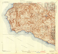
 1925 San Pedro Hills1925 Print · USGSCovers Harbor City, including Los Angeles, Torrance, and other nearby areas
 - 1928 Map of San Pedro Hills
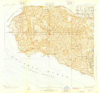 1928 San Pedro Hills1928 Print · USGSCovers Harbor City, including Los Angeles, Torrance, and other nearby areas3 unique versions available
 - 1930 Map of Compton
 1930 Compton1930 Print · USGSCovers Harbor City, including Los Angeles, Long Beach, and other nearby areas2 unique versions available
 - 1934 Map of Torrance
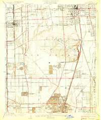
 1934 Torrance1934 Print · USGSCovers Harbor City, including Los Angeles, Torrance, and other nearby areas3 unique versions available
 - 1942 Map of San Pedro Hill
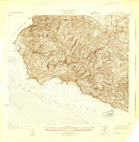
 1942 San Pedro Hill1942 Print · USGSCovers Harbor City, including Los Angeles, Torrance, and other nearby areas
 - 1943 Map of San Pedro
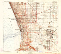
 1943 San Pedro1943 Print · USGSCovers Harbor City, including Los Angeles, Long Beach, and other nearby areas
 - 1944 Map of Redondo
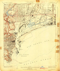
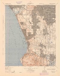 1944 Redondo1944 Print · USGSCovers Harbor City, including Los Angeles, Torrance, and other nearby areas
 - 1949 Map of Long Beach
 1949 Long Beach1949 Print · USGSCovers Harbor City, including Los Angeles, Long Beach, and other nearby areas2 unique versions available
 - 1951 Map of Torrance, 1953 Print
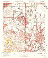 1951 Torrance1953 Print · USGSCovers Harbor City, including Los Angeles, Torrance, and other nearby areas2 unique versions available
 - 1957 Map of Long Beach
 1957 Long Beach1957 Print · USGSCovers Harbor City, including Los Angeles, Long Beach, and other nearby areas4 unique versions available
 - 1958 Map of Long Beach
 1958 Long Beach1958 Print · USGSCovers Harbor City, including Los Angeles, Long Beach, and other nearby areas
 - 1960 Map of Long Beach
 1960 Long Beach1960 Print · USGSCovers Harbor City, including Los Angeles, Long Beach, and other nearby areas2 unique versions available
 - 1964 Map of Torrance, 1966 Print
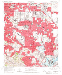 1964 Torrance1966 Print · USGSCovers Harbor City, including Los Angeles, Torrance, and other nearby areas3 unique versions available
 - 1981 Map of Long Beach
 1981 Long Beach1981 Print · USGSCovers Harbor City, including Los Angeles, Long Beach, and other nearby areas3 unique versions available
End of results
Showing maps 1-21 of 21
Frequently asked questions
- What are the different types of historical maps available for Harbor City?
- What is the oldest map of Harbor City?
- Where can I purchase historical maps of Harbor City for my home or office?
- Where can I download high-res historical maps of Harbor City?
- Are there historical topographic maps available for Harbor City?
- Is there historical aerial imagery available for Harbor City?
- Where are historical maps of Harbor City sourced from?