Old Maps of Silver Triangle, Los Angeles for Hiking & Exploration
Hike through history with 22 historic maps of Silver Triangle. Explore old trails, ghost towns, and forgotten backroads — perfect for outdoor adventurers and local explorers.
- Rediscover forgotten places: Map out old mining camps, roads, and footpaths that no longer exist on modern maps.
- Layer with modern tools: Combine with LiDAR or satellite views to plan hikes through historical terrain.
- Made for exploration: Popular among hikers, overlanders, and local history lovers.
Use these maps to find adventure and explore the hidden past of Silver Triangle.
Silver Triangle, Los Angeles maps
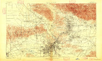
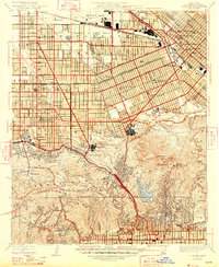
(22)- 1894 Map of Los Angeles
 1894 Los Angeles1894 Print · USGSCovers Silver Triangle, including Los Angeles, Glendale, and other nearby areas2 unique versions available
 - 1896 Map of Santa Monica
 1896 Santa Monica1896 Print · USGSCovers Silver Triangle, including Los Angeles, Glendale, and other nearby areas
 - 1898 Map of Santa Monica
 1898 Santa Monica1898 Print · USGSCovers Silver Triangle, including Los Angeles, Glendale, and other nearby areas
 - 1900 Map of Los Angeles
 1900 Los Angeles1900 Print · USGSCovers Silver Triangle, including Los Angeles, Glendale, and other nearby areas8 unique versions available
 - 1901 Map of Southern California Sheet No. 1
 1901 Southern California Sheet No. 11901 Print · USGSCovers Silver Triangle, including Los Angeles, Long Beach, and other nearby areas11 unique versions available
 - 1902 Map of Santa Monica
 1902 Santa Monica1902 Print · USGSCovers Silver Triangle, including Los Angeles, Glendale, and other nearby areas4 unique versions available
 - 1904 Map of Southern California Sheet No. 1, 1905 Print
 1904 Southern California Sheet No. 11905 Print · USGSCovers Silver Triangle, including Los Angeles, Long Beach, and other nearby areas3 unique versions available
 - 1920 Map of Santa Monica
 1920 Santa Monica1920 Print · USGSCovers Silver Triangle, including Los Angeles, Glendale, and other nearby areas
 - 1921 Map of Santa Monica
 1921 Santa Monica1921 Print · USGSCovers Silver Triangle, including Los Angeles, Glendale, and other nearby areas3 unique versions available
 - 1924 Map of Van Nuys
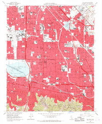
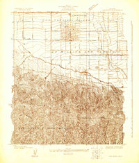 1924 Van Nuys1924 Print · USGSCovers Silver Triangle, including Los Angeles, Beverly Hills, and other nearby areas
 - 1926 Map of Van Nuys
 1926 Van Nuys1926 Print · USGSCovers Silver Triangle, including Los Angeles, Beverly Hills, and other nearby areas4 unique versions available
 - 1926 Map of Burbank
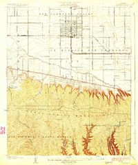
 1926 Burbank1926 Print · USGSCovers Silver Triangle, including Los Angeles, Glendale, and other nearby areas3 unique versions available
 - 1948 Map of Burbank
 1948 Burbank1948 Print · USGSCovers Silver Triangle, including Los Angeles, Glendale, and other nearby areas
 - 1949 Map of Los Angeles
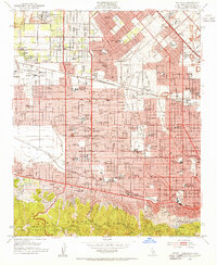
 1949 Los Angeles1949 Print · USGSCovers Silver Triangle, including Los Angeles, Oxnard, and other nearby areas3 unique versions available
 - 1953 Map of Van Nuys, 1955 Print
 1953 Van Nuys1955 Print · USGSCovers Silver Triangle, including Los Angeles, Los Angeles County, and other nearby areas2 unique versions available
 - 1955 Map of Los Angeles
 1955 Los Angeles1955 Print · USGSCovers Silver Triangle, including Los Angeles, Oxnard, and other nearby areas
 - 1959 Map of Los Angeles
 1959 Los Angeles1959 Print · USGSCovers Silver Triangle, including Los Angeles, Oxnard, and other nearby areas3 unique versions available
 - 1966 Map of Los Angeles
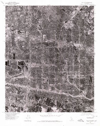
 1966 Los Angeles1966 Print · USGSCovers Silver Triangle, including Los Angeles, Oxnard, and other nearby areas
 - 1966 Map of Van Nuys, 1968 Print
 1966 Van Nuys1968 Print · USGSCovers Silver Triangle, including Los Angeles, Los Angeles County, and other nearby areas4 unique versions available
 - 1975 Map of Los Angeles, 1977 Print
 1975 Los Angeles1977 Print · USGSCovers Silver Triangle, including Los Angeles, Oxnard, and other nearby areas2 unique versions available
 - 1976 Map of Van Nuys, 1980 Print
 1976 Van Nuys1980 Print · USGSCovers Silver Triangle, including Los Angeles, Los Angeles County, and other nearby areas
 - 1979 Map of Los Angeles
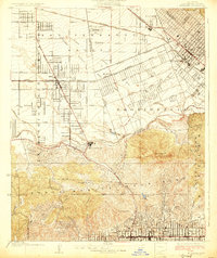
 1979 Los Angeles1979 Print · USGSCovers Silver Triangle, including Los Angeles, Glendale, and other nearby areas
End of results
Showing maps 1-22 of 22
Frequently asked questions
- What are the different types of historical maps available for Silver Triangle?
- What is the oldest map of Silver Triangle?
- Where can I purchase historical maps of Silver Triangle for my home or office?
- Where can I download high-res historical maps of Silver Triangle?
- Are there historical topographic maps available for Silver Triangle?
- Is there historical aerial imagery available for Silver Triangle?
- Where are historical maps of Silver Triangle sourced from?