Old Maps of West Hills, Los Angeles for Genealogy
Trace your family roots with 16 historic maps of West Hills. These high-res maps reveal old neighborhoods, homesites, landmarks, and streets — helping you uncover where your ancestors lived and how the area evolved over time.
- Explore historic neighborhoods: Identify where your relatives may have lived in the 1800s or 1900s.
- Compare maps over time: Trace the changes in streets, buildings, and landmarks for multi-generational research.
- Perfect for genealogy & ancestry research: Used by family historians and researchers to map out lineage and migration.
These maps are an incredible resource for exploring your personal connection to West Hills's past.
West Hills, Los Angeles maps
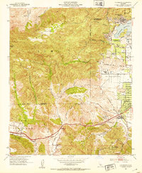
(16)- 1903 Map of Calabasas
 1903 Calabasas1903 Print · USGSCovers West Hills, including Los Angeles, Simi Valley, and other nearby areas9 unique versions available
 - 1903 Map of Camulos
 1903 Camulos1903 Print · USGSCovers West Hills, including Los Angeles, Santa Clarita, and other nearby areas5 unique versions available
 - 1925 Map of Chatsworth
 1925 Chatsworth1925 Print · USGSCovers West Hills, including Los Angeles, Simi Valley, and other nearby areas
 - 1927 Map of Chatsworth
 1927 Chatsworth1927 Print · USGSCovers West Hills, including Los Angeles, Simi Valley, and other nearby areas
 - 1929 Map of Chatsworth
 1929 Chatsworth1929 Print · USGSCovers West Hills, including Los Angeles, Simi Valley, and other nearby areas
 - 1933 Map of Chatsworth
 1933 Chatsworth1933 Print · USGSCovers West Hills, including Los Angeles, Simi Valley, and other nearby areas
 - 1940 Map of Chatsworth
 1940 Chatsworth1940 Print · USGSCovers West Hills, including Los Angeles, Simi Valley, and other nearby areas
 - 1944 Map of Calabasas
 1944 Calabasas1944 Print · USGSCovers West Hills, including Los Angeles, Simi Valley, and other nearby areas
 - 1949 Map of Los Angeles
 1949 Los Angeles1949 Print · USGSCovers West Hills, including Los Angeles, Oxnard, and other nearby areas3 unique versions available
 - 1952 Map of Calabasas, 1953 Print
 1952 Calabasas1953 Print · USGSCovers West Hills, including Los Angeles, Simi Valley, and other nearby areas9 unique versions available
 - 1955 Map of Los Angeles
 1955 Los Angeles1955 Print · USGSCovers West Hills, including Los Angeles, Oxnard, and other nearby areas
 - 1959 Map of Los Angeles
 1959 Los Angeles1959 Print · USGSCovers West Hills, including Los Angeles, Oxnard, and other nearby areas3 unique versions available
 - 1966 Map of Los Angeles
 1966 Los Angeles1966 Print · USGSCovers West Hills, including Los Angeles, Oxnard, and other nearby areas
 - 1975 Map of Los Angeles, 1977 Print
 1975 Los Angeles1977 Print · USGSCovers West Hills, including Los Angeles, Oxnard, and other nearby areas2 unique versions available
 - 1976 Map of Calabasas, 1980 Print
 1976 Calabasas1980 Print · USGSCovers West Hills, including Los Angeles, Simi Valley, and other nearby areas2 unique versions available
 - 1979 Map of Los Angeles
 1979 Los Angeles1979 Print · USGSCovers West Hills, including Los Angeles, Glendale, and other nearby areas
End of results
Showing maps 1-16 of 16
Frequently asked questions
- What are the different types of historical maps available for West Hills?
- What is the oldest map of West Hills?
- Where can I purchase historical maps of West Hills for my home or office?
- Where can I download high-res historical maps of West Hills?
- Are there historical topographic maps available for West Hills?
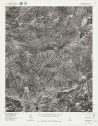
- Is there historical aerial imagery available for West Hills?
- Where are historical maps of West Hills sourced from?