Old Maps of Winnetka Neighborhood Council District, Los Angeles for Hiking & Exploration
Hike through history with 16 historic maps of Winnetka Neighborhood Council District. Explore old trails, ghost towns, and forgotten backroads — perfect for outdoor adventurers and local explorers.
- Rediscover forgotten places: Map out old mining camps, roads, and footpaths that no longer exist on modern maps.
- Layer with modern tools: Combine with LiDAR or satellite views to plan hikes through historical terrain.
- Made for exploration: Popular among hikers, overlanders, and local history lovers.
Use these maps to find adventure and explore the hidden past of Winnetka Neighborhood Council District.
Winnetka Neighborhood Council District, Los Angeles maps
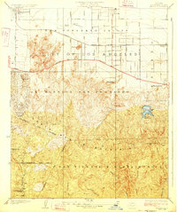
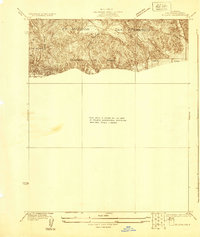
(16)- 1903 Map of Calabasas
 1903 Calabasas1903 Print · USGSCovers Winnetka Neighborhood Council District, including Los Angeles, Simi Valley, and other nearby areas9 unique versions available
 - 1903 Map of Camulos
 1903 Camulos1903 Print · USGSCovers Winnetka Neighborhood Council District, including Los Angeles, Santa Clarita, and other nearby areas5 unique versions available
 - 1928 Map of Zelzah
 1928 Zelzah1928 Print · USGSCovers Winnetka Neighborhood Council District, including Los Angeles, Deer Lake Highlands, and other nearby areas
 - 1928 Map of Reseda
 1928 Reseda1928 Print · USGSCovers Winnetka Neighborhood Council District, including Los Angeles, Topanga, and other nearby areas4 unique versions available
 - 1929 Map of Zelzah
 1929 Zelzah1929 Print · USGSCovers Winnetka Neighborhood Council District, including Los Angeles, Deer Lake Highlands, and other nearby areas
 - 1932 Map of Zelzah
 1932 Zelzah1932 Print · USGSCovers Winnetka Neighborhood Council District, including Los Angeles, Deer Lake Highlands, and other nearby areas
 - 1941 Map of Zelzah
 1941 Zelzah1941 Print · USGSCovers Winnetka Neighborhood Council District, including Los Angeles, Deer Lake Highlands, and other nearby areas2 unique versions available
 - 1944 Map of Calabasas
 1944 Calabasas1944 Print · USGSCovers Winnetka Neighborhood Council District, including Los Angeles, Simi Valley, and other nearby areas
 - 1949 Map of Los Angeles
 1949 Los Angeles1949 Print · USGSCovers Winnetka Neighborhood Council District, including Los Angeles, Oxnard, and other nearby areas3 unique versions available
 - 1952 Map of Canoga Park, 1954 Print
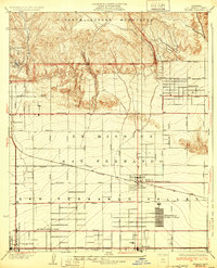
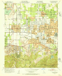 1952 Canoga Park1954 Print · USGSCovers Winnetka Neighborhood Council District, including Los Angeles, Calabasas, and other nearby areas7 unique versions available
 - 1955 Map of Los Angeles
 1955 Los Angeles1955 Print · USGSCovers Winnetka Neighborhood Council District, including Los Angeles, Oxnard, and other nearby areas
 - 1959 Map of Los Angeles
 1959 Los Angeles1959 Print · USGSCovers Winnetka Neighborhood Council District, including Los Angeles, Oxnard, and other nearby areas3 unique versions available
 - 1966 Map of Los Angeles
 1966 Los Angeles1966 Print · USGSCovers Winnetka Neighborhood Council District, including Los Angeles, Oxnard, and other nearby areas
 - 1975 Map of Los Angeles, 1977 Print
 1975 Los Angeles1977 Print · USGSCovers Winnetka Neighborhood Council District, including Los Angeles, Oxnard, and other nearby areas2 unique versions available
 - 1976 Map of Canoga Park, 1977 Print
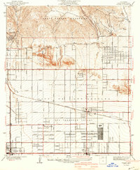
 1976 Canoga Park1977 Print · USGSCovers Winnetka Neighborhood Council District, including Los Angeles, Calabasas, and other nearby areas2 unique versions available
 - 1979 Map of Los Angeles
 1979 Los Angeles1979 Print · USGSCovers Winnetka Neighborhood Council District, including Los Angeles, Glendale, and other nearby areas
End of results
Showing maps 1-16 of 16
Frequently asked questions
- What are the different types of historical maps available for Winnetka Neighborhood Council District?
- What is the oldest map of Winnetka Neighborhood Council District?
- Where can I purchase historical maps of Winnetka Neighborhood Council District for my home or office?
- Where can I download high-res historical maps of Winnetka Neighborhood Council District?
- Are there historical topographic maps available for Winnetka Neighborhood Council District?
- Is there historical aerial imagery available for Winnetka Neighborhood Council District?
- Where are historical maps of Winnetka Neighborhood Council District sourced from?