1940s Maps of Pearblossom, California
Explore 2 historic maps of Pearblossom from the 1940s. These maps offer a rare glimpse into what life looked like during the 1940s — showing old roads, neighborhoods, homes, and landmarks that have changed or disappeared over time.
Whether you're researching your family's past, planning a metal detecting trip, or studying how Pearblossom's landscape evolved across the 1940s, these high-resolution maps are a powerful tool for exploring the history of this region.
- Focus on a specific era: All maps on this page are from the 1940s, giving you a focused view of this time period.
- See what’s changed: Compare century-old streets, trails, and buildings to today's modern landscape using overlays and satellite layers.
- Research with precision: Use these maps for genealogy, historical research, land use analysis, or educational projects.
- View, download, or print: Maps are fully viewable online in high resolution, and can be downloaded or printed for your own records.
Start exploring Pearblossom's history through authentic maps from the 1940s. This is your window into the past.
Pearblossom, CA maps
(2)- 1945 Map of Alpine Butte
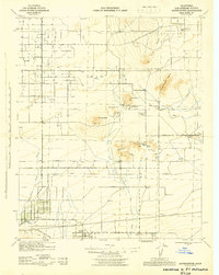 1945 Alpine Butte1945 Print · USGSAntelope Valley in the mid-forties reveals a landscape of isolated desert buttes and early ranching settlements. Genealogists and historians can trace family-named sites like Wilsona Ranch and Morrison Ranch or locate the Wilsona Sch and Antelope Valley Indian Museum.
 - 1947 Map of Alpine Butte
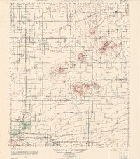 1947 Alpine Butte1947 Print · USGSPost-war ranching and desert life emerge in the Antelope Valley during the late 1940s. Researchers can trace family-named landmarks like Wilsona Ranch and Morrison Ranch or locate the Antelope Valley Indian Museum and Wilsona Sch 1.
End of results
Showing maps 1-2 of 2
Top cities near Pearblossom
Frequently asked questions
- What are the different types of historical maps available for Pearblossom?
- What is the oldest map of Pearblossom?
- Where can I purchase historical maps of Pearblossom for my home or office?
- Where can I download high-res historical maps of Pearblossom?
- Are there historical topographic maps available for Pearblossom?
- Is there historical aerial imagery available for Pearblossom?
- Where are historical maps of Pearblossom sourced from?