Old Maps of Windsor Hills, Los Angeles County for Hiking & Exploration
Hike through history with 16 historic maps of Windsor Hills. Explore old trails, ghost towns, and forgotten backroads — perfect for outdoor adventurers and local explorers.
- Rediscover forgotten places: Map out old mining camps, roads, and footpaths that no longer exist on modern maps.
- Layer with modern tools: Combine with LiDAR or satellite views to plan hikes through historical terrain.
- Made for exploration: Popular among hikers, overlanders, and local history lovers.
Use these maps to find adventure and explore the hidden past of Windsor Hills.
Windsor Hills, Los Angeles County maps
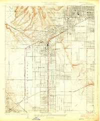
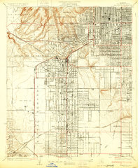
(16)- 1896 Map of Redondo
 1896 Redondo1896 Print · USGSCovers Windsor Hills, including Los Angeles, Torrance, and other nearby areas10 unique versions available
 - 1901 Map of Southern California Sheet No. 1
 1901 Southern California Sheet No. 11901 Print · USGSCovers Windsor Hills, including Los Angeles, Long Beach, and other nearby areas11 unique versions available
 - 1904 Map of Southern California Sheet No. 1, 1905 Print
 1904 Southern California Sheet No. 11905 Print · USGSCovers Windsor Hills, including Los Angeles, Long Beach, and other nearby areas3 unique versions available
 - 1924 Map of Inglewood
 1924 Inglewood1924 Print · USGSCovers Windsor Hills, including Los Angeles, Inglewood, and other nearby areas
 - 1930 Map of Inglewood
 1930 Inglewood1930 Print · USGSCovers Windsor Hills, including Los Angeles, Inglewood, and other nearby areas
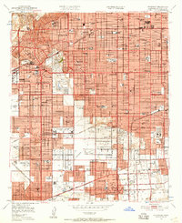
 - 1943 Map of San Pedro
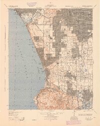
 1943 San Pedro1943 Print · USGSCovers Windsor Hills, including Los Angeles, Long Beach, and other nearby areas
 - 1944 Map of Redondo
 1944 Redondo1944 Print · USGSCovers Windsor Hills, including Los Angeles, Torrance, and other nearby areas
 - 1948 Map of Inglewood
 1948 Inglewood1948 Print · USGSCovers Windsor Hills, including Los Angeles, Inglewood, and other nearby areas
 - 1949 Map of Long Beach
 1949 Long Beach1949 Print · USGSCovers Windsor Hills, including Los Angeles, Long Beach, and other nearby areas2 unique versions available
 - 1950 Map of Inglewood, 1957 Print
 1950 Inglewood1957 Print · USGSCovers Windsor Hills, including Los Angeles, Torrance, and other nearby areas
 - 1952 Map of Inglewood
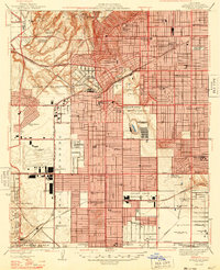
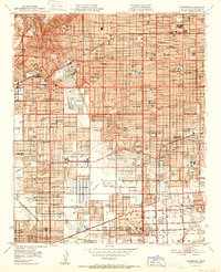 1952 Inglewood1952 Print · USGSCovers Windsor Hills, including Los Angeles, Torrance, and other nearby areas
 - 1957 Map of Long Beach
 1957 Long Beach1957 Print · USGSCovers Windsor Hills, including Los Angeles, Long Beach, and other nearby areas4 unique versions available
 - 1958 Map of Long Beach
 1958 Long Beach1958 Print · USGSCovers Windsor Hills, including Los Angeles, Long Beach, and other nearby areas
 - 1960 Map of Long Beach
 1960 Long Beach1960 Print · USGSCovers Windsor Hills, including Los Angeles, Long Beach, and other nearby areas2 unique versions available
 - 1964 Map of Inglewood, 1965 Print
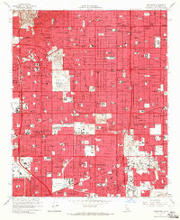 1964 Inglewood1965 Print · USGSCovers Windsor Hills, including Los Angeles, Torrance, and other nearby areas4 unique versions available
 - 1981 Map of Long Beach
 1981 Long Beach1981 Print · USGSCovers Windsor Hills, including Los Angeles, Long Beach, and other nearby areas3 unique versions available
End of results
Showing maps 1-16 of 16
Frequently asked questions
- What are the different types of historical maps available for Windsor Hills?
- What is the oldest map of Windsor Hills?
- Where can I purchase historical maps of Windsor Hills for my home or office?
- Where can I download high-res historical maps of Windsor Hills?
- Are there historical topographic maps available for Windsor Hills?
- Is there historical aerial imagery available for Windsor Hills?
- Where are historical maps of Windsor Hills sourced from?