Old Maps of Bass Lake Annex, California for Academic Research
Study the evolution of Bass Lake Annex with 14 high-resolution historic maps. Whether you're teaching, researching, or modeling changes in land use, these maps provide essential visual documentation of urban, environmental, and geographic change.
- Analyze long-term change: Track patterns in development, transportation, and natural features.
- Ideal for environmental or urban studies: Support academic projects with primary historical map data.
- Use in the classroom or lab: Educators and researchers rely on these maps to bring historical context to life.
These maps are a powerful tool for teaching, research, and visualizing how Bass Lake Annex has changed over the decades.
Bass Lake Annex, CA maps
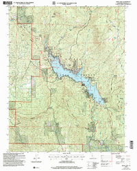
(14)- 1912 Map of Mariposa
 1912 Mariposa1912 Print · USGSThe California Sierra foothills in the early twentieth century are mapped here as a hive of mining and timber activity. Researchers can trace the legacy of remote settlements and family lands including Grub Gulch, the Indian Settlement, and Knowles.6 unique versions available
 - 1947 Map of Mariposa, 1948 Print
 1947 Mariposa1948 Print · USGSThe High Sierra and Owens Valley transition is captured here in the late 1940s, just as the region’s hydroelectric and tourism infrastructure was maturing. Genealogists and historians can trace old ranger stations, the Casa Diablo Mine, and rail stops along the Southern Pacific like Benton Station and Zurich.2 unique versions available
 - 1948 Map of Mariposa, 1951 Print
 1948 Mariposa1951 Print · USGSThe High Sierra and Mariposa foothills are shown here in the late 1940s as the post-war tourism and water infrastructure expanded. Genealogists and historians can locate vanished waypoints like Mormon Bar, the Glacier Point Hotel, and the granite quarries of Knowles.
 - 1953 Map of Bass Lake, 1955 Print
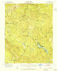 1953 Bass Lake1955 Print · USGSThe foothills of the Sierra Nevada come alive in the early fifties, detailing a landscape of historic mines and emerging mountain resorts. Genealogists and historians can trace the footprint of early ranching and industry at Bissetts Ranch, Texas Flat Mine, and the Ahwahnee Sanatorium.4 unique versions available
 - 1957 Map of Mariposa, 1966 Print
 1957 Mariposa1966 Print · USGSThe High Sierra and Owens Valley appear in the mid-fifties, showing the intersection of conservation, hydroelectric power, and mountain industry. Genealogists and researchers can trace local landmarks like Yosemite Cemetery, the remote Kinsley Station, and the Pine Creek Mine.4 unique versions available
 - 1963 Map of Mariposa
 1963 Mariposa1963 Print · USGSThe High Sierra and Owens Valley meet in the early sixties, showing a landscape defined by gold-rush history and massive post-war water projects. Genealogists and researchers can trace old mining routes near Mariposa, locate the Glacier Point Hotel, and find small settlements like Coarse Gold or Knowles Junction.
 - 1980 Map of Shaver Lake
 1980 Shaver Lake1980 Print · USGSThe Sierra Nevada foothills and high country come into focus during the early eighties, showing the region's complex water and timber infrastructure. Researchers can trace the heritage of local industry at Knowles Quarry, Buchanan Mine, and the hydroelectric works around Big Creek.3 unique versions available
 - 1990 Map of Bass Lake
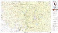
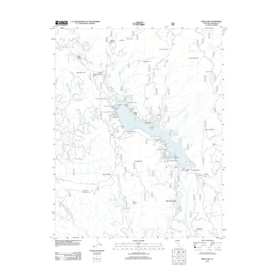
 1990 Bass Lake1990 Print · USGSThe Sierra Nevada foothills near Madera County appear here at the start of the 1990s as a hub of mountain recreation and hydro-infrastructure. Researchers can trace local community roots at the Bass Lake Sch and Denver Church or locate the old Powerhouse No 3 and Nelder Grove.
 - 1993 Map of Bass Lake, 2002 Print
 1993 Bass Lake2002 Print · USGSThe Sierra National Forest highlands are captured here in the early nineties, centered on the developed shores of Bass Lake. Genealogists and historians can trace community landmarks like the Bass Lake Sch, Hale Ranch, and the Denver Church.
 - 2004 Map of Bass Lake, 2007 Print
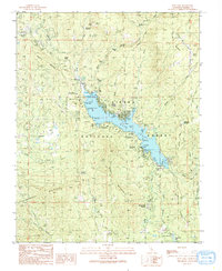
 2004 Bass Lake2007 Print · USGSMadera County’s high country is captured here during the early 2000s, centered on the vital hydroelectric and recreational waters of Bass Lake. Researchers can locate civic landmarks like the Bass Lake Sch or trace historical sites such as Hele Ranch (Site) and Denver Church.
 - 2012 Map of Bass Lake, 2012 Print
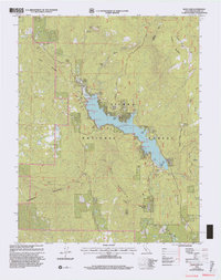
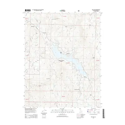
 2012 Bass Lake2012 Print · USGSCovers Bass Lake Annex, including Old Corral, The Pines, and other nearby areas
 - 2015 Map of Bass Lake, 2015 Print
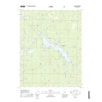
 2015 Bass Lake2015 Print · USGSCovers Bass Lake Annex, including Old Corral, The Pines, and other nearby areas
 - 2018 Map of Bass Lake, 2018 Print
 2018 Bass Lake2018 Print · USGSCovers Bass Lake Annex, including Old Corral, The Pines, and other nearby areas
 - 2021 Map of Bass Lake, 2021 Print
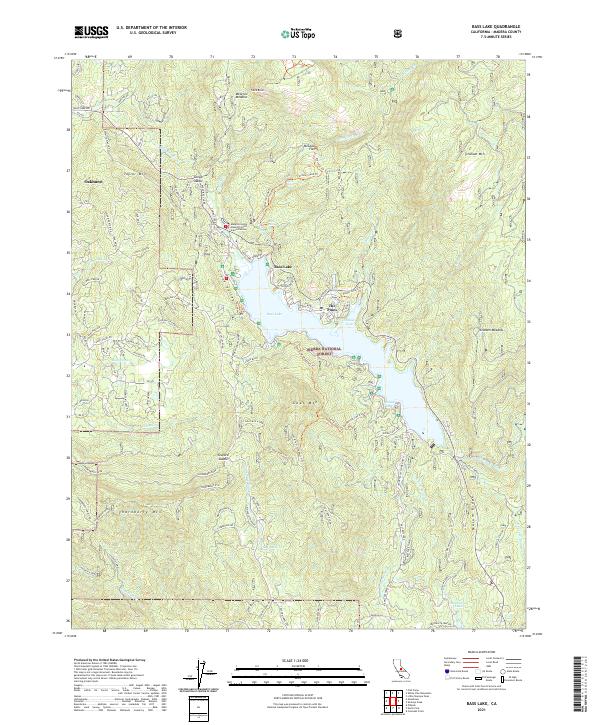 2021 Bass Lake2021 Print · USGSThe High Sierra foothills near Oakhurst come into sharp focus in the early 2020s, centered on the recreation and forestry hub of Bass Lake. Researchers can trace old resource extraction sites like the Broken Shovel Mine or locate early landmarks such as The Pines and McLeod Flat.
End of results
Showing maps 1-14 of 14
Top cities near Bass Lake Annex
Frequently asked questions
- What are the different types of historical maps available for Bass Lake Annex?
- What is the oldest map of Bass Lake Annex?
- Where can I purchase historical maps of Bass Lake Annex for my home or office?
- Where can I download high-res historical maps of Bass Lake Annex?
- Are there historical topographic maps available for Bass Lake Annex?
- Is there historical aerial imagery available for Bass Lake Annex?
- Where are historical maps of Bass Lake Annex sourced from?