2020s Maps of Novato, California
Explore 3 historic maps of Novato from the 2020s. These maps offer a rare glimpse into what life looked like during the 2020s — showing old roads, neighborhoods, homes, and landmarks that have changed or disappeared over time.
Whether you're researching your family's past, planning a metal detecting trip, or studying how Novato's landscape evolved across the 2020s, these high-resolution maps are a powerful tool for exploring the history of this region.
- Focus on a specific era: All maps on this page are from the 2020s, giving you a focused view of this time period.
- See what’s changed: Compare century-old streets, trails, and buildings to today's modern landscape using overlays and satellite layers.
- Research with precision: Use these maps for genealogy, historical research, land use analysis, or educational projects.
- View, download, or print: Maps are fully viewable online in high resolution, and can be downloaded or printed for your own records.
Start exploring Novato's history through authentic maps from the 2020s. This is your window into the past.
Novato, CA maps
(3)- 2021 Map of Petaluma River, 2021 Print
 2021 Petaluma River2021 Print · USGSThe Petaluma River valley and its intricate marshlands are captured in this recent survey of the North Bay. Researchers can trace the boundaries of SONOMA CO and MARIN CO while locating landmarks like Gnoss Field, Burdell Mtn, and the riverfront at Lakeville.
 - 2021 Map of Novato, 2021 Print
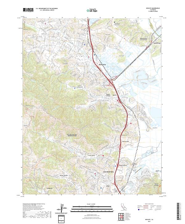 2021 Novato2021 Print · USGSMarin County's northern corridor comes into focus in the early 2020s, showcasing the suburban expansion between the bay marshes and the ridges. Genealogists and locals can trace family sites at Valley Memorial Park or explore the route of the Old Railroad Grade near Novato.
 - 2022 Map of Petaluma Point, 2022 Print
 2022 Petaluma Point2022 Print · USGSSan Pablo Bay and the Marin coastline are captured here in the early 2020s, showing the meeting of four major North Bay counties. Researchers can trace the unique shoreline topography of China Camp Point, the marshes of Tubbs Island, and hills like Turtle Back.
End of results
Showing maps 1-3 of 3
Top cities near Novato
- San Francisco historical maps
- Oakland historical maps
- Vallejo historical maps
- Berkeley historical maps
- Richmond historical maps
- Napa historical maps
See more
Top neighborhoods of Novato
- Ignacio historical maps
- Dewitt historical maps
- Rafael Village historical maps
- Old Town historical maps
- Canyon Green historical maps
Frequently asked questions
- What are the different types of historical maps available for Novato?
- What is the oldest map of Novato?
- Where can I purchase historical maps of Novato for my home or office?
- Where can I download high-res historical maps of Novato?
- Are there historical topographic maps available for Novato?
- Is there historical aerial imagery available for Novato?
- Where are historical maps of Novato sourced from?