Old Maps of Branscomb, California for Academic Research
Study the evolution of Branscomb with 10 high-resolution historic maps. Whether you're teaching, researching, or modeling changes in land use, these maps provide essential visual documentation of urban, environmental, and geographic change.
- Analyze long-term change: Track patterns in development, transportation, and natural features.
- Ideal for environmental or urban studies: Support academic projects with primary historical map data.
- Use in the classroom or lab: Educators and researchers rely on these maps to bring historical context to life.
These maps are a powerful tool for teaching, research, and visualizing how Branscomb has changed over the decades.
Branscomb, CA maps
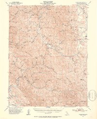
(10)- 1921 Map of Branscomb
 1921 Branscomb1921 Print · USGSCoastal Mendocino County is documented during the height of early twentieth-century timber harvesting, focusing on the remote drainages of the Eel and Ten Mile Rivers. Local historians can trace logging infrastructure at N.W. Redwood Co. Camp No. 3 and early settlements like Branscomb and Wilderness Lodge.
 - 1951 Map of Branscomb, 1953 Print
 1951 Branscomb1953 Print · USGSMendocino County's coastal ranges and timberlands are captured here in the early 1950s as remote ranching and logging hubs thrived. Genealogists and historians can trace the foundations of Branscomb, locate family-named sites like O'Conner Orchard, and identify early landmarks such as the Laytonville Rancheria.4 unique versions available
 - 1957 Map of Ukiah, 1966 Print
 1957 Ukiah1966 Print · USGSNorthern California's diverse terrain comes into focus in the mid-1950s, from the rugged timberlands of the Jackson State Forest to the productive Sacramento Valley. Genealogists and historians can trace the rail lines of the Northwestern Pacific or locate early valley settlements like Arbuckle and Paskenta.3 unique versions available
 - 1960 Map of Ukiah
 1960 Ukiah1960 Print · USGSNorthern California during the late fifties reveals a landscape of deep timber forests and valley agriculture before modern expansion. Trace the historic rail lines of the California Western RR and the Northwestern Pacific RR through settlements like Fort Bragg and Ukiah.2 unique versions available
 - 1966 Map of Lincoln Ridge, 1969 Print
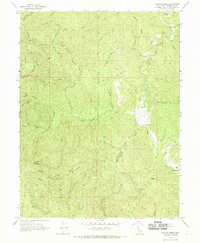 1966 Lincoln Ridge1969 Print · USGSMendocino County's interior ridges and river forks are captured here in the late sixties, showing a landscape defined by timber and isolated homesteads. Researchers can trace the path of the South Fork Eel River and locate family-named sites like Baptiste Orchard and Wilderness Lodge.2 unique versions available
 - 1981 Map of Covelo
 1981 Covelo1981 Print · USGSIn the early 1980s, Mendocino County's interior and coastline remained a patchwork of tribal lands and timber outposts. Trace the Northwestern Pacific rail line and discover the boundaries of the Round Valley Indian Reservation Boundary and Covelo.2 unique versions available
 - 2012 Map of Lincoln Ridge, 2012 Print
 2012 Lincoln Ridge2012 Print · USGSCovers Branscomb, including Mendocino County, United States, and other nearby areas
 - 2015 Map of Lincoln Ridge, 2015 Print
 2015 Lincoln Ridge2015 Print · USGSCovers Branscomb, including Mendocino County, United States, and other nearby areas
 - 2018 Map of Lincoln Ridge, 2018 Print
 2018 Lincoln Ridge2018 Print · USGSCovers Branscomb, including Mendocino County, United States, and other nearby areas
 - 2021 Map of Lincoln Ridge, 2021 Print
 2021 Lincoln Ridge2021 Print · USGSMendocino County's high ridges and river valleys are captured here in the early twenty-first century. Genealogists and historians can trace the road networks around Branscomb and follow the paths of Hollow Tree Cr and the S Fork Eel River.
End of results
Showing maps 1-10 of 10
Top cities near Branscomb
Frequently asked questions
- What are the different types of historical maps available for Branscomb?
- What is the oldest map of Branscomb?
- Where can I purchase historical maps of Branscomb for my home or office?
- Where can I download high-res historical maps of Branscomb?
- Are there historical topographic maps available for Branscomb?
- Is there historical aerial imagery available for Branscomb?
- Where are historical maps of Branscomb sourced from?