Old Maps of Comptche, California for Academic Research
Study the evolution of Comptche with 11 high-resolution historic maps. Whether you're teaching, researching, or modeling changes in land use, these maps provide essential visual documentation of urban, environmental, and geographic change.
- Analyze long-term change: Track patterns in development, transportation, and natural features.
- Ideal for environmental or urban studies: Support academic projects with primary historical map data.
- Use in the classroom or lab: Educators and researchers rely on these maps to bring historical context to life.
These maps are a powerful tool for teaching, research, and visualizing how Comptche has changed over the decades.
Comptche, CA maps
(11)- 1920 Map of Glenblair
 1920 Glenblair1920 Print · USGSCoastal Mendocino County is seen here during the height of the early twentieth-century timber boom, where private rail lines carved through the redwood canyons. Researchers can trace the old logging camps and industrial spurs of the Albion Lumber Company and the California Western Railroad & Navigation Co through Irmulco and Northspur.
 - 1943 Map of Glenblair
 1943 Glenblair1943 Print · USGSCoastal Mendocino County timberlands and rail corridors are captured here during the 1940s, highlighting the region's logging legacy. Researchers can trace family ranch sites and remote camps like Irmulco, Northspur, and the Mendocino Lumber Co Ranch along the rail lines.2 unique versions available
 - 1957 Map of Ukiah, 1966 Print
 1957 Ukiah1966 Print · USGSNorthern California's diverse terrain comes into focus in the mid-1950s, from the rugged timberlands of the Jackson State Forest to the productive Sacramento Valley. Genealogists and historians can trace the rail lines of the Northwestern Pacific or locate early valley settlements like Arbuckle and Paskenta.3 unique versions available
 - 1960 Map of Ukiah
 1960 Ukiah1960 Print · USGSNorthern California during the late fifties reveals a landscape of deep timber forests and valley agriculture before modern expansion. Trace the historic rail lines of the California Western RR and the Northwestern Pacific RR through settlements like Fort Bragg and Ukiah.2 unique versions available
 - 1960 Map of Comptche, 1962 Print
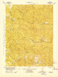
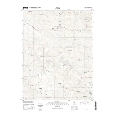
 1960 Comptche1962 Print · USGSCoastal Mendocino County is seen here in the early sixties, dominated by the timber lands of the Jackson State Forest. Genealogists and historians can trace rail-line settlements like Irmulco and Northspur along the California Western Railroad.2 unique versions available
 - 1981 Map of Ukiah
 1981 Ukiah1981 Print · USGSMendocino County’s timber and rail landscape is captured here in the early eighties, from the coastal lumber mills to the inland valleys. Trace the California Western Railroad and find settlements like Fort Bragg, Comptche, and Navarro.3 unique versions available
 - 1991 Map of Comptche
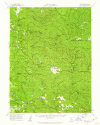
 1991 Comptche1991 Print · USGSThe Mendocino coastal range comes into focus in the early nineties, centered on the forestry hub of Comptche. Researchers can trace old timber access points and remote outposts like the Chamberlain Creek Conservation Camp and McDuffy Opening.
 - 2012 Map of Comptche, 2012 Print
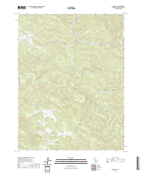
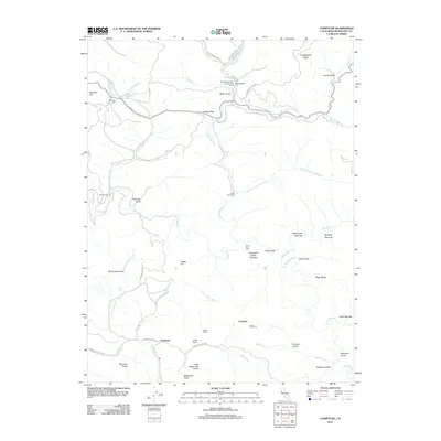 2012 Comptche2012 Print · USGSCovers Comptche, including Mendocino County, United States, and other nearby areas
 - 2015 Map of Comptche, 2015 Print
 2015 Comptche2015 Print · USGSCovers Comptche, including Mendocino County, United States, and other nearby areas
 - 2018 Map of Comptche, 2018 Print
 2018 Comptche2018 Print · USGSCovers Comptche, including Mendocino County, United States, and other nearby areas
 - 2021 Map of Comptche, 2021 Print
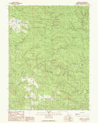
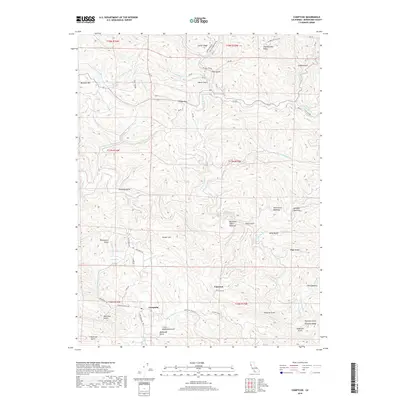
 2021 Comptche2021 Print · USGSThe mountain settlement of Comptche and the surrounding Mendocino ridges are captured here in the early twenty-first century. Researchers can trace the drainage of the Albion River and locate historic forest clearings like Nathaniel Smith Opening and McDuffy Opening.
End of results
Showing maps 1-11 of 11
Top cities near Comptche
Frequently asked questions
- What are the different types of historical maps available for Comptche?
- What is the oldest map of Comptche?
- Where can I purchase historical maps of Comptche for my home or office?
- Where can I download high-res historical maps of Comptche?
- Are there historical topographic maps available for Comptche?
- Is there historical aerial imagery available for Comptche?
- Where are historical maps of Comptche sourced from?