Old Maps of Elk, California for Metal Detecting
Plan your next treasure hunt with 11 historic maps of Elk. Find old homesites, ghost towns, trails, and gathering spots that may be lost to time — perfect for identifying promising metal detecting locations.
- Locate forgotten sites: Uncover places like long-lost settlements, abandoned rail lines, or gathering spots.
- Plan better hunts: Use map overlays combined with LiDAR or satellite views to narrow in on historically rich areas.
- Made for detectorists: Thousands of hobbyists use these maps to discover relics, coins, and hidden history.
Use these historic maps to boost your research and find new opportunities beneath the surface of Elk.
Elk, CA maps
(11)- 1943 Map of Navarro, 1954 Print
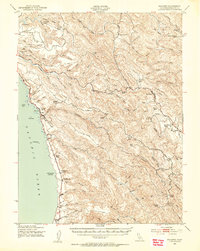 1943 Navarro1954 Print · USGSCoastal Mendocino County during the early war years reveals a rugged timber and ranching economy along the Pacific shore. Genealogists and local historians can trace family landmarks like the Galletti Ranch, small rural school sites such as Signal Sch, and maritime history at Bridgeport Landing.3 unique versions available
 - 1944 Map of Saddle Point
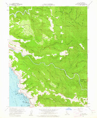
 1944 Saddle Point1944 Print · USGSCoastal Mendocino County is captured here in the mid-1940s, showing a landscape of maritime landings and upland ranches. Genealogists can trace family holdings like Gallatti Ranch and Williams Ranch or locate vanished rural schoolhouses such as Signal School and Hansen School.
 - 1957 Map of Ukiah, 1966 Print
 1957 Ukiah1966 Print · USGSNorthern California's diverse terrain comes into focus in the mid-1950s, from the rugged timberlands of the Jackson State Forest to the productive Sacramento Valley. Genealogists and historians can trace the rail lines of the Northwestern Pacific or locate early valley settlements like Arbuckle and Paskenta.3 unique versions available
 - 1960 Map of Ukiah
 1960 Ukiah1960 Print · USGSNorthern California during the late fifties reveals a landscape of deep timber forests and valley agriculture before modern expansion. Trace the historic rail lines of the California Western RR and the Northwestern Pacific RR through settlements like Fort Bragg and Ukiah.2 unique versions available
 - 1960 Map of Elk, 1962 Print
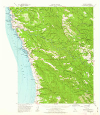
 1960 Elk1962 Print · USGSThe Mendocino coast in the early sixties is captured here as a landscape of timber ridges and Pacific headlands. Genealogists and historians can trace the settlements of Elk and Brown or locate specific landmarks like Cuffeys Point and the Airstrip.3 unique versions available
 - 1961 Map of Navarro, 1962 Print
 1961 Navarro1962 Print · USGSThe Mendocino coast in the early sixties reveals a landscape of timber history and coastal villages. Trace the former shipping sites at Whitesboro and Bridgeport Landing or the winding path of the Albion Railroad.2 unique versions available
 - 1981 Map of Ukiah
 1981 Ukiah1981 Print · USGSMendocino County’s timber and rail landscape is captured here in the early eighties, from the coastal lumber mills to the inland valleys. Trace the California Western Railroad and find settlements like Fort Bragg, Comptche, and Navarro.3 unique versions available
 - 2012 Map of Elk, 2012 Print
 2012 Elk2012 Print · USGSCovers Elk, including Mendocino County, United States, and other nearby areas
 - 2015 Map of Elk, 2015 Print
 2015 Elk2015 Print · USGSCovers Elk, including Mendocino County, United States, and other nearby areas
 - 2018 Map of Elk, 2018 Print
 2018 Elk2018 Print · USGSCovers Elk, including Mendocino County, United States, and other nearby areas
 - 2021 Map of Elk, 2021 Print
 2021 Elk2021 Print · USGSThe Mendocino coast comes into focus in this recent survey, centered on the settlement of Elk and the dramatic sea cliffs of Cuffeys Point. Researchers can locate historic burial sites including the Cuffeys Cove Catholic Cem and trace the timber-era paths of Cavanaugh Grade and Navarro Ridge.
End of results
Showing maps 1-11 of 11
Top cities near Elk
Frequently asked questions
- What are the different types of historical maps available for Elk?
- What is the oldest map of Elk?
- Where can I purchase historical maps of Elk for my home or office?
- Where can I download high-res historical maps of Elk?
- Are there historical topographic maps available for Elk?
- Is there historical aerial imagery available for Elk?
- Where are historical maps of Elk sourced from?