Old Maps of Inglenook, California for Academic Research
Study the evolution of Inglenook with 11 high-resolution historic maps. Whether you're teaching, researching, or modeling changes in land use, these maps provide essential visual documentation of urban, environmental, and geographic change.
- Analyze long-term change: Track patterns in development, transportation, and natural features.
- Ideal for environmental or urban studies: Support academic projects with primary historical map data.
- Use in the classroom or lab: Educators and researchers rely on these maps to bring historical context to life.
These maps are a powerful tool for teaching, research, and visualizing how Inglenook has changed over the decades.
Inglenook, CA maps
(11)- 1921 Map of Westport
 1921 Westport1921 Print · USGSThe Mendocino coast comes alive in the early twentieth century as a hub for timber and coastal shipping. Genealogists and historians can trace the foundations of Westport and Rockport, or follow the path of the Ten Mile River Logging RR.2 unique versions available
 - 1950 Map of Cape Vizcaino, 1960 Print
 1950 Cape Vizcaino1960 Print · USGSThe Mendocino coast at the middle of the twentieth century shows a landscape defined by timber and tide. Researchers can trace the legacy of coastal settlements like Westport, Rockport, and Newport alongside the extensive Logging Road networks of the era.2 unique versions available
 - 1951 Map of Cape Vizcaino
 1951 Cape Vizcaino1951 Print · USGSThe Mendocino coastline is captured here in the early fifties, featuring the isolated timber landings and seaside settlements north of Fort Bragg. You can trace early coastal roads and industry sites from Rockport and Union Landing to the Tenmile River and the Fort Bragg Grange.2 unique versions available
 - 1957 Map of Ukiah, 1966 Print
 1957 Ukiah1966 Print · USGSNorthern California's diverse terrain comes into focus in the mid-1950s, from the rugged timberlands of the Jackson State Forest to the productive Sacramento Valley. Genealogists and historians can trace the rail lines of the Northwestern Pacific or locate early valley settlements like Arbuckle and Paskenta.3 unique versions available
 - 1960 Map of Ukiah
 1960 Ukiah1960 Print · USGSNorthern California during the late fifties reveals a landscape of deep timber forests and valley agriculture before modern expansion. Trace the historic rail lines of the California Western RR and the Northwestern Pacific RR through settlements like Fort Bragg and Ukiah.2 unique versions available
 - 1966 Map of Inglenook, 1968 Print
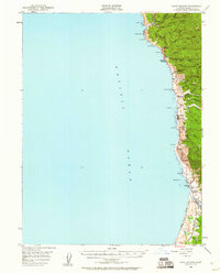
 1966 Inglenook1968 Print · USGSThe Mendocino coast in the 1960s reveals a sparse network of seaside settlements and expansive Sand Dunes north of Fort Bragg. Genealogists can locate family sites at Newport and Inglenook, or trace the winding course of the Ten Mile River.4 unique versions available
 - 1981 Map of Covelo
 1981 Covelo1981 Print · USGSIn the early 1980s, Mendocino County's interior and coastline remained a patchwork of tribal lands and timber outposts. Trace the Northwestern Pacific rail line and discover the boundaries of the Round Valley Indian Reservation Boundary and Covelo.2 unique versions available
 - 2012 Map of Inglenook, 2012 Print
 2012 Inglenook2012 Print · USGSCovers Inglenook, including Mendocino County, United States, and other nearby areas
 - 2015 Map of Inglenook, 2015 Print
 2015 Inglenook2015 Print · USGSCovers Inglenook, including Mendocino County, United States, and other nearby areas
 - 2018 Map of Inglenook, 2018 Print
 2018 Inglenook2018 Print · USGSCovers Inglenook, including Mendocino County, United States, and other nearby areas
 - 2021 Map of Inglenook, 2021 Print
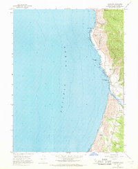
 2021 Inglenook2021 Print · USGSThe Mendocino coast at the start of the 2020s shows a landscape where industrial heritage meets protected wilderness. Genealogists and historians can trace old coastal settlements at Kibesillah and Newport while locating the Newport Cem and Inglenook Cem.
End of results
Showing maps 1-11 of 11
Top cities near Inglenook
Frequently asked questions
- What are the different types of historical maps available for Inglenook?
- What is the oldest map of Inglenook?
- Where can I purchase historical maps of Inglenook for my home or office?
- Where can I download high-res historical maps of Inglenook?
- Are there historical topographic maps available for Inglenook?
- Is there historical aerial imagery available for Inglenook?
- Where are historical maps of Inglenook sourced from?