Old Maps of Lingard, California
Explore 14 old maps of Lingard, spanning from 1918 to today. These high-resolution historic maps reveal how streets, neighborhoods, landmarks, and natural features evolved over time — perfect for genealogy, metal detecting, research, and local history exploration.
What you can do with these maps:
- See how Lingard changed over time: Compare historical maps to modern-day views to trace roads, homesites, rail lines & more.
- View detailed metadata: Each map includes creators, publishers, year, scale, and archive source.
- Overlay maps with satellite & LiDAR: Visualize the past alongside modern tools to explore terrain & human change.
- Trusted historical sources: Maps sourced from the USGS, Library of Congress, and other archives.
- Access maps your way: View online, download high-res files, or order prints for personal or research use.
Start exploring old maps of Lingard to uncover forgotten places, hidden landmarks, and the deep history beneath your feet.
Lingard, CA maps
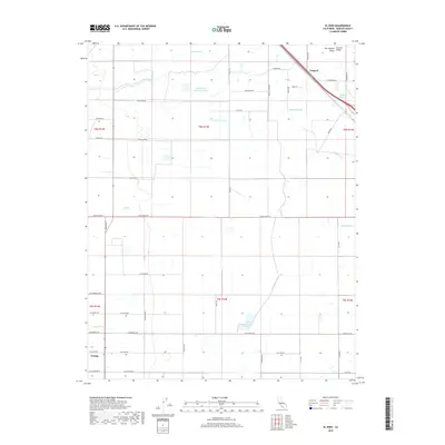
(14)- 1918 Map of Lingard
 1918 Lingard1918 Print · USGSAgricultural plains in the San Joaquin Valley appear during a period of steady ranch expansion in the years after the first World War. Researchers can trace historic property boundaries and school districts using landmarks like Russell School, the rail stop at Lingard, and the winding path of Old Chowchilla Creek.
 - 1942 Map of Athlone
 1942 Athlone1942 Print · USGSThe Merced and Madera county line area is shown here in the early 1940s as agricultural irrigation and rail transport defined the region. Genealogists can locate family-named landmarks like Bliss Ranch and several rural schoolhouses including Alamo Sch and Pioneer Sch.
 - 1947 Map of San Jose, 1948 Print
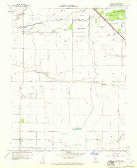
 1947 San Jose1948 Print · USGSNorthern California's heartland is captured here just after the war, showing the rapid growth of the Santa Clara and Central Valleys. Researchers can trace the legacy of rail and water at Castle Air Force Base, Stockton, and the Hetch Hetchy Aqueduct.
 - 1948 Map of Lingard
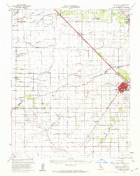
 1948 Lingard1948 Print · USGSThe rural agricultural heart of Merced County is captured here shortly after the war, showing a landscape defined by rail and water. Genealogists and local historians can trace family-named roads and schools like Russell Sch and Bliss Sch alongside the Southern Pacific line near Lingard.
 - 1956 Map of San Jose
 1956 San Jose1956 Print · USGSCentral California in the mid-fifties reveals the transition from sprawling orchards to growing urban hubs like San Jose and Stockton. Genealogists and historians can trace the rail-era landscape of the Mother Lode through Chinese Camp and Tuttletown, or follow the water through the Joaquin River and Calaveras Reservoir.
 - 1960 Map of El Nido, 1961 Print
 1960 El Nido1961 Print · USGSMerced County agriculture and irrigation are in full focus at the start of the 1960s. Researchers can trace the Southern Pacific rail line through Lingard, locate the Duck Club, and follow the complex water routes of Deadman Creek and Duck Slough.2 unique versions available
 - 1960 Map of Chowchilla, 1962 Print
 1960 Chowchilla1962 Print · USGSThe San Joaquin Valley's agricultural heartland is mapped here during a period of steady growth along the Southern Pacific rail line. Genealogists can locate family sites near Chowchilla, Le Grand, and Ashview Sch, or trace historical property lines along SANDY MUSH ROAD.
 - 1962 Map of San Jose
 1962 San Jose1962 Print · USGSCentral California in the early sixties showcases the expansion of the San Joaquin and Santa Clara valleys. Researchers can trace the rail-to-road transition along the Southern Pacific RR or locate landmarks like Castle USAF Base and Loma Prieta.4 unique versions available
 - 1966 Map of San Jose
 1966 San Jose1966 Print · USGSCentral California in the mid-1960s reveals a landscape of massive irrigation projects and expanding Cold War military footprints. Researchers can trace the rail-and-river network of the San Joaquin Valley or locate specialized sites like Castle Air Force Base and the Sharp General Depot (Military).
 - 1983 Map of Merced
 1983 Merced1983 Print · USGSThe San Joaquin Valley at the start of the eighties is captured here in its full agricultural and military height. Trace the legacy of Castle Air Force Base, old mines like Pocahontas Mine, and the vast Kesterson National Wildlife Refuge.
 - 2012 Map of El Nido, 2012 Print
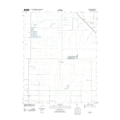 2012 El Nido2012 Print · USGSCovers Lingard, including El Nido, Merced County, and other nearby areas
 - 2015 Map of El Nido, 2015 Print
 2015 El Nido2015 Print · USGSCovers Lingard, including El Nido, Merced County, and other nearby areas
 - 2018 Map of El Nido, 2018 Print
 2018 El Nido2018 Print · USGSCovers Lingard, including El Nido, Merced County, and other nearby areas
 - 2021 Map of El Nido, 2021 Print
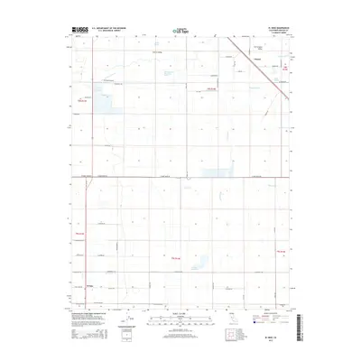
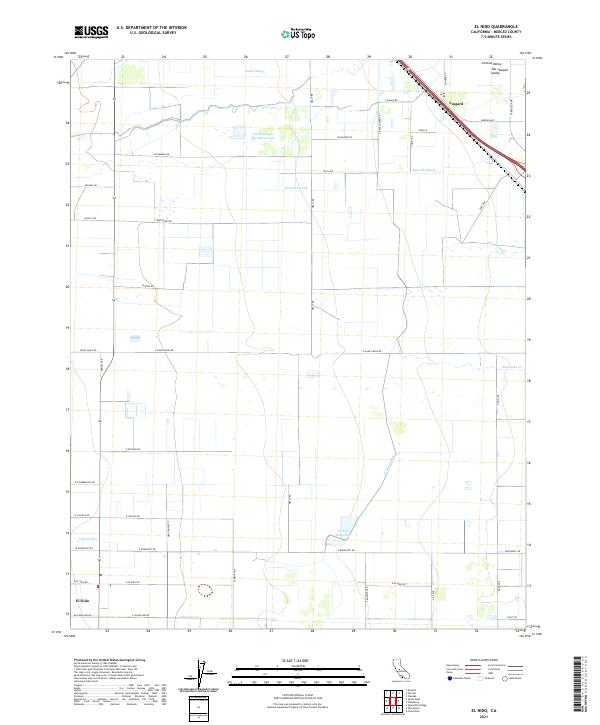 2021 El Nido2021 Print · USGSMerced County agriculture thrives in the early 2020s within this detailed record of the San Joaquin Valley. Researchers can trace the water systems of the Central Valley through El Nido Reservoir, the El Nido Canal, and historic sloughs.
End of results
Showing maps 1-14 of 14
Top cities near Lingard
- Merced historical maps
- Atwater historical maps
- Chowchilla historical maps
- Winton historical maps
- Planada historical maps
- Le Grand historical maps
Frequently asked questions
- What are the different types of historical maps available for Lingard?
- What is the oldest map of Lingard?
- Where can I purchase historical maps of Lingard for my home or office?
- Where can I download high-res historical maps of Lingard?
- Are there historical topographic maps available for Lingard?
- Is there historical aerial imagery available for Lingard?
- Where are historical maps of Lingard sourced from?