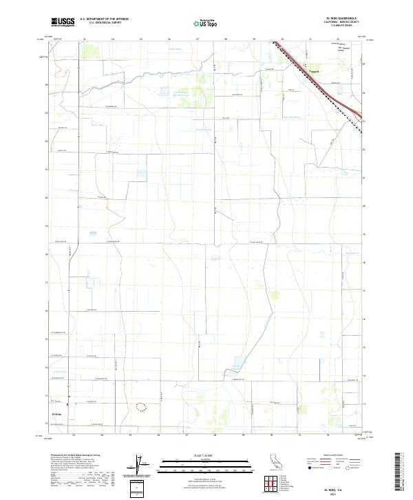
2021 Map of El Nido
USGS Topo · Published 2021About this map
Central Valley agriculture defines this portion of the San Joaquin Valley in Merced County. The settlement of El Nido anchors the southern portion of the map, while the community of Lingard sits at the northern edge along the railroad corridor. The landscape is a complex network of water management features essential for farming, including the El Nido Canal and El Nido Reservoir, alongside natural drainages like North Slough Mariposa Creek and Snake Slough. The land is organized into a rigid grid of rural roads, such as Sandy Mush Rd and Healy Rd, which facilitate the movement of goods between fields and rail lines. Notable irrigation infrastructure like Russell Lateral and Tetzlaff Lateral further illustrates the intensive modification of the terrain for high-yield production.
Find a feature on this map
55 named features on this map. Tap any name to fly to it.
Don’t see what you’re looking for? This feature index may not catch every label — zoom into the map to look around manually.
Map Details
Editions of this 2021 El Nido Map
This is the sole edition of this map. No revisions or reprints were ever made.
Other maps of this area

1914 · Merced
USGS Topo · 1:31,680

1916 · Santa Rita Bridge
USGS Topo · 1:24,000

1917 · Merced
USGS Topo · 1:31,680

1918 · Bliss Ranch
USGS Topo · 1:31,680

1918 · Lingard
USGS Topo · 1:31,680

1918 · Atwater
USGS Topo · 1:31,680

1918 · Chowchilla
USGS Topo · 1:31,680

1918 · Sandy Mush
USGS Topo · 1:31,680

1918 · Planada
USGS Topo · 1:31,680

1919 · Plainsberg
USGS Topo · 1:31,680