1990s Maps of Likely, California
Explore 2 historic maps of Likely from the 1990s. These maps offer a rare glimpse into what life looked like during the 1990s — showing old roads, neighborhoods, homes, and landmarks that have changed or disappeared over time.
Whether you're researching your family's past, planning a metal detecting trip, or studying how Likely's landscape evolved across the 1990s, these high-resolution maps are a powerful tool for exploring the history of this region.
- Focus on a specific era: All maps on this page are from the 1990s, giving you a focused view of this time period.
- See what’s changed: Compare century-old streets, trails, and buildings to today's modern landscape using overlays and satellite layers.
- Research with precision: Use these maps for genealogy, historical research, land use analysis, or educational projects.
- View, download, or print: Maps are fully viewable online in high resolution, and can be downloaded or printed for your own records.
Start exploring Likely's history through authentic maps from the 1990s. This is your window into the past.
Likely, CA maps
(2)- 1990 Map of Likely
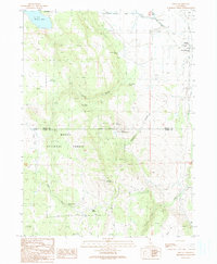 1990 Likely1990 Print · USGSLikely and its surrounding rangelands are documented here in the early nineties, where the high Modoc plateau meets the irrigated South Fork valley. Researchers can trace the ranching landscape through landmarks like the South Fork Union Sch, the village Cem, and the isolated Depau settlement.
 - 1993 Map of Likely, 1996 Print
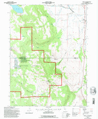 1993 Likely1996 Print · USGSLikely and the surrounding Modoc County ranchlands are documented here in the early nineties as the local economy balanced forest management and river-valley agriculture. Researchers can locate the South Fork Union Sch, the town Cem, and rural landmarks like the Fireguard Station (BLM).
End of results
Showing maps 1-2 of 2
Frequently asked questions
- What are the different types of historical maps available for Likely?
- What is the oldest map of Likely?
- Where can I purchase historical maps of Likely for my home or office?
- Where can I download high-res historical maps of Likely?
- Are there historical topographic maps available for Likely?
- Is there historical aerial imagery available for Likely?
- Where are historical maps of Likely sourced from?