Old Maps of Surprise Station, California for Metal Detecting
Plan your next treasure hunt with 14 historic maps of Surprise Station. Find old homesites, ghost towns, trails, and gathering spots that may be lost to time — perfect for identifying promising metal detecting locations.
- Locate forgotten sites: Uncover places like long-lost settlements, abandoned rail lines, or gathering spots.
- Plan better hunts: Use map overlays combined with LiDAR or satellite views to narrow in on historically rich areas.
- Made for detectorists: Thousands of hobbyists use these maps to discover relics, coins, and hidden history.
Use these historic maps to boost your research and find new opportunities beneath the surface of Surprise Station.
Surprise Station, CA maps
(14)- 1886 Map of Alturas
 1886 Alturas1886 Print · USGSNortheastern California at the close of the nineteenth century was a territory of high-desert basins and isolated outposts. Researchers can trace early township developments and strategic sites like Fort Bidwell, the remote Old Indian Villages, and the mining camp at Hayden Hill.
 - 1892 Map of Alturas
 1892 Alturas1892 Print · USGSNortheastern California at the close of the nineteenth century reveals a landscape of high-desert outposts and military history. Genealogists and historians can trace the early foundations of Fort Bidwell, Cedarville, and the remote Old Indian Villages near the Pit River.7 unique versions available
 - 1954 Map of Alturas, 1968 Print
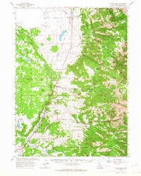
 1954 Alturas1968 Print · USGSThe Modoc Plateau and Surprise Valley appear in the mid-1950s as a landscape of remote ranching towns and vast wildlife refuges. Researchers can trace early settlements like Fort Bidwell, locate the McArthur Grain Elevator, and follow the Southern Pacific rail lines.4 unique versions available
 - 1958 Map of Alturas
 1958 Alturas1958 Print · USGSThe Modoc Plateau and Warner Mountains appear here during the late fifties, showcasing a landscape of high-desert ranching and volcanic terrain. Researchers can trace the rail-and-water economy through Alturas, Cedarville, and the Fort Bidwell Indian Res.2 unique versions available
 - 1962 Map of Alturas
 1962 Alturas1962 Print · USGSThe high desert of Modoc and Siskiyou counties is shown in the early sixties as a hub of timber, rail, and agriculture. Genealogists and historians can trace rail-side life via the Southern Pacific RR, the Tionesta PO, and the McArthur Grain Elevator.
 - 1962 Map of Davis Creek, 1964 Print
 1962 Davis Creek1964 Print · USGSModoc County ranching and tribal lands are meticulously detailed in this early 1960s survey of the Warner Mountains foothills. Genealogists and researchers can trace family landmarks and rural infrastructure from the XL Ranch Indian Reservation to the Cem at Davis Creek.2 unique versions available
 - 1965 Map of Alturas
 1965 Alturas1965 Print · USGSNortheastern California and southern Oregon appear in this mid-century survey of the high plateau and volcanic highlands. Researchers can trace the path of the Southern Pacific railroad through Alturas or locate rural outposts like Stronghold and Eagleville.
 - 1983 Map of Cedarville
 1983 Cedarville1983 Print · USGSNortheastern California at the turn of the 1980s reveals a landscape of high-altitude basins and remote mountain ranges. Researchers can trace historic mining operations at Yellow Jacket Mines, locate the XL Ranch Indian Reservation, and follow the Southern Pacific line through Willow Ranch.2 unique versions available
 - 1990 Map of Surprise Station
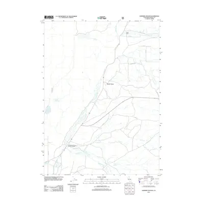
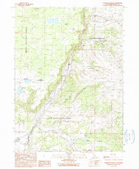 1990 Surprise Station1990 Print · USGSNortheastern California's high plateau comes into focus here in the late twentieth century, showing a landscape shaped by the river and the reservation. You can locate the Chimney Rock Historical Mon, trace the North Fork Pit River, and find remote outposts like Surprise Station.
 - 1993 Map of Surprise Station, 1995 Print
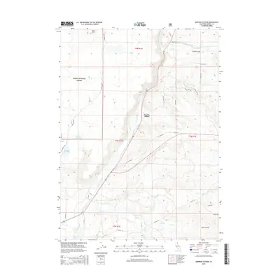
 1993 Surprise Station1995 Print · USGSModoc County ranching and reservation lands are documented here during the early 1990s as they border the national forest. Researchers can locate remote infrastructure like the Alturas Agr Insp Sta, the Chimney Rock Historical Mon, and the Surprise Station railway point.
 - 2012 Map of Surprise Station, 2012 Print
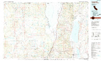
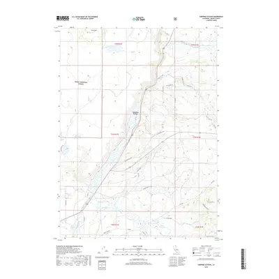
 2012 Surprise Station2012 Print · USGSCovers Surprise Station, including Modoc County, United States, and other nearby areas
 - 2015 Map of Surprise Station, 2015 Print
 2015 Surprise Station2015 Print · USGSCovers Surprise Station, including Modoc County, United States, and other nearby areas
 - 2018 Map of Surprise Station, 2018 Print
 2018 Surprise Station2018 Print · USGSCovers Surprise Station, including Modoc County, United States, and other nearby areas
 - 2022 Map of Surprise Station, 2022 Print
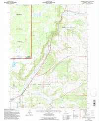
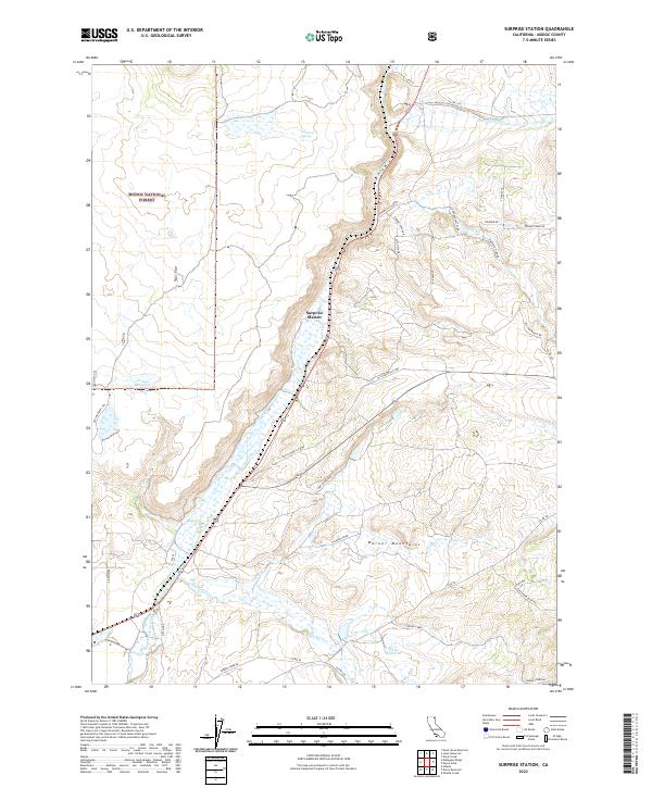 2022 Surprise Station2022 Print · USGSModoc County ranching country is shown here in the 2020s, where the high desert meets the Warner Mountains. Researchers can trace the path of the Old Immigrant Trl and locate remote features like Surprise Station and Griener Reservoir.
End of results
Showing maps 1-14 of 14
Top cities near Surprise Station
Frequently asked questions
- What are the different types of historical maps available for Surprise Station?
- What is the oldest map of Surprise Station?
- Where can I purchase historical maps of Surprise Station for my home or office?
- Where can I download high-res historical maps of Surprise Station?
- Are there historical topographic maps available for Surprise Station?
- Is there historical aerial imagery available for Surprise Station?
- Where are historical maps of Surprise Station sourced from?