Old Maps of Oasis, California
Explore 13 old maps of Oasis, spanning from 1908 to today. These high-resolution historic maps reveal how streets, neighborhoods, landmarks, and natural features evolved over time — perfect for genealogy, metal detecting, research, and local history exploration.
What you can do with these maps:
- See how Oasis changed over time: Compare historical maps to modern-day views to trace roads, homesites, rail lines & more.
- View detailed metadata: Each map includes creators, publishers, year, scale, and archive source.
- Overlay maps with satellite & LiDAR: Visualize the past alongside modern tools to explore terrain & human change.
- Trusted historical sources: Maps sourced from the USGS, Library of Congress, and other archives.
- Access maps your way: View online, download high-res files, or order prints for personal or research use.
Start exploring old maps of Oasis to uncover forgotten places, hidden landmarks, and the deep history beneath your feet.
Oasis, CA maps
(13)- 1908 Map of Lida
 1908 Lida1908 Print · USGSEsmeralda County enters its mining peak at the start of the twentieth century as rail lines and boomtowns transform the high desert. Researchers can trace the exact layout of the Tonopah and Goldfield RR, find remote camps like Diamondfield, and locate the Rattlesnake Mine.
 - 1913 Map of Lida
 1913 Lida1913 Print · USGSThe Nevada and California borderlands appear here at the peak of the gold rush era, centered on the bustling streets of Goldfield. Genealogists and historians can trace the early rail networks of the Bullfrog Goldfield RR and locate camps like Gen Thomas Camp or the remote Palmetto Mine.5 unique versions available
 - 1954 Map of Goldfield, 1967 Print
 1954 Goldfield1967 Print · USGSThe Nevada desert during the early Cold War era shows the convergence of traditional mining districts and military expansion. Genealogists and historians can trace the Tonopah and Tidewater Railroad route and locate remote sites like Gold Point and Scottys Castle.3 unique versions available
 - 1955 Map of Goldfield
 1955 Goldfield1955 Print · USGSThe Nevada desert in the mid-fifties reveals a landscape of mining camps and military expansion. You can trace legacy sites from the Klondike Mine to Gold Point, and locate remote outposts like Bonnie Claire and Staininger Ranch at the edge of Death Valley.
 - 1958 Map of Goldfield
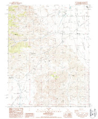
 1958 Goldfield1958 Print · USGSThe Nevada-California borderlands in the late fifties show a landscape defined by mining history and emerging military ranges. Researchers can trace old routes to Scotty's Castle, identify the locations of Numerous mines near Gold Point, and find Goldfield at its peak.2 unique versions available
 - 1958 Map of Soldier Pass, 1959 Print
 1958 Soldier Pass1959 Print · USGSThe California-Nevada borderlands in the late fifties reveal a landscape of isolated mining outposts and high-desert basins. Researchers can trace the historic Von Schmidt Line, find the White Mtn City (Ruin), and locate remote operations like the Copper Queen Mine.2 unique versions available
 - 1962 Map of Goldfield
 1962 Goldfield1962 Print · USGSThe Nevada desert during the early sixties reveals a landscape of high-stakes military ranges and waning mining districts. Trace the path of the old railroad grade between Goldfield and Beatty, or locate the isolated sites of Gold Point and Lida.
 - 1985 Map of Last Chance Range
 1985 Last Chance Range1985 Print · USGSThe high deserts of the California-Nevada border come alive in the mid-eighties, showing a landscape shaped by remote mining and volcanic geology. Researchers can trace historic extraction routes at the Sylvania Mine, locate the iconic Scotty's Castle, or follow the Old Railroad Grade past Bonnie Claire.2 unique versions available
 - 1988 Map of Chocolate Mtn
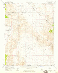
 1988 Chocolate Mtn1988 Print · USGSThe high-desert borderlands of Mono and Inyo counties are captured here in the late eighties, showing a landscape defined by mining and isolation. Trace the remains of White Mountain City, the Copper Queen Mine, and the remote settlement of Oasis.2 unique versions available
 - 2012 Map of Chocolate Mountain, 2012 Print
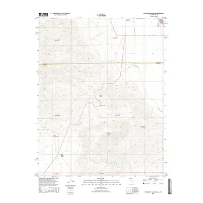
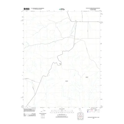 2012 Chocolate Mountain2012 Print · USGSCovers Oasis, including Inyo County, Esmeralda County, and other nearby areas
 - 2015 Map of Chocolate Mountain, 2015 Print
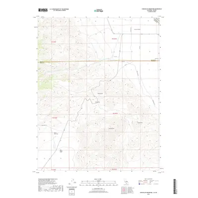
 2015 Chocolate Mountain2015 Print · USGSCovers Oasis, including Inyo County, Esmeralda County, and other nearby areas
 - 2018 Map of Chocolate Mountain, 2018 Print
 2018 Chocolate Mountain2018 Print · USGSCovers Oasis, including Inyo County, Esmeralda County, and other nearby areas
 - 2021 Map of Chocolate Mountain, 2021 Print
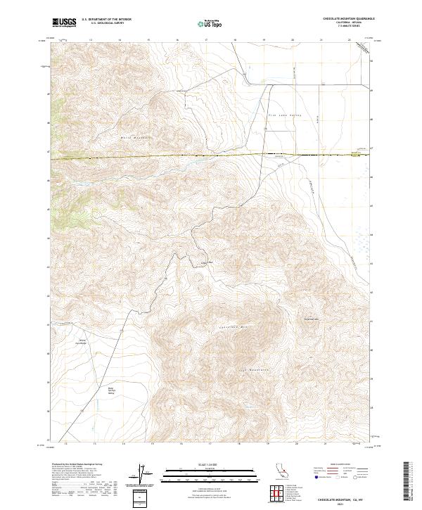 2021 Chocolate Mountain2021 Print · USGSThe high-desert borderlands of California and Nevada are mapped here in the early twenty-first century, showcasing the intersection of the Inyo and White Mountains. Researchers can trace the protected waters of Cottonwood Creek Wild and Scenic River or locate landmarks like Gilbert Pass and Tule Spring.
End of results
Showing maps 1-13 of 13
Top cities near Oasis
Frequently asked questions
- What are the different types of historical maps available for Oasis?
- What is the oldest map of Oasis?
- Where can I purchase historical maps of Oasis for my home or office?
- Where can I download high-res historical maps of Oasis?
- Are there historical topographic maps available for Oasis?
- Is there historical aerial imagery available for Oasis?
- Where are historical maps of Oasis sourced from?