Old Maps of Dyer, Nevada
Explore 13 old maps of Dyer, spanning from 1917 to today. These high-resolution historic maps reveal how streets, neighborhoods, landmarks, and natural features evolved over time — perfect for genealogy, metal detecting, research, and local history exploration.
What you can do with these maps:
- See how Dyer changed over time: Compare historical maps to modern-day views to trace roads, homesites, rail lines & more.
- View detailed metadata: Each map includes creators, publishers, year, scale, and archive source.
- Overlay maps with satellite & LiDAR: Visualize the past alongside modern tools to explore terrain & human change.
- Trusted historical sources: Maps sourced from the USGS, Library of Congress, and other archives.
- Access maps your way: View online, download high-res files, or order prints for personal or research use.
Start exploring old maps of Dyer to uncover forgotten places, hidden landmarks, and the deep history beneath your feet.
Dyer, NV maps
(13)- 1917 Map of White Mountain
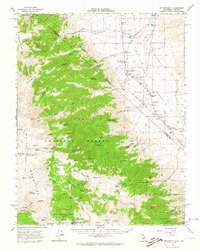
 1917 White Mountain1917 Print · USGSThe high desert borderlands of California and Nevada come alive in this survey from the mid-1910s. Researchers can trace the Southern Pacific rail line past remote outposts like Benton Sta. or locate high-altitude workings at the Sacramento Mine and Gold Hit.7 unique versions available
 - 1947 Map of Mariposa, 1948 Print
 1947 Mariposa1948 Print · USGSThe High Sierra and Owens Valley transition is captured here in the late 1940s, just as the region’s hydroelectric and tourism infrastructure was maturing. Genealogists and historians can trace old ranger stations, the Casa Diablo Mine, and rail stops along the Southern Pacific like Benton Station and Zurich.2 unique versions available
 - 1948 Map of Mariposa, 1951 Print
 1948 Mariposa1951 Print · USGSThe High Sierra and Mariposa foothills are shown here in the late 1940s as the post-war tourism and water infrastructure expanded. Genealogists and historians can locate vanished waypoints like Mormon Bar, the Glacier Point Hotel, and the granite quarries of Knowles.
 - 1957 Map of Mariposa, 1966 Print
 1957 Mariposa1966 Print · USGSThe High Sierra and Owens Valley appear in the mid-fifties, showing the intersection of conservation, hydroelectric power, and mountain industry. Genealogists and researchers can trace local landmarks like Yosemite Cemetery, the remote Kinsley Station, and the Pine Creek Mine.4 unique versions available
 - 1962 Map of Mt. Barcroft, 1964 Print
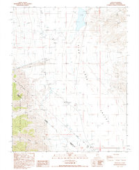
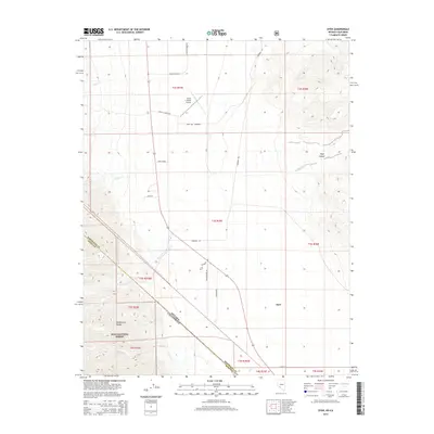
 1962 Mt. Barcroft1964 Print · USGSThe high White Mountains and Fish Lake Valley meet in the early sixties, showing a landscape of scientific research and desert ranching. Genealogists and historians can trace family operations like Circle L Ranch and Winkonley Ranch or locate the community center at Dyer.3 unique versions available
 - 1963 Map of Mariposa
 1963 Mariposa1963 Print · USGSThe High Sierra and Owens Valley meet in the early sixties, showing a landscape defined by gold-rush history and massive post-war water projects. Genealogists and researchers can trace old mining routes near Mariposa, locate the Glacier Point Hotel, and find small settlements like Coarse Gold or Knowles Junction.
 - 1987 Map of Dyer
 1987 Dyer1987 Print · USGSHigh-desert life in Fish Lake Valley is captured here during the late eighties, centered on the community of Dyer. Local researchers can trace early infrastructure and land use through features like the Dyer Sch, the Von Schmidt Line, and the local Cem.
 - 1988 Map of Benton Range
 1988 Benton Range1988 Print · USGSThe high desert and alpine peaks of the California-Nevada border come alive in this late-century survey of the Benton Range. Researchers can trace the heritage of remote outposts like Benton and Montgomery City alongside historic workings like the Black Warrior Mine.2 unique versions available
 - 1994 Map of Dyer, 1997 Print
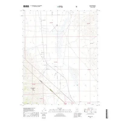
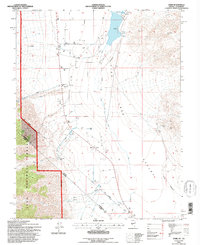 1994 Dyer1997 Print · USGSFish Lake Valley in the mid-1990s shows a high-desert community defined by its remote location and water management. Genealogists and historians can locate the Dyer settlement, including the Dyer Sch, and trace the historic Von Schmidt Line.
 - 2012 Map of Dyer, 2012 Print
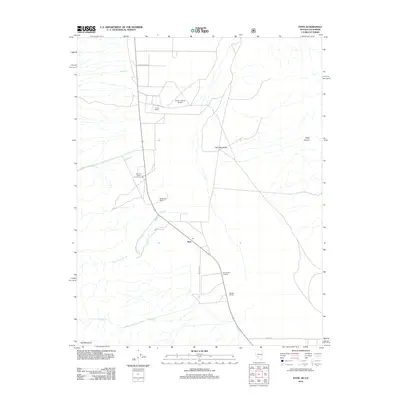 2012 Dyer2012 Print · USGSCovers Dyer, including Esmeralda County, Mono County, and other nearby areas
 - 2014 Map of Dyer, 2014 Print
 2014 Dyer2014 Print · USGSCovers Dyer, including Esmeralda County, Mono County, and other nearby areas
 - 2018 Map of Dyer, 2018 Print
 2018 Dyer2018 Print · USGSCovers Dyer, including Esmeralda County, Mono County, and other nearby areas
 - 2021 Map of Dyer, 2021 Print
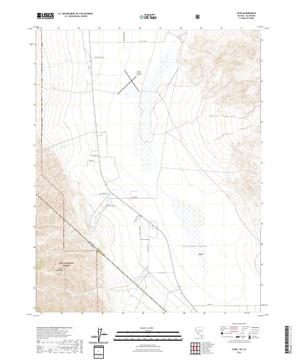 2021 Dyer2021 Print · USGSFish Lake Valley and the high peaks of the Nevada-California border are captured in this recent survey. Researchers can trace the rural layout of Dyer, follow watercourses like McAfee Cr, and locate remote landmarks such as the Circle L Ranch Airport.
End of results
Showing maps 1-13 of 13
Frequently asked questions
- What are the different types of historical maps available for Dyer?
- What is the oldest map of Dyer?
- Where can I purchase historical maps of Dyer for my home or office?
- Where can I download high-res historical maps of Dyer?
- Are there historical topographic maps available for Dyer?
- Is there historical aerial imagery available for Dyer?
- Where are historical maps of Dyer sourced from?