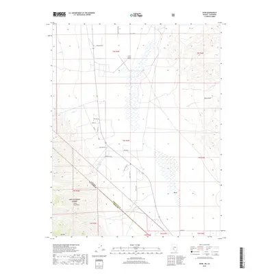
2018 Map of Dyer
USGS Topo · Published 2018About this map
Dyer sits at the eastern edge of Fish Lake Valley, where the high peaks of the White-Inyo Range meet the desert floor. This 2018 survey captures a landscape defined by sparse water sources and ranching infrastructure, spanning the border where Nevada meets California. The area's agricultural character is evident in the network of named roads like Stanley Ranch Rd and Winds Ranch Rd, alongside landmarks such as the Circle L Ranch Airport.
Find a feature on this map
33 named features on this map. Tap any name to fly to it.
Don’t see what you’re looking for? This feature index may not catch every label — zoom into the map to look around manually.
Map Details
Editions of this 2018 Dyer Map
This is the sole edition of this map. No revisions or reprints were ever made.
Other maps of this area

1898 · Silver Peak
USGS Topo · 1:125,000

1900 · Silver Peak
USGS Topo · 1:125,000

1908 · Lida
USGS Topo · 1:250,000

1913 · Lida
USGS Topo · 1:250,000

1917 · White Mountain
USGS Topo · 1:125,000

1947 · Mariposa
USGS Topo · 1:250,000

1948 · Mariposa
USGS Topo · 1:250,000

1954 · Goldfield
USGS Topo · 1:250,000

1955 · Goldfield
USGS Topo · 1:250,000

1957 · Mariposa
USGS Topo · 1:250,000