
1957 Map of Mariposa
USGS Topo · Published 1966About this map
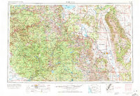
Yosemite Valley serves as the focal point of this mid-century survey, illustrating the complex infrastructure required to support one of California's most famous landscapes. The map captures the centralized services of Yosemite Village, including the Yosemite Post Office, Yosemite School, and the Yosemite Cemetery. Beyond the park boundaries, the landscape transitions into the industrial and agricultural corridors of the Owens Valley and the mining districts near Tungsten City and the Pine Creek Mine.
Find a feature on this map
83 named features on this map. Tap any name to fly to it.
Don’t see what you’re looking for? This feature index may not catch every label — zoom into the map to look around manually.
Map Details
Editions of this 1957 Mariposa Map
4 editions found
Other maps of this area

1891 · Big Trees
USGS Topo · 1:125,000

1893 · Sonora
USGS Topo · 1:125,000

1894 · Big Trees
USGS Topo · 1:125,000

1896 · Dardanelles
USGS Topo · 1:125,000

1896 · Sonora
USGS Topo · 1:125,000

1897 · Sonora
USGS Topo · 1:125,000

1897 · Big Trees
USGS Topo · 1:125,000

1897 · Yosemite
USGS Topo · 1:125,000

1898 · Dardanelles
USGS Topo · 1:125,000

1898 · Sonora
USGS Topo · 1:125,000
Featured Places
- Mammoth Lakes, CA
- Oakhurst, CA
- Coarsegold, CA
- Bishop, CA
- Dixon Lane–Meadow Creek, Dixon Lane-Meadow Creek