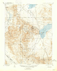
1898 Map of Silver Peak
USGS Topo · Published 1954About this map
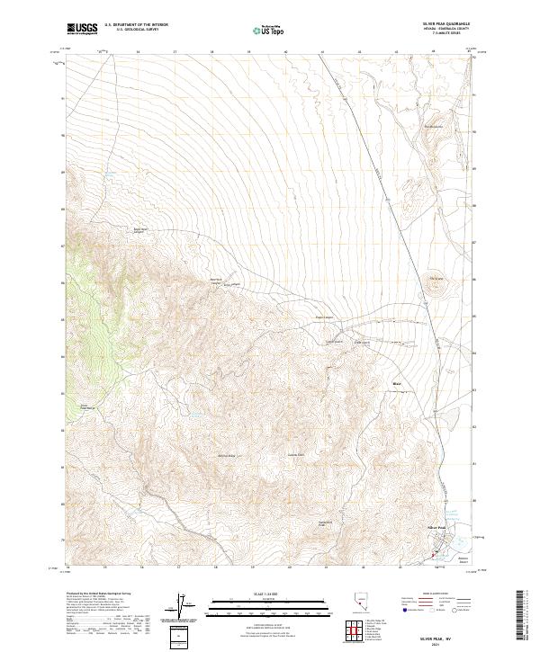
Silver Peak and the neighboring settlement of Blair anchor this late 19th-century survey of the high desert along the Nevada-California border. The landscape is defined by the massive Silver Peak Range and the industrial activity concentrated at Mineral Ridge, where the Drinkwater Mine and the Pacific Borax Co. Mill indicate the mining and processing economy of the era. A short line, the Silver Peak R.R., connects these sites to the dry expanse of Clayton Valley, where topographical curiosities like Goat Island and Alcatraz Island rise from the basin floor.
Find a feature on this map
49 named features on this map. Tap any name to fly to it.
Don’t see what you’re looking for? This feature index may not catch every label — zoom into the map to look around manually.
Map Details
Editions of this 1898 Silver Peak Map
This is the sole edition of this map. No revisions or reprints were ever made.
Historical Maps of Silver Peak Through Time
7 maps found