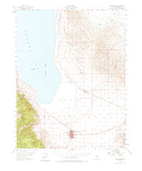
1911 Map of Hawthorne
USGS Topo · Published 1911About this map
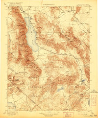
Walker Lake dominates this 1911 survey of the Nevada-California borderlands, serving as a terminal point for the Walker River while a network of railroads defines the early twentieth-century economy. The Nevada and California RR traces the lake's western shore, connecting the town of Hawthorne to northern hubs, while the Tonopah and Goldfield RR serves the southeastern mining districts near Mina and Sodaville. Evidence of the region's boom-and-bust cycle is visible in the transition of high-desert camps, with Buckley Camp and Oro City already marked as declining settlements.
Find a feature on this map
123 named features on this map. Tap any name to fly to it.
Don’t see what you’re looking for? This feature index may not catch every label — zoom into the map to look around manually.
Map Details
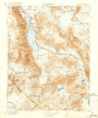
Editions of this 1911 Hawthorne Map
4 editions found
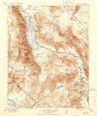
Historical Maps of Hawthorne Through Time
4 maps found