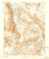
1911 Map of Hawthorne
USGS Topo · Published 1921About this map
Walker Lake dominates the basin between the Wassauk Range and the Gillis Range, serving as a focal point for the arid landscape of west-central Nevada. Early twentieth-century transit relies heavily on a network of rails, including the Southern Pacific and the Tonopah and Goldfield railroads, which connect mining hubs and supply points. The map reveals a transition from active settlements like Hawthorne and Mina to those already in decline, such as Oro City and Buckley Camp.
Find a feature on this map
120 named features on this map. Tap any name to fly to it.
Don’t see what you’re looking for? This feature index may not catch every label — zoom into the map to look around manually.
Map Details
Editions of this 1911 Hawthorne Map
4 editions found

Other maps of this area

1891 · Wabuska
USGS Topo · 1:125,000

1891 · Wellington
USGS Topo · 1:125,000

1893 · Wellington
USGS Topo · 1:125,000

1894 · Wabuska
USGS Topo · 1:125,000

1898 · Silver Peak
USGS Topo · 1:125,000

1900 · Silver Peak
USGS Topo · 1:125,000

1901 · Mt. Lyell
USGS Topo · 1:125,000

1907 · Tonopah
USGS Topo · 1:250,000

1908 · Lida
USGS Topo · 1:250,000

1908 · Tonopah
USGS Topo · 1:250,000