
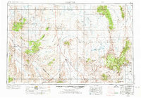
1954 Map of Goldfield
USGS Topo · Published 1967About this map
Goldfield anchors this high-desert landscape in the mid-20th century, a region defined by its intensive mining history and the expanding military presence of the Nellis Air Force Range. The map documents a landscape of extremes, where the Silver Peak Range and Kawich Range tower over broad basins like Sarcobatus Flat and Stonewall Flat. Evidence of the mining economy is pervasive, from the Silver King Mine to the numerous lead and silver workings scattered through the mountains.
Find a feature on this map
127 named features on this map. Tap any name to fly to it.
Don’t see what you’re looking for? This feature index may not catch every label — zoom into the map to look around manually.
Map Details
Editions of this 1954 Goldfield Map
3 editions found
Other maps of this area

1898 · Silver Peak
USGS Topo · 1:125,000

1900 · Silver Peak
USGS Topo · 1:125,000

1907 · Mt. Whitney
USGS Topo · 1:125,000

1907 · Tonopah
USGS Topo · 1:250,000

1907 · Las Vegas
USGS Topo · 1:250,000

1908 · Kawich
USGS Topo · 1:250,000

1908 · Lida
USGS Topo · 1:250,000

1908 · Furnace Creek
USGS Topo · 1:250,000

1908 · Las Vegas
USGS Topo · 1:250,000

1908 · Tonopah
USGS Topo · 1:250,000