Old Maps of Greenfield, California
Explore 24 old maps of Greenfield, spanning from 1912 to today. These high-resolution historic maps reveal how streets, neighborhoods, landmarks, and natural features evolved over time — perfect for genealogy, metal detecting, research, and local history exploration.
What you can do with these maps:
- See how Greenfield changed over time: Compare historical maps to modern-day views to trace roads, homesites, rail lines & more.
- View detailed metadata: Each map includes creators, publishers, year, scale, and archive source.
- Overlay maps with satellite & LiDAR: Visualize the past alongside modern tools to explore terrain & human change.
- Trusted historical sources: Maps sourced from the USGS, Library of Congress, and other archives.
- Access maps your way: View online, download high-res files, or order prints for personal or research use.
Start exploring old maps of Greenfield to uncover forgotten places, hidden landmarks, and the deep history beneath your feet.
Greenfield, CA maps
(24)- 1912 Map of Metz
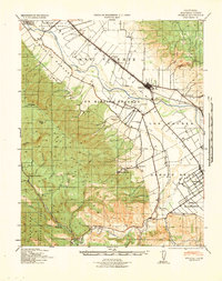
 1912 Metz1912 Print · USGSThe Salinas Valley agricultural corridor was just beginning to take its modern shape in 1912. Genealogists and historians can trace the early layout of Greenfield and locate the now-vanished rail stops at Metz and Coburn.
 - 1915 Map of Soledad
 1915 Soledad1915 Print · USGSThe Salinas Valley is captured in the early twentieth century as irrigation and the railroad transformed old land grants. Trace early settlements and rural schoolhouses like Fort Romie School and Paraiso Springs School alongside the Southern Pacific line.4 unique versions available
 - 1921 Map of Metz
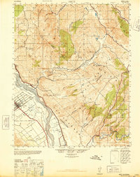
 1921 Metz1921 Print · USGSIn the early 1920s, the Salinas River valley served as a vital agricultural corridor between the Gabilan mountains and the coastal ranges. Researchers can trace historic landholdings like Coburn Ranch, locate the Metz School, and see the early footprint of Greenfield.4 unique versions available
 - 1940 Map of Metz
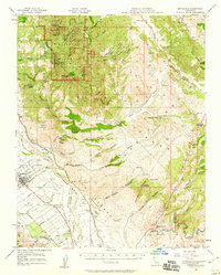
 1940 Metz1940 Print · USGSThe Salinas River valley and the Gabilan Range come into sharp focus just before the war, showing the area's transition into a major agricultural corridor. Genealogists and historians can locate specific family landmarks like Schmidt Ranch, the Metz School, and early layouts of Greenfield.
 - 1940 Map of Soledad
 1940 Soledad1940 Print · USGSThe Salinas Valley of the 1940s is shown here as a landscape of historic ranchos and rising agricultural industry. Genealogists and researchers can locate Mission Soledad (Ruins), the Camphora School, and family landmarks like the Olson Ranch.
 - 1947 Map of Metz
 1947 Metz1947 Print · USGSThe Salinas Valley and the Gabilan Range come to life in this post-war survey of Monterey County. Genealogists and local historians can trace the early footprints of the Metz School and family operations like Coburn Ranch and Mathews Ranch.2 unique versions available
 - 1948 Map of Santa Cruz
 1948 Santa Cruz1948 Print · USGSThe Central Coast and San Joaquin Valley meet in this mid-century look at the region's agricultural and military geography. Genealogists and historians can trace the paths of El Camino Real, locate family farms near Hollister, or study the footprint of the Fort Ord Military Reservation.2 unique versions available
 - 1955 Map of Santa Cruz
 1955 Santa Cruz1955 Print · USGSCoastal Monterey Bay and the fertile Salinas Valley are captured here during the post-war expansion of the mid-fifties. Researchers can trace the era's rail-and-road network via the Southern Pacific lines and find landmarks like Fort Ord or the Lonoak School.
 - 1956 Map of Greenfield, 1957 Print
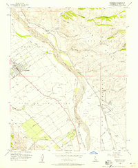 1956 Greenfield1957 Print · USGSMid-century Monterey County comes into focus as the agricultural grid around Greenfield expands along the Salinas River. Genealogists and historians can trace rail stops at Coburn and Metz or locate family plots in the Greenfield Cemetery.4 unique versions available
 - 1956 Map of Paraiso Springs, 1958 Print
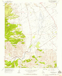 1956 Paraiso Springs1958 Print · USGSThe Salinas Valley transitions from the Sierra foothills to fertile plains in the mid-1950s. Genealogists and researchers can trace the Vineyard of Mission Soledad, early street grids in Greenfield, and landmarks like Paraiso Springs.3 unique versions available
 - 1957 Map of Santa Cruz
 1957 Santa Cruz1957 Print · USGSCentral California comes into sharp focus during the late fifties, from the fog-swept Monterey Bay to the sun-drenched San Joaquin Valley. Genealogists and historians can trace the mid-century footprints of Fort Ord Military Reservation, the Southern Pacific line, and the historic streets of San Juan Bautista.
 - 1957 Map of Greenfield, 1959 Print
 1957 Greenfield1959 Print · USGSThe Salinas Valley and Gabilan Range meet in this late 1950s survey, showing the agricultural expansion around Greenfield. Genealogists and historians can trace family-named sites like Mathews Ranch and old rail stops at Metz or Coburn along the Southern Pacific.3 unique versions available
 - 1958 Map of Santa Cruz
 1958 Santa Cruz1958 Print · USGSCoastal California and the central valleys are shown during the mid-fifties, capturing a landscape of massive military reserves and vital rail arteries. Genealogists and historians can trace the Southern Pacific line through Salinas or explore the early footprints of the Fort Ord Military Reservation and San Juan Bautista.2 unique versions available
 - 1965 Map of Santa Cruz, 1968 Print
 1965 Santa Cruz1968 Print · USGSThe Central Coast and San Joaquin Valley meet here during the mid-sixties, capturing the growth of agricultural and coastal hubs. Trace the historic Southern Pacific RR lines and locate sites like the Presidio of Monterey or Pinnacles National Monument.
 - 1974 Map of Monterey, 1977 Print
 1974 Monterey1977 Print · USGSThe Central Coast and San Joaquin Valley meet in this mid-seventies survey of the Monterey region. Genealogists and historians can locate Spanish-era sites like the San Antonio de Padua Mission, early industrial markers such as the New Idria Mine, and coastal landmarks like the Point Sur Lighthouse.
 - 1982 Map of Point Sur, 1980 Print
 1982 Point Sur1980 Print · USGSCoastal mountains and fertile valleys meet in the early eighties as the Southern Pacific railroad links Monterey County's growing agricultural towns. Trace remote landmarks like Tassajara Hot Springs, the Soledad State Prison, and the sprawling Fort Hunter Liggett Military Reservation.3 unique versions available
 - 2012 Map of Paraiso Springs, 2012 Print
 2012 Paraiso Springs2012 Print · USGSCovers Greenfield, including Monterey County, United States, and other nearby areas
 - 2012 Map of Greenfield, 2012 Print
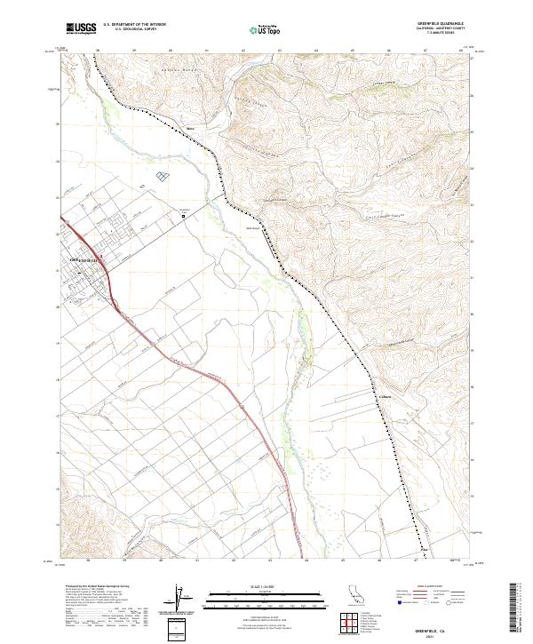
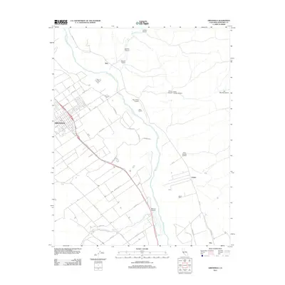 2012 Greenfield2012 Print · USGSCovers Greenfield, including Coburn, Metz, and other nearby areas
 - 2015 Map of Paraiso Springs, 2015 Print
 2015 Paraiso Springs2015 Print · USGSCovers Greenfield, including Monterey County, United States, and other nearby areas
 - 2015 Map of Greenfield, 2015 Print
 2015 Greenfield2015 Print · USGSCovers Greenfield, including Coburn, Metz, and other nearby areas
 - 2018 Map of Greenfield, 2018 Print
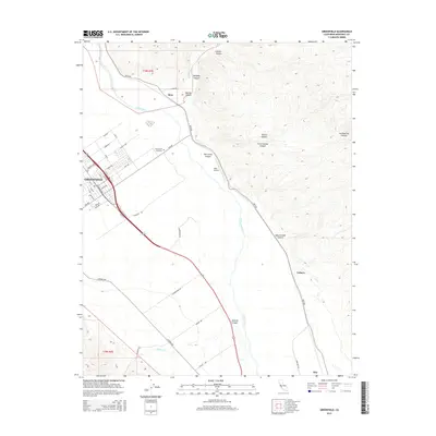
 2018 Greenfield2018 Print · USGSCovers Greenfield, including Coburn, Metz, and other nearby areas
 - 2018 Map of Paraiso Springs, 2018 Print
 2018 Paraiso Springs2018 Print · USGSCovers Greenfield, including Monterey County, United States, and other nearby areas
 - 2021 Map of Paraiso Springs, 2021 Print
 2021 Paraiso Springs2021 Print · USGSThe Salinas Valley meets the coastal ranges in the early 2020s, showing the intersection of agriculture and wilderness. Trace the transition from Greenfield streets to the heights of Pettits Peak and the winding Arroyo Seco.
 - 2021 Map of Greenfield, 2021 Print
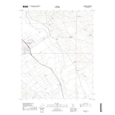
 2021 Greenfield2021 Print · USGSIn the fertile Salinas Valley of the early 2020s, this area shows the established agricultural grid of Greenfield and its surrounding canyonlands. Researchers can trace the town's street names, locate the Greenfield Cem, and find the smaller stops of Metz and Coburn along the river.
End of results
Showing maps 1-24 of 24
Top cities near Greenfield
Frequently asked questions
- What are the different types of historical maps available for Greenfield?
- What is the oldest map of Greenfield?
- Where can I purchase historical maps of Greenfield for my home or office?
- Where can I download high-res historical maps of Greenfield?
- Are there historical topographic maps available for Greenfield?
- Is there historical aerial imagery available for Greenfield?
- Where are historical maps of Greenfield sourced from?