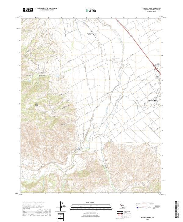
2021 Map of Paraiso Springs
USGS Topo · Published 2021About this map
Sierra de Salinas and the Santa Lucia Range dominate the western portion of this 2021 landscape, where deep drainages like Beeswax Canyon and Milindee Canyon carve through the high ground. The terrain transitions from these steep ridges down toward the alluvial floor of the Salinas Valley, where the settlement of Greenfield sits along the corridor of El Camino Real S. This area showcases the distinct shift from wilderness and ranching land to structured agricultural grids and urban development.
Find a feature on this map
61 named features on this map. Tap any name to fly to it.
Don’t see what you’re looking for? This feature index may not catch every label — zoom into the map to look around manually.
Map Details
Editions of this 2021 Paraiso Springs Map
This is the sole edition of this map. No revisions or reprints were ever made.
Other maps of this area

1910 · Soledad
USGS Topo · 1:31,680

1912 · Metz
USGS Topo · 1:31,680

1915 · Soledad
USGS Topo · 1:62,500

1919 · King City
USGS Topo · 1:62,500

1919 · Junipero Serra
USGS Topo · 1:62,500

1921 · Metz
USGS Topo · 1:62,500

1939 · King City
USGS Topo · 1:62,500

1940 · Metz
USGS Topo · 1:62,500

1940 · Soledad
USGS Topo · 1:62,500

1941 · Junipero Serra
USGS Topo · 1:62,500