2020s Maps of Yountville, California
Explore 2 historic maps of Yountville from the 2020s. These maps offer a rare glimpse into what life looked like during the 2020s — showing old roads, neighborhoods, homes, and landmarks that have changed or disappeared over time.
Whether you're researching your family's past, planning a metal detecting trip, or studying how Yountville's landscape evolved across the 2020s, these high-resolution maps are a powerful tool for exploring the history of this region.
- Focus on a specific era: All maps on this page are from the 2020s, giving you a focused view of this time period.
- See what’s changed: Compare century-old streets, trails, and buildings to today's modern landscape using overlays and satellite layers.
- Research with precision: Use these maps for genealogy, historical research, land use analysis, or educational projects.
- View, download, or print: Maps are fully viewable online in high resolution, and can be downloaded or printed for your own records.
Start exploring Yountville's history through authentic maps from the 2020s. This is your window into the past.
Yountville, CA maps
(2)- 2021 Map of Rutherford, 2021 Print
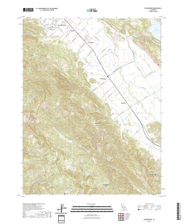 2021 Rutherford2021 Print · USGSThe heart of the Napa Valley is captured here in the early twenty-first century, spanning the famous corridor between St. Helena and Yountville. Researchers can trace property lines and landmarks like Zinfandel, Holy Cross Catholic Cem, and the terrain around Mt Veeder.
 - 2021 Map of Yountville, 2021 Print
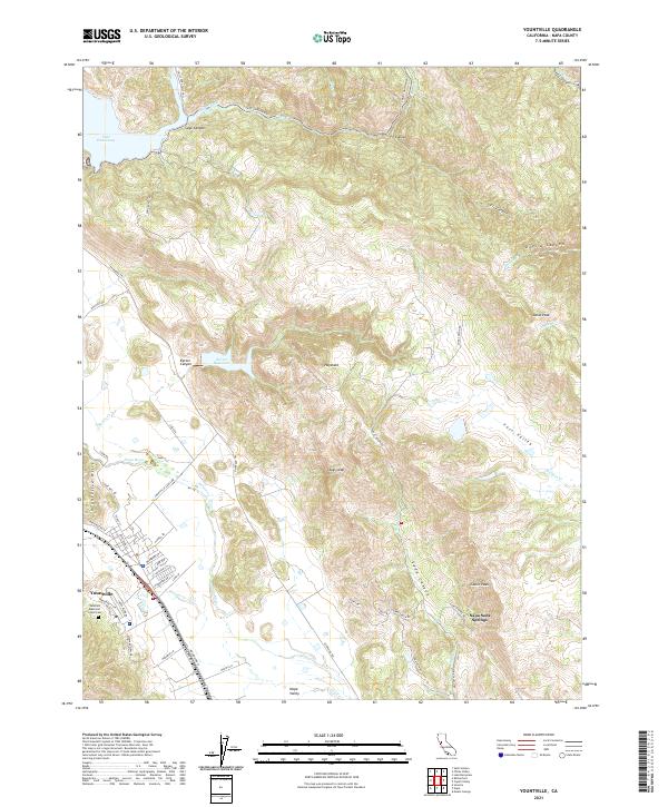 2021 Yountville2021 Print · USGSThe heart of the Napa Valley comes into focus in this recent survey, showing the established vineyards and rugged ridges of the Vaca Mountains. Local researchers can trace the roads around Yountville, find the Veterans Memorial Grove Cem, and explore the terrain of Stags Leap.
End of results
Showing maps 1-2 of 2
Top cities near Yountville
- Santa Rosa historical maps
- Vallejo historical maps
- Fairfield historical maps
- Napa historical maps
- Petaluma historical maps
- American Canyon historical maps
See more
Frequently asked questions
- What are the different types of historical maps available for Yountville?
- What is the oldest map of Yountville?
- Where can I purchase historical maps of Yountville for my home or office?
- Where can I download high-res historical maps of Yountville?
- Are there historical topographic maps available for Yountville?
- Is there historical aerial imagery available for Yountville?
- Where are historical maps of Yountville sourced from?